Old Maps of Rutland County, Vermont for Metal Detecting
Plan your next treasure hunt with 248 historic maps of Rutland County. Find old homesites, ghost towns, trails, and gathering spots that may be lost to time — perfect for identifying promising metal detecting locations.
- Locate forgotten sites: Uncover places like long-lost settlements, abandoned rail lines, or gathering spots.
- Plan better hunts: Use map overlays combined with LiDAR or satellite views to narrow in on historically rich areas.
- Made for detectorists: Thousands of hobbyists use these maps to discover relics, coins, and hidden history.
Use these historic maps to boost your research and find new opportunities beneath the surface of Rutland County.
Rutland County, VT maps
(248)- 1891 Map of Rutland, 1956 Print
 1891 Rutland1956 Print · USGSRutland and its surrounding mountain townships appear here during the expansion of the rail era in the late nineteenth century. Genealogists and historians can trace the early rail networks of the Central Vermont Railroad or locate family roots in communities like North Chittenden, East Pittsford, and Mendon.
 - 1893 Map of Wallingford
 1893 Wallingford1893 Print · USGSThe Green Mountains of Rutland County appear in the 1890s as a landscape of busy rail corridors and upland villages. Genealogists can trace family names and small industrial hubs like Mechanicsville, Cuttingsville, and the remote mountain settlement of Griffith.8 unique versions available
 - 1893 Map of Rutland
 1893 Rutland1893 Print · USGSThe rail hub of the Green Mountains thrives in the 1890s as several lines converge in the valley below the great peaks. Researchers can trace the early rail stops at Cold River Sta. or locate high-altitude settlements like North Chittenden and North Sherburne.8 unique versions available
 - 1893 Map of Fort Ann, 1954 Print
 1893 Fort Ann1954 Print · USGSWashington County was a crossroads of canal and rail commerce in the late nineteenth century. Genealogists and local historians can trace the foundations of Granville, locate family homes near Chamberlain Mills, and follow the path of the Abandoned Delaware and Hudson Canal.2 unique versions available
 - 1893 Map of Whitehall, 1954 Print
 1893 Whitehall1954 Print · USGSThe borderlands of New York and Vermont are captured here during the peak of the canal and rail era. Genealogists and local historians can trace the transit networks of the Champlain Canal and find family-named points like Snody Dock, Benson Landing, and Howard Hill.
 - 1894 Map of Ticonderoga, 1954 Print
 1894 Ticonderoga1954 Print · USGSLake Champlain and its strategic fortifications appear here in the 1890s as a landscape of iron mining and essential rail junctions. Trace the historic grounds of Ft. Ticonderoga Ruin and the rail corridors of the Delaware and Hudson RR through Crown Point and Orwell.2 unique versions available
 - 1894 Map of Pawlet, 1964 Print
 1894 Pawlet1964 Print · USGSRutland and Bennington Counties at the close of the nineteenth century reveal a rugged landscape of rail-linked valley towns and high mountain hollows. Genealogists can locate family lands near Middletown Springs, Danby Four Corners, or the remote Burnham Hollow.
 - 1895 Map of Whitehall
 1895 Whitehall1895 Print · USGSThe Lake Champlain valley at the close of the nineteenth century reveals a landscape shaped by water and rail. Genealogists and historians can trace the early village of Whitehall, identify old steamer routes on Lake George, and locate rural settlements like Low Hampton and Dresden Center.
 - 1895 Map of Fort Ann
 1895 Fort Ann1895 Print · USGSWashington County in the late nineteenth century is a landscape defined by the Saratoga and Champlain Canal and early railroads. You can trace the development of hamlets like Chamberlain Mills and Truthville as they appeared before the modern era.
 - 1895 Map of Castleton, 1960 Print
 1895 Castleton1960 Print · USGSRutland County's rugged terrain and valley settlements are captured here in the late nineteenth century, showing a landscape defined by mountain peaks and rail lines. You can trace the path of the Delaware and Hudson RR and locate vanished hamlets like Gothantown and Blissville.
 - 1896 Map of Ticonderoga
 1896 Ticonderoga1896 Print · USGSThe strategic narrows of Lake Champlain and Lake George are shown here in the late nineteenth century, capturing the area's transition from military frontier to industrial corridor. Genealogists and historians can trace rail lines, steamer routes, and local landmarks like Ticonderoga Ruin, French Ch., and Burdicks Crossing.2 unique versions available
 - 1897 Map of Pawlet
 1897 Pawlet1897 Print · USGSVermont's Taconic borderlands are captured here in the late nineteenth century, showing a landscape of high peaks and tightly clustered valley settlements. Researchers can trace the routes of the DELAWARE AND HUDSON RR or locate vanished hamlets like Spanktown and Brimstone Corners.8 unique versions available
 - 1897 Map of Castleton
 1897 Castleton1897 Print · USGSRutland County's industrial and agricultural heartland is captured here at the close of the nineteenth century. Researchers can trace historic rail routes like the Clarendon and Pittsford R. R. or locate family homesteads near Lake Bomoseen and Clarendon Springs.9 unique versions available
 - 1898 Map of Whitehall
 1898 Whitehall1898 Print · USGSThe Lake Champlain and Poultney River borderlands appear here in the late nineteenth century, just as the rail-and-water shipping corridor reached its height. Genealogists and historians can trace the old docks and depots at Snody Dock, Chubbs Dock, and Putnam Station.2 unique versions available
 - 1898 Map of Fort Ann
 1898 Fort Ann1898 Print · USGSUpper Washington County at the close of the nineteenth century reveals a landscape dominated by the Champlain Canal and the Mettawee River. Genealogists and local historians can trace early settlements and transit points like Smith Basin, Chamberlain Mills, and Battle Hill.
 - 1901 Map of Fort Ann
 1901 Fort Ann1901 Print · USGSWashington County at the close of the nineteenth century was a vital corridor of New York commerce, defined by its historic canal and rail lines. You can trace the early industrial landscape through Smith Basin, find family homesteads near Slyboro, and follow the Mettawee River as it crosses the Vermont border.
 - 1902 Map of Whitehall
 1902 Whitehall1902 Print · USGSThe borderlands of New York and Vermont at the turn of the century show a region defined by the Champlain Canal and the Delaware and Hudson R.R. maritime and rail networks. Genealogists and historians can trace the early layout of Whitehall, small lakeside landings like Snody Dock, and the winding Poultney River.10 unique versions available
 - 1902 Map of Ticonderoga
 1902 Ticonderoga1902 Print · USGSThe Champlain Valley at the start of the twentieth century is captured here in the borderlands of New York and Vermont. Researchers can trace the military grounds of Fort Ticonderoga, identify operations at the Iron Mine, and locate rural stations like Burdick Crossing.11 unique versions available
 - 1902 Map of Brandon, 1956 Print
 1902 Brandon1956 Print · USGSCentral Vermont at the turn of the century shows a landscape defined by the Otter Creek valley and the bustling Rutland Railroad. Genealogists and historians can trace old homesteads and rail sidings at Leicester Junction, Hyde Manor, and Forestdale.2 unique versions available
 - 1903 Map of Mettawee
 1903 Mettawee1903 Print · USGSThe New York and Vermont borderlands come alive in this turn-of-the-century survey of the Mettawee Valley. Genealogists can trace family footprints from Middletown Springs down to the Saratoga and Champlain Canal at Fort Ann.2 unique versions available
 - 1904 Map of Fort Ann
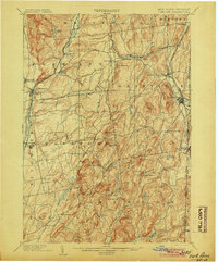 1904 Fort Ann1904 Print · USGSWashington County at the turn of the century shows a landscape defined by the slate industry and early rail lines along the Vermont border. Genealogists can locate family lands near Chamberlain Mills, Smith Basin, and the crossroads of North Hebron or Slyboro.6 unique versions available
 - 1904 Map of Brandon
 1904 Brandon1904 Print · USGSCentral Vermont at the opening of the century shows a landscape defined by the Rutland R.R. and the winding Otter Creek. Genealogists and researchers can trace local landmarks from Hyde Manor to the mills of Forestdale and the rail hub at Leicester Junction.5 unique versions available
 - 1911 Map of Woodstock, 1958 Print
 1911 Woodstock1958 Print · USGSWindsor County villages and mountain hollows are captured here at the dawn of the twentieth century. Researchers can trace the early path of the Woodstock Railroad or locate family sites near the Town Farm and Plymouth Notch.
 - 1913 Map of Woodstock
 1913 Woodstock1913 Print · USGSWindsor County villages and narrow valley settlements are captured here in the decade before the First World War. Genealogists can trace family lines through numerous rural schoolhouses like Mendall School and early post offices at Bridgewater Center Briggs P O.5 unique versions available
 - 1915 Map of Rochester, 1963 Print
 1915 Rochester1963 Print · USGSThe Green Mountains in the early twentieth century were a landscape of remote hollow schools and narrow valley settlements. Genealogists and historians can trace old property lines and landmarks like the Williams Mine, Hancock Tunnel, and the Texas School.
Showing maps 1-25 of 248
Top cities of Rutland County
- Rutland City historical maps
- Brandon historical maps
- Poultney historical maps
- Fair Haven historical maps
- Clarendon historical maps
- Wallingford historical maps
See more
Frequently asked questions
- What are the different types of historical maps available for Rutland County?
- What is the oldest map of Rutland County?
- Where can I purchase historical maps of Rutland County for my home or office?
- Where can I download high-res historical maps of Rutland County?
- Are there historical topographic maps available for Rutland County?
- Is there historical aerial imagery available for Rutland County?
- Where are historical maps of Rutland County sourced from?