Old Maps of East Montpelier, Vermont for Genealogy
Trace your family roots with 42 historic maps of East Montpelier. These high-res maps reveal old neighborhoods, homesites, landmarks, and streets — helping you uncover where your ancestors lived and how the area evolved over time.
- Explore historic neighborhoods: Identify where your relatives may have lived in the 1800s or 1900s.
- Compare maps over time: Trace the changes in streets, buildings, and landmarks for multi-generational research.
- Perfect for genealogy & ancestry research: Used by family historians and researchers to map out lineage and migration.
These maps are an incredible resource for exploring your personal connection to East Montpelier's past.
East Montpelier, VT maps
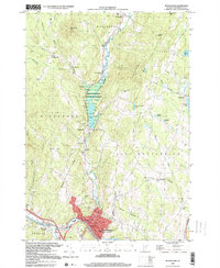
(42)- 1919 Map of Montpelier, 1958 Print
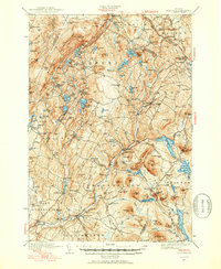
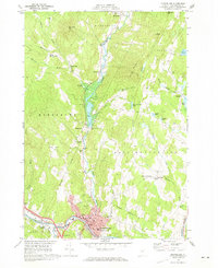
 1919 Montpelier1958 Print · USGSMontpelier and the Winooski River valley are shown here just after the Great War, when rail lines and early highways connected a landscape of small hill farms and mines. Genealogists can locate dozens of rural landmarks, including the Talc Mine, the Sodom PO, and the Green Mountain Cemetery.2 unique versions available
 - 1921 Map of Montpelier
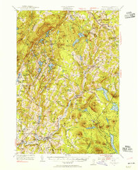
 1921 Montpelier1921 Print · USGSMontpelier and the Winooski valley are seen here in the early twenties, framed by the peaks of the Worcester Mountains. Genealogists and local historians can locate dozens of district schools and unique landmarks like the Talc Mine, Sodom PO, and the Central Vermont Ry.6 unique versions available
 - 1922 Map of Barre
 1922 Barre1922 Print · USGSCentral Vermont in the early 1920s is revealed as a bustling landscape of granite quarries, hillside farms, and the historic Norwich University campus. Genealogists and historians can trace district schoolhouses, remote cemeteries like West Hill Cemetery, and industrial landmarks including the Talc Mine and numerous quarries.
 - 1924 Map of Barre
 1924 Barre1924 Print · USGSVermont's granite country and the Dog River valley are captured here in the mid-1920s, showing the early industrial roots of the region. Researchers can locate dozens of district schools, the Norwich University campus, and local industry sites like the Washington Granite Co and the Talc Mine.5 unique versions available
 - 1939 Map of Plainfield
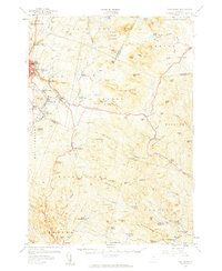
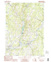
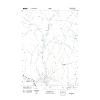
 1939 Plainfield1939 Print · USGSVermont's granite-and-timber country is captured here on the eve of the 1940s, when remote rail lines still connected upland villages. Genealogists can trace family names at the Old West Ch, Hollister Hill Sch, and the isolated Lanesboro rail stop.
 - 1940 Map of Plainfield, 1953 Print
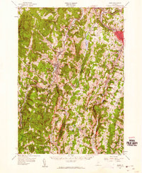
 1940 Plainfield1953 Print · USGSVermont's hill country is captured here just before the war, showing a landscape defined by small farms and upland schools. Genealogists can locate family landmarks at Maple Cors Calais PO, Old West Ch, and the St Johnsbury and Lake Champlain RR.2 unique versions available
 - 1943 Map of Plainfield
 1943 Plainfield1943 Print · USGSVermont's highland farming and rail communities are captured here in the 1940s as the state's rural landscape remained densely settled. Genealogists can locate family-named landmarks like Hollister Hill Sch, trace the Montpelier and Wells River RR, or find the Old West Ch near Kent Cors.2 unique versions available
 - 1944 Map of Montpelier
 1944 Montpelier1944 Print · USGSCentral Vermont in the mid-1940s is mapped here with a focus on its mountain settlements and river valley corridors. Genealogists can trace family roots through numerous district schools like Loomis Hill Sch and the location of the Talc Mine.
 - 1947 Map of Corinth
 1947 Corinth1947 Print · USGSThe granite quarrying region of Vermont is captured here just after the war, showing the industrial density of the hills. Genealogists can trace family roots through numerous local landmarks like Wilson Cem, Miles Sch, and settlements such as Goose Green and Websterville.
 - 1948 Map of East Barre
 1948 East Barre1948 Print · USGSCentral Vermont's quarrying and timber lands are captured here just after the war, showing the industrial centers of the Knox Mountains area. Genealogists can trace family roots through numerous remote burial grounds like Hutchinson Cem and schoolhouses such as Quarry Sch.2 unique versions available
 - 1950 Map of Lake Champlain
 1950 Lake Champlain1950 Print · USGSThe Lake Champlain valley and its surrounding peaks are captured in detail during the late 1940s, showing the vital rail and road connections between New York and Vermont. Researchers can trace the routes of the Central Vermont Railway or locate old industrial centers like Mineville and Witherbee.2 unique versions available
 - 1953 Map of Plainfield, 1954 Print
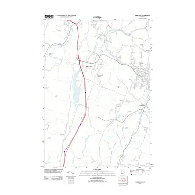
 1953 Plainfield1954 Print · USGSThe hills of Washington and Caledonia counties are captured here in the early fifties, showing the region's transition from old upland farming to a wood-and-water economy. Researchers can locate vanished landmarks like Maple Cor Calais PO, the Dwinell Sch, and the St Johnsbury and Lake Champlain RR.4 unique versions available
 - 1957 Map of East Barre, 1959 Print
 1957 East Barre1959 Print · USGSThe granite industry and deep woodland of central Vermont are on display in the mid-fifties. Genealogists can trace family lines through Wilson Cem or locate the Quarry Sch near Upper Graniteville.4 unique versions available
 - 1957 Map of Barre, 1960 Print
 1957 Barre1960 Print · USGSCentral Vermont’s rugged spine is captured in the late fifties, showcasing the tight-knit valley towns and mountain camps of Washington County. Genealogists and historians can trace the Central Vermont rail line, find old schools like No 9 Sch, and locate the historic State Fish Hatchery near Roxbury.3 unique versions available
 - 1958 Map of Lake Champlain
 1958 Lake Champlain1958 Print · USGSThe Champlain Valley and surrounding high peaks are captured here in the late fifties, showcasing the cross-border region from the Adirondacks to the Green Mountains. Researchers can trace historic rail routes like the Rutland Railway or locate old valley settlements such as Keeseville and Vergennes.2 unique versions available
 - 1962 Map of Lake Champlain, 1975 Print
 1962 Lake Champlain1975 Print · USGSLake Champlain and the high peaks of the Adirondacks and Green Mountains are captured here during the mid-twentieth century. Researchers can trace the industrial legacy of the Lyon Mountain Mine and the rail corridors of the Central Vermont RR and Delaware & Hudson RR.3 unique versions available
 - 1968 Map of Montpelier, 1973 Print
 1968 Montpelier1973 Print · USGSThe Vermont state capital and surrounding townships of the late sixties are captured here in high detail. Researchers can trace the Central Vermont rail lines through the city or locate family plots at Green Mount Cemetery and North Branch Cem.2 unique versions available
 - 1978 Map of Barre West, 1979 Print
 1978 Barre West1979 Print · USGSCentral Vermont's granite and rail heritage is on full display in the late seventies as the industrial corridors between Barre and Montpelier continue to evolve. Researchers can locate numerous family burial sites like Hope Cem or trace the routes of the Central Vermont and Montpelier and Barre railroads.3 unique versions available
 - 1981 Map of Barre East
 1981 Barre East1981 Print · USGSThe granite industry of central Vermont is captured here in the early 1980s, centered on the massive extraction sites of Millstone Hill. Researchers can trace the layout of quarrying villages like Websterville and Graniteville or locate family sites near Hope Cem and Wilson Cem.2 unique versions available
 - 1986 Map of Plainfield, 1987 Print
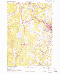
 1986 Plainfield1987 Print · USGSUpper Washington County in the mid-1980s shows a landscape of river-valley villages and high-pasture townships. Researchers can trace the Old RR Grade through East Montpelier or locate family history at the Covered Bridge and small cemeteries near East Calais.
 - 1988 Map of Montpelier
 1988 Montpelier1988 Print · USGSThe area surrounding Vermont’s capital city appears here during the early 1940s, showing the vital rail-and-river network. Genealogists can trace family names across a dozen district schools and rural sites like Middlesex Center and the Talc Mine.2 unique versions available
 - 1999 Map of Montpelier, 2000 Print
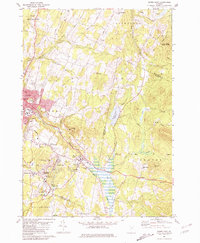
 1999 Montpelier2000 Print · USGSMontpelier and the surrounding hills are captured in the late 1990s, showcasing the capital's layout and its river-valley geography. Researchers can trace the grounds of the State Capitol, locate the Green Mount Cemetery, and find rural landmarks like The Old Meetinghouse Ch.
 - 2012 Map of Montpelier, 2012 Print
 2012 Montpelier2012 Print · USGSCovers East Montpelier, including Montpelier, Berlin, and other nearby areas
 - 2012 Map of Barre West, 2012 Print
 2012 Barre West2012 Print · USGSCovers East Montpelier, including Barre, Montpelier, and other nearby areas
 - 2012 Map of Plainfield, 2012 Print
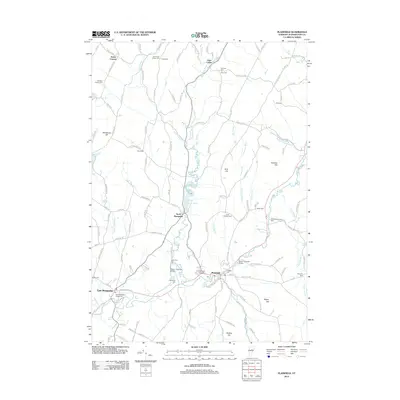 2012 Plainfield2012 Print · USGSCovers East Montpelier, including Calais, Marshfield, and other nearby areas
Showing maps 1-25 of 42
Top cities near East Montpelier
- Barre historical maps
- Montpelier historical maps
- Northfield historical maps
- Waterbury historical maps
- Stowe historical maps
- Williamstown historical maps
See more
Top neighborhoods of East Montpelier
Frequently asked questions
- What are the different types of historical maps available for East Montpelier?
- What is the oldest map of East Montpelier?
- Where can I purchase historical maps of East Montpelier for my home or office?
- Where can I download high-res historical maps of East Montpelier?
- Are there historical topographic maps available for East Montpelier?
- Is there historical aerial imagery available for East Montpelier?
- Where are historical maps of East Montpelier sourced from?