1960s Maps of Windsor County, Vermont
Explore 7 historic maps of Windsor County from the 1960s. These maps offer a rare glimpse into what life looked like during the 1960s — showing old roads, neighborhoods, homes, and landmarks that have changed or disappeared over time.
Whether you're researching your family's past, planning a metal detecting trip, or studying how Windsor County's landscape evolved across the 1960s, these high-resolution maps are a powerful tool for exploring the history of this region.
- Focus on a specific era: All maps on this page are from the 1960s, giving you a focused view of this time period.
- See what’s changed: Compare century-old streets, trails, and buildings to today's modern landscape using overlays and satellite layers.
- Research with precision: Use these maps for genealogy, historical research, land use analysis, or educational projects.
- View, download, or print: Maps are fully viewable online in high resolution, and can be downloaded or printed for your own records.
Start exploring Windsor County's history through authentic maps from the 1960s. This is your window into the past.
Windsor County, VT maps
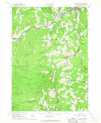
(7)- 1961 Map of Killington Peak, 1964 Print
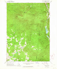 1961 Killington Peak1964 Print · USGSThe Green Mountains of central Vermont are captured here during the early 1960s as the regional ski industry was beginning to reshape the landscape. Genealogists and hikers can trace the Appalachian Long Trail or locate family sites like Northam Cemetery and the Mission Chapel.3 unique versions available
 - 1961 Map of Pico Peak, 1964 Print
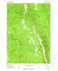 1961 Pico Peak1964 Print · USGSSherburne and the high peaks of the Green Mountains are captured here in the early 1960s as recreational skiing began to shape the peaks. Researchers can trace the junction of the Appalachian Trail, locate the Riverside Cem, and find local landmarks like the Sherburne Valley Sch.5 unique versions available
 - 1964 Map of Glens Falls
 1964 Glens Falls1964 Print · USGSThe tri-state borderlands of New York, Vermont, and New Hampshire appear here in the mid-1960s. Researchers can trace the rail routes of the Rutland RR and find historic sites like Ticonderoga and Saratoga National Historical Park.
 - 1966 Map of Plymouth, 1968 Print
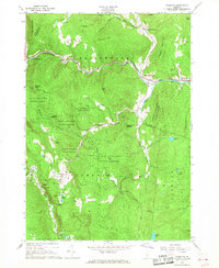 1966 Plymouth1968 Print · USGSWindsor County as it appeared in the mid-sixties reveals a landscape of presidential heritage and mountain recreation. Genealogists and historians can locate family landmarks like Toplift Cem and trace the development of the Calvin Coolidge Birthplace near Plymouth Notch.2 unique versions available
 - 1966 Map of Delectable Mountain, 1968 Print
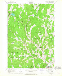
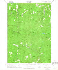 1966 Delectable Mountain1968 Print · USGSThe Green Mountain interior at the mid-point of the century shows a landscape of high ridges and isolated hollows. Researchers can trace the original route of the Appalachian Trail, locate Cem Smith, and find small settlements like Notown and Morgan Corners.3 unique versions available
 - 1966 Map of Woodstock South, 1968 Print
 1966 Woodstock South1968 Print · USGSWindsor County in the mid-1960s reflects a landscape of river-valley villages and high mountain forests. Researchers can trace family sites near Riverside Cemetery, locate the Covered Bridge over the Ottauquechee River, or follow the Long Trail.3 unique versions available
 - 1966 Map of Woodstock North, 1968 Print
 1966 Woodstock North1968 Print · USGSThe rural highlands of Windsor County come alive in this mid-century survey of Barnard and Pomfret. Genealogists and historians can trace family locations through Old Cem and Burns Cem, or follow the high-country path of the APPALACHIAN TRAIL.3 unique versions available
End of results
Showing maps 1-7 of 7
Top cities of Windsor County
- Hartford historical maps
- Springfield historical maps
- Hartland historical maps
- Norwich historical maps
- Woodstock historical maps
- Royalton historical maps
See more
Frequently asked questions
- What are the different types of historical maps available for Windsor County?
- What is the oldest map of Windsor County?
- Where can I purchase historical maps of Windsor County for my home or office?
- Where can I download high-res historical maps of Windsor County?
- Are there historical topographic maps available for Windsor County?
- Is there historical aerial imagery available for Windsor County?
- Where are historical maps of Windsor County sourced from?