1980s Maps of Windsor County, Vermont
Explore 17 historic maps of Windsor County from the 1980s. These maps offer a rare glimpse into what life looked like during the 1980s — showing old roads, neighborhoods, homes, and landmarks that have changed or disappeared over time.
Whether you're researching your family's past, planning a metal detecting trip, or studying how Windsor County's landscape evolved across the 1980s, these high-resolution maps are a powerful tool for exploring the history of this region.
- Focus on a specific era: All maps on this page are from the 1980s, giving you a focused view of this time period.
- See what’s changed: Compare century-old streets, trails, and buildings to today's modern landscape using overlays and satellite layers.
- Research with precision: Use these maps for genealogy, historical research, land use analysis, or educational projects.
- View, download, or print: Maps are fully viewable online in high resolution, and can be downloaded or printed for your own records.
Start exploring Windsor County's history through authentic maps from the 1980s. This is your window into the past.
Windsor County, VT maps
(17)- 1980 Map of Bethel, 1981 Print
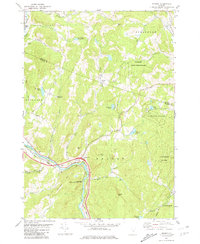
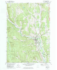
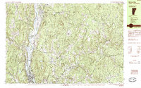
 1980 Bethel1981 Print · USGSWindsor County's high ridges and river valleys are captured here in the early eighties, showing the traditional mountain settlements of the Green Mountains. Researchers can trace family sites at the Sylvester Plot Cem, the village of Gaysville, and the White River National Fish Hatchery.3 unique versions available
 - 1981 Map of Sharon
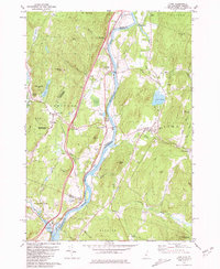
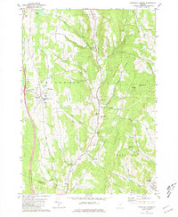
 1981 Sharon1981 Print · USGSThe White River valley in the early eighties shows a landscape of mountain forests and river-bottom transport. You can locate family landmarks like the Joseph Smith Monument, the Button Cem, and the old Covered Bridge.2 unique versions available
 - 1981 Map of South Strafford
 1981 South Strafford1981 Print · USGSThe rural uplands of Orange County come into focus in the early eighties, documenting a landscape shaped by mining and the Ompompanoosuc River. Researchers can trace the industrial footprint of the Elizabeth Mine, locate family plots at Kibling Cem, or find the Covered Bridge at Union Village.2 unique versions available
 - 1981 Map of South Royalton
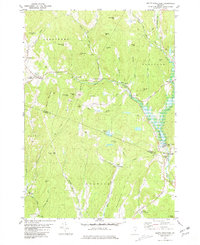
 1981 South Royalton1981 Print · USGSWindsor County in the early eighties shows a landscape of river-valley villages and winding upland roads. Genealogists and local historians can trace family locations through sites like Hickey Cem, Haven Cem, and the village of East Bethel.2 unique versions available
 - 1981 Map of Lyme
 1981 Lyme1981 Print · USGSThe Upper Valley of the Connecticut River comes alive in the early eighties, showcasing the rural character of Vermont and New Hampshire. Genealogists and local historians can trace family ties through Lyme Cem, Highland Cem, and the historic Thetford Academy.3 unique versions available
 - 1981 Map of Randolph
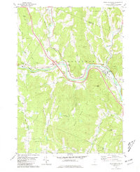
 1981 Randolph1981 Print · USGSThe Orange County hills and river valleys around Randolph are captured here in the early 1980s. Local researchers can trace the Central Vermont rail line and locate historic landmarks like the General Thomas Monument and Pleasant View Cem.2 unique versions available
 - 1981 Map of Randolph Center
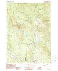
 1981 Randolph Center1981 Print · USGSCentral Vermont in the late seventies reveals a landscape of ridge-top institutions and valley-floor hamlets. Trace family histories at Allen Cem or Kelsey Mtn Cem, and locate traditional landmarks like the Cilley Covered Bridge and Vermont Technical College.2 unique versions available
 - 1984 Map of Saxtons River
 1984 Saxtons River1984 Print · USGSSoutheast Vermont in the 1980s was a landscape of deep river valleys and small villages tucked between the hills. Researchers can trace historic family burial sites at Middletown Cem, follow old roads through Lawrence Four Corners, and locate former mills at Brockways Mills.2 unique versions available
 - 1984 Map of Canaan
 1984 Canaan1984 Print · USGSGrafton County in the early eighties shows a landscape of clustered village centers and emerging wildlife management areas. Genealogists and local historians can trace family roots through the settlements of Canaan Street, Hanover Center, and the historic Shaker Hill district.3 unique versions available
 - 1984 Map of Mt. Ascutney
 1984 Mt. Ascutney1984 Print · USGSThe Vermont and New Hampshire borderlands are captured here in the early eighties, centered on the Connecticut River and the heights of Mt Ascutney. Genealogists can locate family landmarks like Child Cem and Mountainview Cem or the historic Saint-Gaudens National Historic Site.2 unique versions available
 - 1984 Map of Springfield
 1984 Springfield1984 Print · USGSThe Upper Connecticut River Valley in the mid-eighties shows a landscape of river-driven industry and upland settlements. Genealogists can locate family landmarks like Goulds Mill, Oak Hill Cem, and the Farwell Sch along the border hills.
 - 1985 Map of Bellows Falls
 1985 Bellows Falls1985 Print · USGSThe Connecticut River valley comes alive in the mid-eighties as it passes through the industrial hubs and riverside meadows of the Vermont-New Hampshire border. Trace the rail lines of the Boston and Maine or locate family landmarks near Pine Grove Cem and South Acworth.2 unique versions available
 - 1985 Map of Claremont, 1986 Print
 1985 Claremont1986 Print · USGSUpper Valley and Green Mountain life are captured here in the mid-eighties, centered on the river-linked hubs of Claremont and Springfield. Trace old family routes and rail lines like the Boston & Maine RR, or locate properties near Lake Sunapee and Mount Ascutney State Park.2 unique versions available
 - 1985 Map of Rutland, 1988 Print
 1985 Rutland1988 Print · USGSThe Upper Valley of the mid-1980s comes to life along the winding Connecticut River as it divides the Green Mountain and Granite states. Historians can trace the industrial rail hubs of White River Junction and the paths of the Appalachian Trail and Long Trail.
 - 1986 Map of Mount Holly, 1987 Print
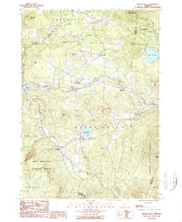 1986 Mount Holly1987 Print · USGSMount Holly and the surrounding Vermont highlands are shown here in the 1980s as a landscape of timber forests and tight-knit mountain villages. Researchers can trace historic settlements like Belmont, Tarbellville, and East Wallingford along the banks of the Mill River.2 unique versions available
 - 1986 Map of Londonderry, 1987 Print
 1986 Londonderry1987 Print · USGSWindham County at the dawn of the late eighties shows a landscape where mountain wilderness meets riverside villages. Genealogists and historians can locate old Cemeteries, the quiet hamlet of Thompsonburg, and the layout of South Londonderry along the West River.
 - 1986 Map of Weston, 1987 Print
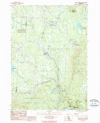
 1986 Weston1987 Print · USGSIn the mid-1980s, the mountain valleys of Windsor County maintained a quiet network of small settlements and protected forests. Trace the secluded grounds of Weston Priory, family plots at Cem sites, and the heights of Morgan Hill.2 unique versions available
End of results
Showing maps 1-17 of 17
Top cities of Windsor County
- Hartford historical maps
- Springfield historical maps
- Hartland historical maps
- Norwich historical maps
- Woodstock historical maps
- Royalton historical maps
See more
Frequently asked questions
- What are the different types of historical maps available for Windsor County?
- What is the oldest map of Windsor County?
- Where can I purchase historical maps of Windsor County for my home or office?
- Where can I download high-res historical maps of Windsor County?
- Are there historical topographic maps available for Windsor County?
- Is there historical aerial imagery available for Windsor County?
- Where are historical maps of Windsor County sourced from?