Old Maps of Alleghany County, Virginia for Metal Detecting
Plan your next treasure hunt with 154 historic maps of Alleghany County. Find old homesites, ghost towns, trails, and gathering spots that may be lost to time — perfect for identifying promising metal detecting locations.
- Locate forgotten sites: Uncover places like long-lost settlements, abandoned rail lines, or gathering spots.
- Plan better hunts: Use map overlays combined with LiDAR or satellite views to narrow in on historically rich areas.
- Made for detectorists: Thousands of hobbyists use these maps to discover relics, coins, and hidden history.
Use these historic maps to boost your research and find new opportunities beneath the surface of Alleghany County.
Alleghany County, VA maps
(154)- 1887 Map of Lewisburg
 1887 Lewisburg1887 Print · USGSThe Greenbrier Valley and the Virginia borderlands are captured here in the late nineteenth century during a period of significant rail expansion. Genealogists and historians can trace early mountain settlements like White Sulphur Springs and Ronceverte, or locate specific landmarks like Van Staverns Mill and the Half Way House.
 - 1891 Map of Lewisburg
 1891 Lewisburg1891 Print · USGSThe Virginia and West Virginia borderlands are captured here in the late 1880s, documenting a landscape of mountain ridges and burgeoning rail infrastructure. Genealogists and historians can trace family-named landmarks like Van Staverns Mill or follow the route of the Chesapeake and Ohio Railroad through the Alleghany Tunnel.8 unique versions available
 - 1894 Map of Natural Bridge, 1898 Print
 1894 Natural Bridge1898 Print · USGSThe Virginia ridges thrived with iron furnaces and mineral springs during the 1890s. Genealogists and historians can trace the early industrial footprint of Long Dale Furnace and Victoria Mines, or locate local landmarks like Lick Run Ferry and Rapps Mill.7 unique versions available
 - 1913 Map of Eagle Rock
 1913 Eagle Rock1913 Print · USGSBotetourt County at the dawn of the twentieth century shows a landscape tied to the James River and iron-era industry. Genealogists can trace family roots through numerous local landmarks like Salisbury Furnace, Fincastle, and the Fair Grounds.2 unique versions available
 - 1915 Map of Eagle Rock
 1915 Eagle Rock1915 Print · USGSBotetourt and Alleghany counties are captured here during a transitional era of mountain industry and rail expansion. Genealogists can locate family landmarks like Kyles Mills and Comptons Bridge, or trace vanished communities at Lignite and Oriskany.3 unique versions available
 - 1921 Map of Callaghan
 1921 Callaghan1921 Print · USGSThe West Virginia and Virginia borderlands come alive in this early 1920s survey of the mountain gaps and valley drafts. Researchers can trace rural life through numerous country schools like Bound School and landmarks such as Columbia Sulphur Springs and Wileys Crossing.
 - 1921 Map of White Sulphur Springs
 1921 White Sulphur Springs1921 Print · USGSThe Greenbrier Valley in the early twenties reveals a landscape of dense rural settlements and early mountain thoroughfares. Genealogists can trace family footprints across dozens of local sites like Germany School, Balm of Gilead Church, and White Sulphur Springs.2 unique versions available
 - 1921 Map of Ronceverte
 1921 Ronceverte1921 Print · USGSThe West Virginia and Virginia borderlands come alive in this early 1920s record of the Greenbrier Valley and Allegheny ridges. Genealogists can trace family roots through numerous local landmarks like Organ Cave, Red Mill, and the Highland Green School.2 unique versions available
 - 1923 Map of White Sulphur Springs
 1923 White Sulphur Springs1923 Print · USGSGreenbrier County is documented in the early twenties as a landscape of river-bend railroads and mountain turnpikes. Genealogists can trace family schoolhouses like Carroll Hill School and local landmarks such as Mathews Fort or Pilgrims Rest.3 unique versions available
 - 1923 Map of Ronceverte
 1923 Ronceverte1923 Print · USGSSoutheast West Virginia in the early twenties is a landscape of mountain ridges and remote hollows. Genealogists can trace the rural communities of Gap Mills and Sweet Springs, alongside dozens of landmarks like Organ Cave and Schley School.4 unique versions available
 - 1923 Map of Callaghan
 1923 Callaghan1923 Print · USGSThe West Virginia and Virginia borderlands come alive in the early 1920s, showing a landscape of remote schoolhouses and mineral springs. Genealogists can trace family footprints near Columbia Sulphur Springs or locate long-gone schools like Wades Draft School and Whites Draft School.3 unique versions available
 - 1929 Map of Falling Spring
 1929 Falling Spring1929 Print · USGSThe Jackson River valley comes to life in this late 1920s survey of the Virginia highlands. Researchers can locate early schools and settlements like Tinkersville, Greavers Mill, and the Valley View Valley Sch.2 unique versions available
 - 1931 Map of Healing Springs
 1931 Healing Springs1931 Print · USGSBath County's famous resort corridor is captured here in the early thirties, showing a unique mix of high-society recreation and deep-hollow rural life. Genealogists and historians can trace family-named sites like Ashwood, Tinkertown, and the Indian Hill Sch.2 unique versions available
 - 1932 Map of Falling Spring
 1932 Falling Spring1932 Print · USGSThe Virginia and West Virginia borderlands in the early 1930s reveal a landscape of mountain ridges and riverside rail industry. Genealogists can trace family footprints at Greavers Mill, Jenkins Ford, and the old Cedar Creek Sch.3 unique versions available
 - 1933 Map of Healing Springs
 1933 Healing Springs1933 Print · USGSBath County in the early 1930s is a landscape of mountain resorts and ridge-and-valley settlements. Researchers can trace the development of the springs at Hot Springs and Healing Springs, or find local landmarks like Oak Grove Sch and the Cascades Golf Club.3 unique versions available
 - 1935 Map of White Sulphur Springs, 1965 Print
 1935 White Sulphur Springs1965 Print · USGSGreenbrier County is shown here in the mid-1930s, featuring a landscape of mountain ridges and river-bottom settlements connected by the Chesapeake and Ohio railroad. Researchers can locate many now-rare landmarks, from Camp Alleghany to the Enon Church and schools like Dansie School.
 - 1939 Map of White Sulphur Springs
 1939 White Sulphur Springs1939 Print · USGSGreenbrier County is captured here in the late 1930s, showing a landscape defined by the winding Greenbrier River and the expanding road network of Lewisburg. Genealogists and historians can trace numerous rural institutions, from the grounds of Camp Alleghany to local centers like Frankford and Pilgrim Rest Church.2 unique versions available
 - 1945 Map of Clifton Forge, 1963 Print
 1945 Clifton Forge1963 Print · USGSThe rail and river corridors of Alleghany County are captured here at the end of the war, centered on the bustling junction of Clifton Forge. Genealogists and historians can trace old community landmarks like Union Chapel, the Rich Patch Mines, and the Deeds Sch among the ridgelines.2 unique versions available
 - 1945 Map of New Castle, 1964 Print
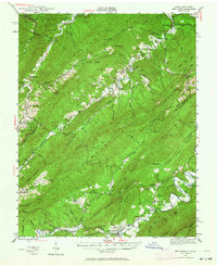 1945 New Castle1964 Print · USGSThe mountain gaps of Craig and Alleghany Counties are captured here at the end of the war, when mining and rail transport still defined the local economy. Researchers can trace the legacy of industry and faith at Jordan Mines, Lignite, and Shoafs Chapel.
 - 1946 Map of Callaghan
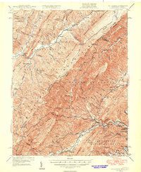 1946 Callaghan1946 Print · USGSThe Virginia and West Virginia borderlands are captured here in the mid-1940s, showing the intersection of heavy rail and mountain life. Genealogists and historians can trace old community sites like Hokes Chapel, Dunlap Sch, and the industrial operations at Stack Mine.4 unique versions available
 - 1946 Map of Millboro, 1957 Print
 1946 Millboro1957 Print · USGSThe Alleghany and Rockbridge county lines are mapped here in the mid-1940s, highlighting a rugged corridor of industry and nature. Researchers can trace the Chesapeake and Ohio RR through the Lick Run Tunnel or locate Long Dale Furnace and Rockbridge Alum Springs.2 unique versions available
 - 1947 Map of New Castle
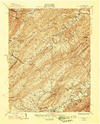 1947 New Castle1947 Print · USGSThe Virginia and West Virginia borderlands in the late 1940s reveal a landscape of mountain resorts and industrial remnants. You can trace the legacy of mineral spas at Sweet Springs and locate early community hubs like Jordan Mines and the Fenwick Mine.2 unique versions available
 - 1947 Map of Roanoke, 1948 Print
 1947 Roanoke1948 Print · USGSCentral Virginia in the late 1940s reveals a region defined by its great mountain ridges and the powerful river-and-rail economy connecting Roanoke to Lynchburg. Researchers can trace the path of the Virginian RR and locate historic county seats like Charlotte Court House.2 unique versions available
 - 1948 Map of Ronceverte, 1964 Print
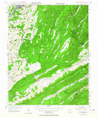 1948 Ronceverte1964 Print · USGSThe West Virginia and Virginia borderlands come into focus in the late 1940s, showing the mountain communities between the Greenbrier River and the Jefferson National Forest. Genealogists can locate family-named landmarks like McGlone and Gutes, or trace rural institutions such as Pleasant Valley Sch and Red Mill.
 - 1949 Map of Callaghan
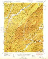 1949 Callaghan1949 Print · USGSThe Virginia and West Virginia borderlands come alive in this mid-century survey of the high Allegheny ridges and river valleys. Genealogists and researchers can trace the Chesapeake and Ohio rail line to vanished stops like Backbone Siding or locate family sites near Hokes Chapel and Whites Draft Sch.2 unique versions available
Showing maps 1-25 of 154
Top cities of Alleghany County
- Clifton Forge historical maps
- Mallow historical maps
- Low Moor historical maps
- Iron Gate historical maps
- Selma historical maps
- Cliftondale Park historical maps
See more
Frequently asked questions
- What are the different types of historical maps available for Alleghany County?
- What is the oldest map of Alleghany County?
- Where can I purchase historical maps of Alleghany County for my home or office?
- Where can I download high-res historical maps of Alleghany County?
- Are there historical topographic maps available for Alleghany County?
- Is there historical aerial imagery available for Alleghany County?
- Where are historical maps of Alleghany County sourced from?