Old Maps of Amherst County, Virginia for Hiking & Exploration
Hike through history with 150 historic maps of Amherst County. Explore old trails, ghost towns, and forgotten backroads — perfect for outdoor adventurers and local explorers.
- Rediscover forgotten places: Map out old mining camps, roads, and footpaths that no longer exist on modern maps.
- Layer with modern tools: Combine with LiDAR or satellite views to plan hikes through historical terrain.
- Made for exploration: Popular among hikers, overlanders, and local history lovers.
Use these maps to find adventure and explore the hidden past of Amherst County.
Amherst County, VA maps
(150)- 1892 Map of Lynchburg
 1892 Lynchburg1892 Print · USGSCentral Virginia in the 1890s centered on the vital rail and river junction of Lynchburg and its surrounding tobacco-growing counties. Family historians can trace ancestral crossings at Wards Road Ferry, locate the Academy church, and follow the early Virginia Midland Rail Road through Evington.6 unique versions available
 - 1892 Map of Buckingham
 1892 Buckingham1892 Print · USGSCentral Virginia in the late nineteenth century was defined by its river-and-rail economy along the James River. Genealogists and historians can trace the foundations of local life through the Kleinburg School, the Soap Stone Quarry, and the Virginia Midland Railroad.7 unique versions available
 - 1892 Map of Appomattox
 1892 Appomattox1892 Print · USGSCentral Virginia in the 1890s appears as a landscape of small agricultural hubs and vital river crossings. Genealogists can trace family names and landmarks like Morris Church, the Grave of Patrick Henry, and crossings such as Beazleys Ford.6 unique versions available
 - 1894 Map of Lexington, 1900 Print
 1894 Lexington1900 Print · USGSAmherst and the surrounding Blue Ridge foothills are captured in the late nineteenth century during a period of rural expansion and early rail development. Genealogists can locate family homesteads near Clifford P.O. or trace landmarks like Cornerstone Ch. and Massies Mill.7 unique versions available
 - 1932 Map of Lexington
 1932 Lexington1932 Print · USGSRockbridge County in the early 1930s shows a landscape of academic centers and rural mill towns. Genealogists and historians can trace family locations near Rockbridge Alum Springs, Brownsburg Mill, or the segregated White Hall (Colored View) School.
 - 1935 Map of Buena Vista
 1935 Buena Vista1935 Print · USGSThe James River corridor in the mid-1930s reveals a landscape of hydroelectric power and deep-rooted mountain communities. Genealogists and historians can locate dozens of country schools and churches, from Ivory Hill Sch to Mt Zion Ch, alongside industrial sites like the LONE JACK QUARRY.
 - 1935 Map of Amherst
 1935 Amherst1935 Print · USGSAmherst County in the mid-thirties reveals a landscape of mountain hollows and rail-connected settlements along the edge of the George Washington National Forest. Genealogists and historians can locate rural landmarks like the Indian Mission, Sweet Briar College, and the old Southern Mineral Plant.
 - 1936 Map of Vesuvius
 1936 Vesuvius1936 Print · USGSThe Blue Ridge mountain front meets the Shenandoah Valley in the 1930s, showing a land of rail junctions and high-country mines. Researchers can trace the Appalachian Trail past peaks like The Priest and find local history at Steeles Tavern or Old Providence Cem.
 - 1937 Map of Lexington
 1937 Lexington1937 Print · USGSRockbridge County during the mid-1930s shows a landscape defined by mountain gaps and the river-and-rail economy of the Shenandoah Valley. Researchers can trace old family names and rural infrastructure through Rockbridge Baths, McClung Mill, and New Monmouth Ch.3 unique versions available
 - 1939 Map of Amherst
 1939 Amherst1939 Print · USGSAmherst County in the mid-1930s is a landscape of mountain ridges and tight-knit rural communities. Genealogists and historians can trace the exact locations of many local landmarks, from Sweet Briar and Amherst to the Indian Mission and Dodds Store.
 - 1939 Map of Buena Vista
 1939 Buena Vista1939 Print · USGSThe James River corridor near Buena Vista was a bustling intersection of rail and water transport in the years before World War II. Researchers can trace the early Appalachian Trail and find rural community hubs like Pedlar Mills, CCC Camp No 10, and Buffalo Forge.
 - 1940 Map of Buena Vista
 1940 Buena Vista1940 Print · USGSThe industrial and rail corridor of the James River is captured here as the region's mountain economy evolved in the 1930s. Researchers can trace the dual rail lines serving Glasgow, find CCC Camp No 10, and locate rural landmarks like Buffalo Forge and Ben Salam Sch.2 unique versions available
 - 1941 Map of Vesuvius
 1941 Vesuvius1941 Print · USGSThe Blue Ridge highlands at the start of the 1940s reveal a landscape of mountain mines and early parkway development. Genealogists and hikers can trace the Appalachian Trail past the Irish Creek Mission and forgotten sites like Mill Creek Sch.2 unique versions available
 - 1944 Map of Lynchburg
 1944 Lynchburg1944 Print · USGSThe James River corridor hums with activity during the mid-1940s as four major railways converge on the industrial and collegiate city of Lynchburg. Researchers can trace old family sites and schools like the Rosenwald Sch, Oxford Furnace, and Galts Mill.3 unique versions available
 - 1947 Map of Roanoke, 1948 Print
 1947 Roanoke1948 Print · USGSCentral Virginia in the late 1940s reveals a region defined by its great mountain ridges and the powerful river-and-rail economy connecting Roanoke to Lynchburg. Researchers can trace the path of the Virginian RR and locate historic county seats like Charlotte Court House.2 unique versions available
 - 1950 Map of Lexington
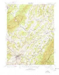 1950 Lexington1950 Print · USGSRockbridge County and the Shenandoah Valley are shown in detail during the mid-twentieth century, centered on the bustling college town of Lexington. Researchers can trace the heritage of the Maury River valley through historic sites like Rockbridge Baths, Goshen Pass, and McClung Mill.2 unique versions available
 - 1950 Map of Goode, 1952 Print
 1950 Goode1952 Print · USGSMid-century Bedford and Campbell Counties are documented here as the rural landscape meets the mountains. Genealogists can trace the location of numerous country landmarks like Poplar Forest, Coltons Mill, and the many schools and churches including North Bedford Ch.3 unique versions available
 - 1950 Map of Buena Vista, 1958 Print
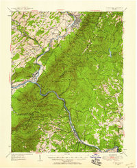 1950 Buena Vista1958 Print · USGSThe Blue Ridge high country is captured here at mid-century as the Blue Ridge Parkway and Appalachian Trail were becoming established. Genealogists and historians can trace family locations near Pedlar Mills, Buffalo Forge, and the riverside rail junction at Glasgow.2 unique versions available
 - 1950 Map of Amherst, 1960 Print
 1950 Amherst1960 Print · USGSAmherst and the surrounding Blue Ridge foothills are documented here at mid-century, just as rural communities and mountain gaps remained largely unchanged. Genealogists can trace family locations through Dodds Store, Mt Moriah Ch, and the Sweet Briar College campus.
 - 1950 Map of Vesuvius, 1960 Print
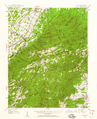 1950 Vesuvius1960 Print · USGSThe Blue Ridge high country of Augusta and Nelson counties comes alive in the mid-twentieth century, showing a landscape of remote mountain missions and state institutions. Genealogists and hikers can trace the Appalachian Trail past Irish Creek Mission, Montebello, and the State Prison Camp No 10.2 unique versions available
 - 1950 Map of Lynchburg, 1963 Print
 1950 Lynchburg1963 Print · USGSMid-century Lynchburg and the surrounding Piedmont hills are caught in a moment of industrial and rail prominence. Researchers can trace the legacy of local commerce and community through landmarks like Oxford Furnace, Tomahawk Mill, and Lynchburg Womens College.
 - 1951 Map of Vesuvius
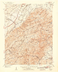 1951 Vesuvius1951 Print · USGSThe Blue Ridge foothills of Augusta and Rockbridge Counties are shown here in the early fifties, capturing a landscape of mountain missions and remote mines. Trace family history through Old Providence Ch, the Irish Creek Mission, and Massies Mill.2 unique versions available
 - 1951 Map of Lexington
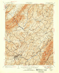 1951 Lexington1951 Print · USGSMid-century Rockbridge County is documented here at the intersection of the Blue Ridge and the Alleghenies. Researchers can trace the river-and-rail economy through McClung Mill, the Norfolk and Western line, and long-standing landmarks like Rockbridge Baths.2 unique versions available
 - 1952 Map of Amherst
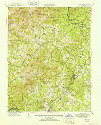 1952 Amherst1952 Print · USGSAmherst County and the Blue Ridge heights are captured here in the early fifties before modern development reshaped the rural landscape. Genealogists can trace family lines through dozens of local landmarks like Dodds Store, Indian Mission, and Pleasant Grove Ch.
 - 1952 Map of Buena Vista
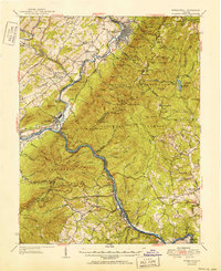 1952 Buena Vista1952 Print · USGSThe James River corridor and the Blue Ridge mountains meet here during the mid-twentieth century, showcasing a landscape of rail-fed industrial towns and remote forest settlements. Trace the heritage of Pedlar Mills and Buffalo Forge, or find local landmarks like Wesley Chapel and the Bluff Mtn Lookout Tower.2 unique versions available
Showing maps 1-25 of 150
Top cities of Amherst County
Frequently asked questions
- What are the different types of historical maps available for Amherst County?
- What is the oldest map of Amherst County?
- Where can I purchase historical maps of Amherst County for my home or office?
- Where can I download high-res historical maps of Amherst County?
- Are there historical topographic maps available for Amherst County?
- Is there historical aerial imagery available for Amherst County?
- Where are historical maps of Amherst County sourced from?