2020s Maps of Bedford County, Virginia
Explore 24 historic maps of Bedford County from the 2020s. These maps offer a rare glimpse into what life looked like during the 2020s — showing old roads, neighborhoods, homes, and landmarks that have changed or disappeared over time.
Whether you're researching your family's past, planning a metal detecting trip, or studying how Bedford County's landscape evolved across the 2020s, these high-resolution maps are a powerful tool for exploring the history of this region.
- Focus on a specific era: All maps on this page are from the 2020s, giving you a focused view of this time period.
- See what’s changed: Compare century-old streets, trails, and buildings to today's modern landscape using overlays and satellite layers.
- Research with precision: Use these maps for genealogy, historical research, land use analysis, or educational projects.
- View, download, or print: Maps are fully viewable online in high resolution, and can be downloaded or printed for your own records.
Start exploring Bedford County's history through authentic maps from the 2020s. This is your window into the past.
Bedford County, VA maps
(24)- 2022 Map of Goode, 2022 Print
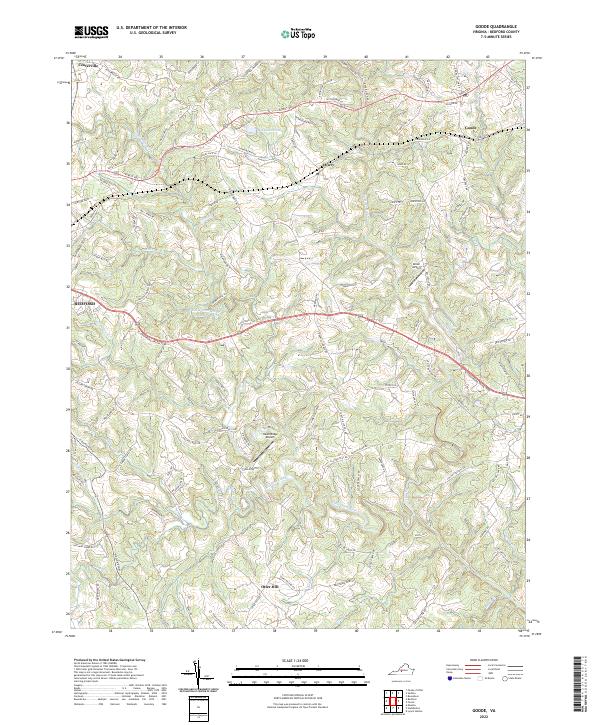 2022 Goode2022 Print · USGSBedford County in the early 2020s shows a landscape of river valleys and small railside communities. Genealogists and local historians can trace the developments around Goode and Lowry, or locate properties along the Little Otter River and Screechum Hollow.
 - 2022 Map of Sedalia, 2022 Print
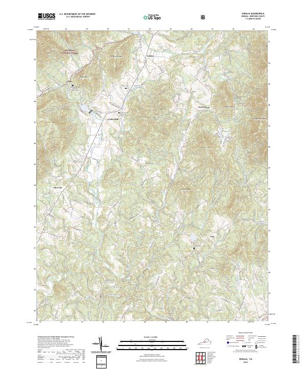 2022 Sedalia2022 Print · USGSThe rolling uplands of Bedford County come into focus in this contemporary survey, showing the rural communities of Sedalia and Cifax among the peaks of the Jefferson National Forest. Researchers can locate family landmarks like the Turpin Cem or trace the old paths to Coltons Mill and Otterville.
 - 2022 Map of Tobacco Row Mountain, 2022 Print
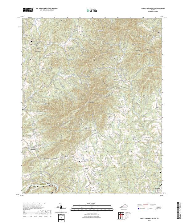 2022 Tobacco Row Mountain2022 Print · USGSAmherst County's ridgelines and river valleys are shown in 2022 as a network of rural settlements and ancestral landmarks. Genealogists can locate family burial sites like Watts Cem or Fletcher Cem near communities such as Elon and Agricola.
 - 2022 Map of Forest, 2022 Print
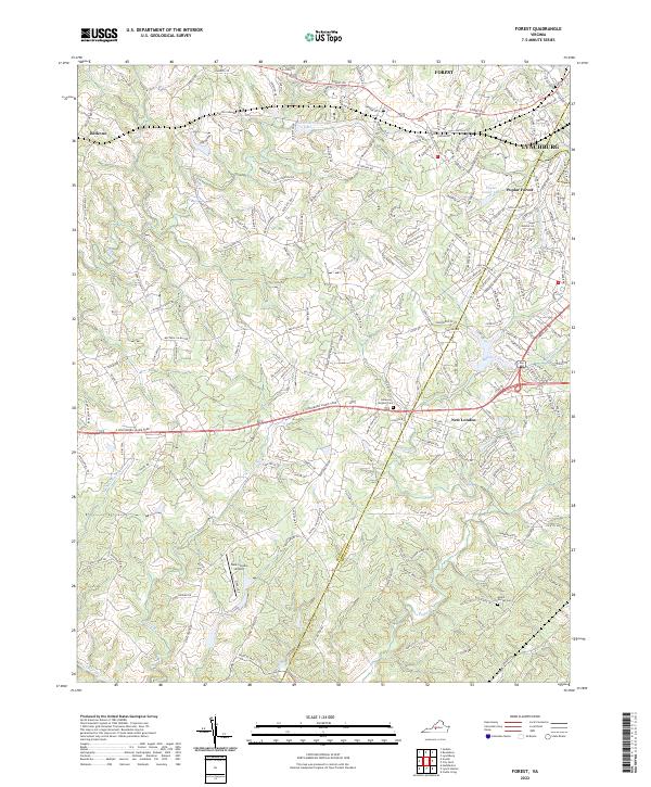 2022 Forest2022 Print · USGSBedford and Campbell Counties are captured in this modern survey as residential growth spreads west from Lynchburg. Researchers can trace historical sites like Poplar Forest and New London, or locate family resting places at Callaway Steptoe Cem.
 - 2022 Map of Boonsboro, 2022 Print
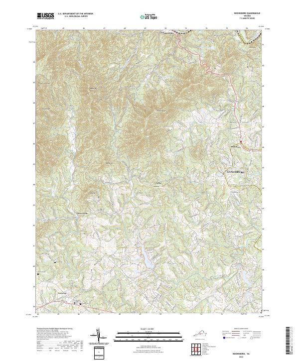 2022 Boonsboro2022 Print · USGSBedford County during its modern period of growth shows a landscape where historic rural outposts meet the expanding reach of the city. Researchers can trace family sites at North Cem and Norwood Cem or explore the ridges of Fleming Mtn and Dolly Mtn.
 - 2022 Map of Hardy, 2022 Print
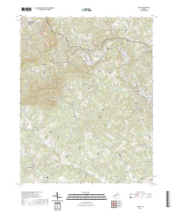 2022 Hardy2022 Print · USGSFranklin and Bedford counties are documented here in the early twenty-first century, showing the rural landscape around Hardy. Genealogists will find a wealth of family history in markers like Amos-Richardson Cem, Oylers Chapel Cem, and Robertson Altice Cem.
 - 2022 Map of Stewartsville, 2022 Print
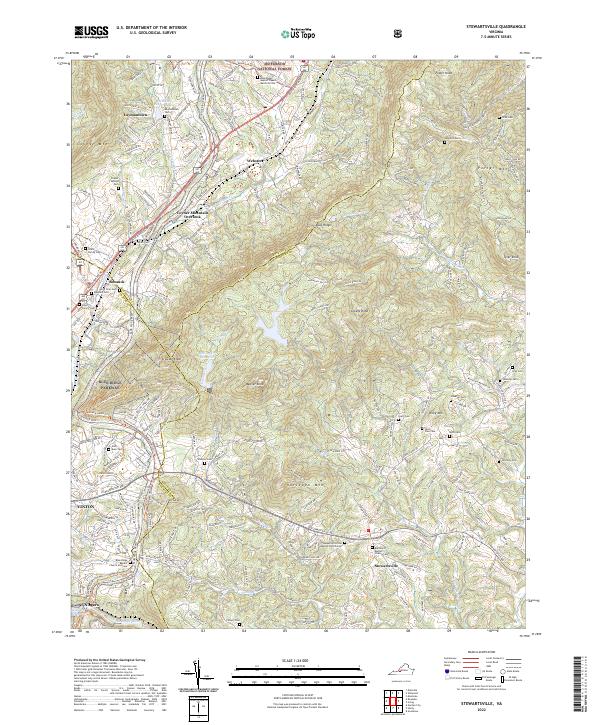 2022 Stewartsville2022 Print · USGSThe foothills of the Blue Ridge Mountains in Bedford and Roanoke counties are captured here in the early twenty-first century. Genealogists can locate numerous family burial sites like Gish Muse Cem and Coyner Springs Cem or trace the development of Stewartsville and Bonsack.
 - 2022 Map of Huddleston, 2022 Print
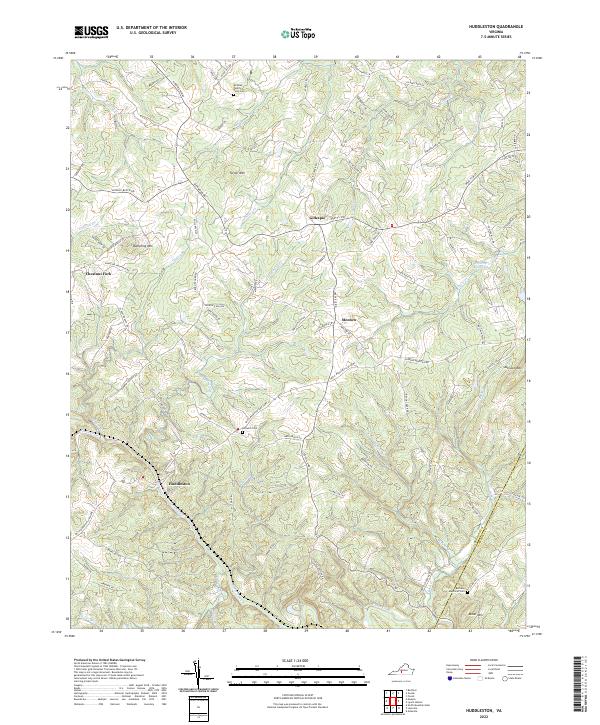 2022 Huddleston2022 Print · USGSBedford County's rural foothills and the community of Huddleston are mapped here as they appeared in the early 2020s. Genealogists and local historians can trace family burial sites like Bethany Memorial Cem and landmarks such as Preston Millpond or Turner Mtn.
 - 2022 Map of Irving, 2022 Print
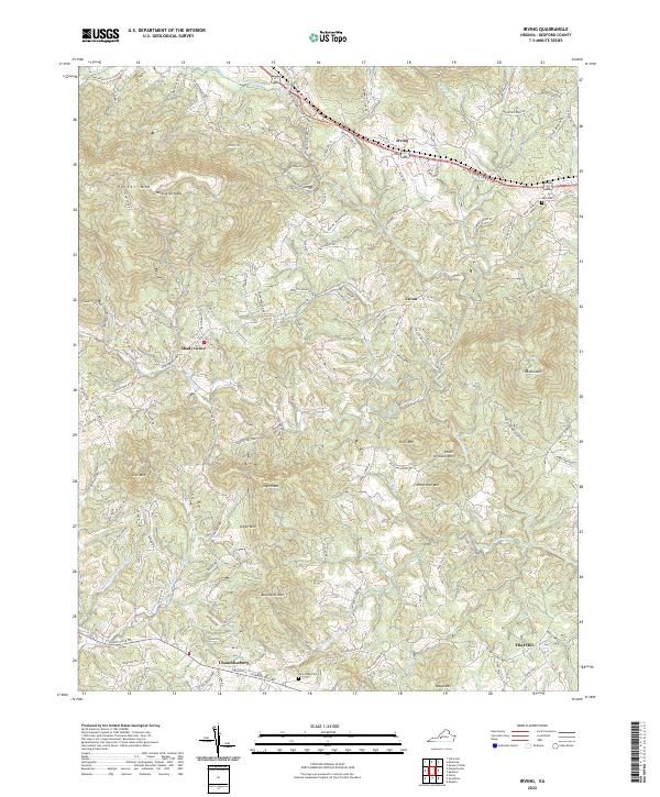 2022 Irving2022 Print · USGSBedford County's high ridges and quiet valleys are documented here in the early twenty-first century. Researchers can trace the paths of the W Lynchburg Salem Tpke and locate rural landmarks such as Tate Cem, Shady Grove, and Chamblissburg.
 - 2022 Map of Leesville, 2022 Print
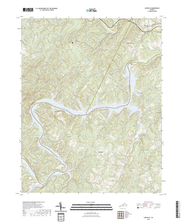 2022 Leesville2022 Print · USGSThe Roanoke River valley at the Pittsylvania and Bedford county line appears here in detail, showcasing a landscape of high ridges and rural settlements. Genealogists can trace family landmarks like Stone Road Cem or explore the geography of Leesville, Browntown, and Coles Quarter.
 - 2022 Map of Villamont, 2022 Print
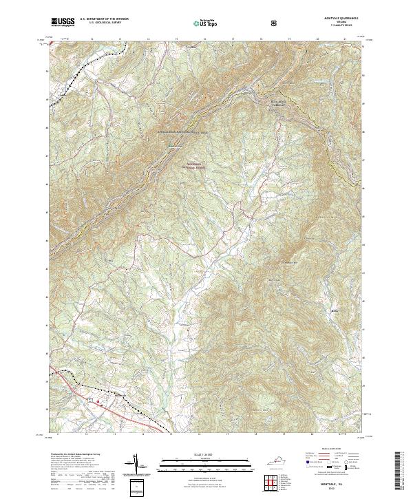
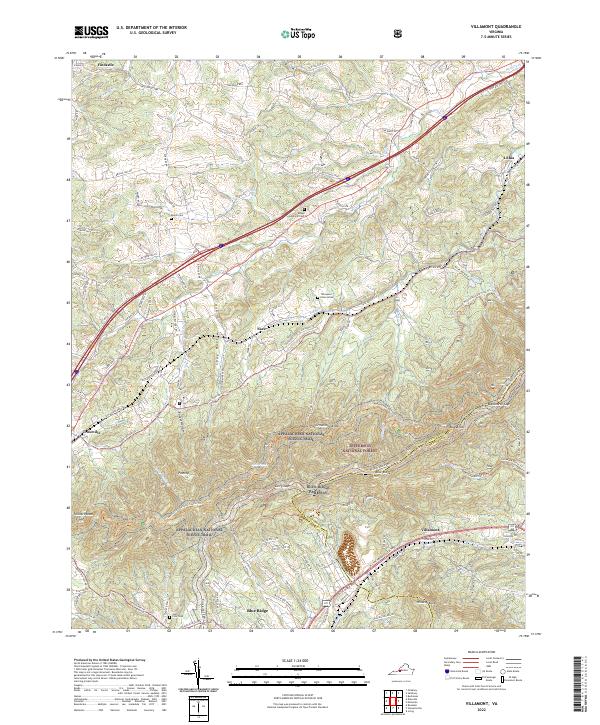 2022 Villamont2022 Print · USGSBotetourt County in the early 2020s remains defined by its mountain gaps and historic transportation corridors. Researchers can locate family landmarks like Booze Cem, follow the N & W RR, and trace the route of the Appalachian National Scenic Trail.
 - 2022 Map of Peaks of Otter, 2022 Print
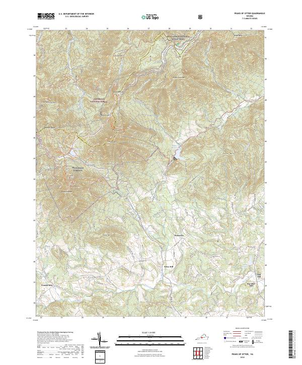 2022 Peaks of Otter2022 Print · USGSThe Blue Ridge high country and its valley settlements are documented here in the early twenty-first century. Genealogists and historians can trace old milling sites like Kelso Mill and Big Otter Mill or follow the path of the Appalachian National Scenic Trail.
 - 2022 Map of Arnold Valley, 2022 Print
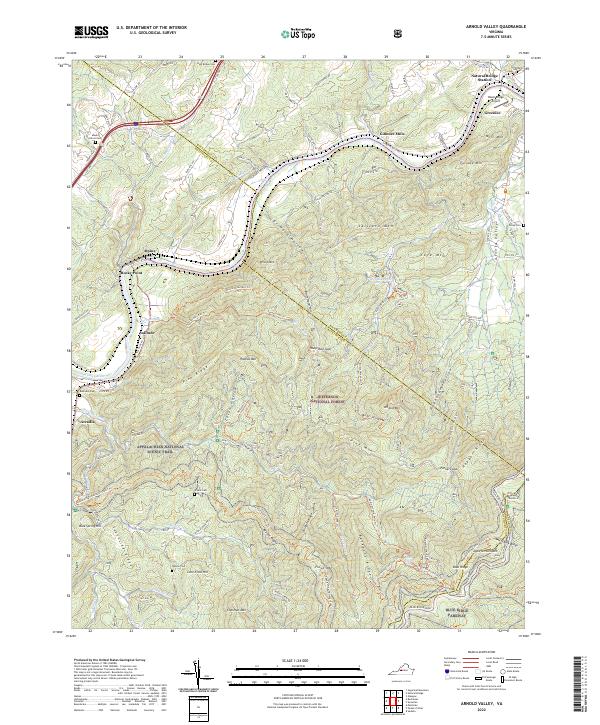 2022 Arnold Valley2022 Print · USGSThe James River corridor near the Rockbridge and Botetourt line was a center of early river transport and mountain industry. Genealogists and historians can trace family cemeteries like Mount Olivet Cem and the riverfront communities of Gilmore Mills and Natural Bridge Station.
 - 2022 Map of Moneta, 2022 Print
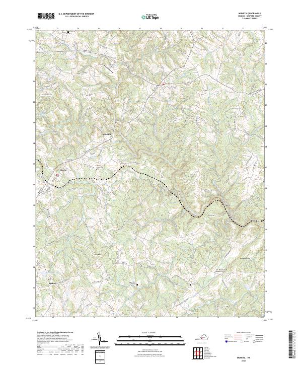 2022 Moneta2022 Print · USGSBedford County is seen here in the early 2020s, showing a landscape of traditional mills and family homesteads. Genealogists can locate legacy sites like Blankenship Family Cem and the old settlement at Davis Mill.
 - 2022 Map of Moneta SW, 2022 Print
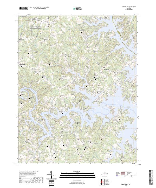 2022 Moneta SW2022 Print · USGSFranklin County's lakeside communities and historic family homesteads are preserved here in the early twenty-first century. Genealogists can trace hundreds of years of local history through family-named sites like Durham Family Cem, the Hales Ford Methodist Church, and the Booker T Washington National Monument.
 - 2022 Map of Big Island, 2022 Print
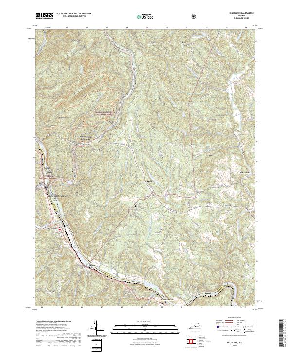 2022 Big Island2022 Print · USGSThe James River valley and the Blue Ridge heights define this area of the Virginia mountains during the early twenty-first century. Researchers can trace rural settlement patterns and local lineage near Pedlar Mills, Ivy Hill Cem, and the historic Waughs Ferry Rd.
 - 2022 Map of Goodview, 2022 Print
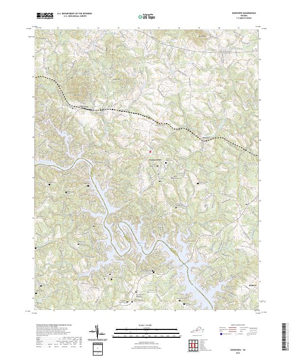 2022 Goodview2022 Print · USGSThe Roanoke River valley near Goodview was transformed by the waters of the Blue Ridge foothills. Researchers can trace dozens of family burial sites like Meador Mitchell Family Cem and Ellis Cem near the shores of Smith Mountain Lake.
 - 2022 Map of Lynch Station, 2022 Print
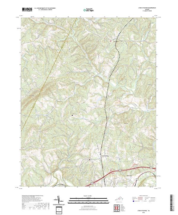 2022 Lynch Station2022 Print · USGSCampbell County and the surrounding Piedmont region are documented here in the early twenty-first century, showing the established communities of Lynch Station and Evington. Researchers can trace local lineage through sites like Mount Hermon Cem or follow the historic drainage of the Big Otter River.
 - 2022 Map of City Farm, 2022 Print
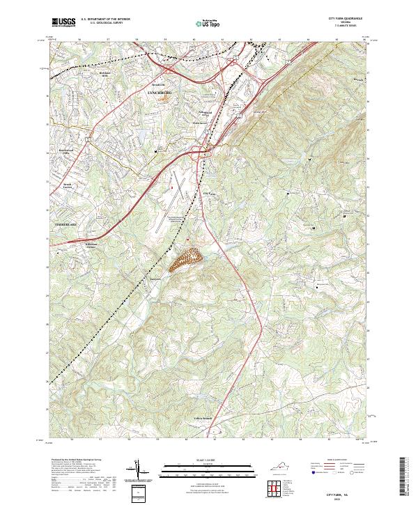 2022 City Farm2022 Print · USGSThe southern outskirts of Lynchburg and Campbell County come into focus in this contemporary survey of Virginia's Piedmont. Researchers can trace family history through several local burial sites like the Dodson Family Cem and Beulah Baptist Church Cem or locate the historic settlement of Lawyers.
 - 2022 Map of Snowden, 2022 Print
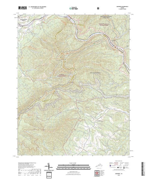 2022 Snowden2022 Print · USGSThe James River gaps and mountain ridges of Bedford and Rockbridge counties come alive in this recent survey. Researchers can trace historic routes through Petites Gap, locate the Sharon Cem, or explore local landmarks like Powells Store and Greenlee.
 - 2022 Map of Montvale, 2022 Print
 2022 Montvale2022 Print · USGSMontvale and the surrounding mountain ridges are shown here in the modern era, as the valley floor meets the high peaks of the Blue Ridge. Researchers can trace the path of the Appalachian National Scenic Trail and locate family names near Lithia and McFalls Mtn.
 - 2022 Map of Smith Mountain Dam, 2022 Print
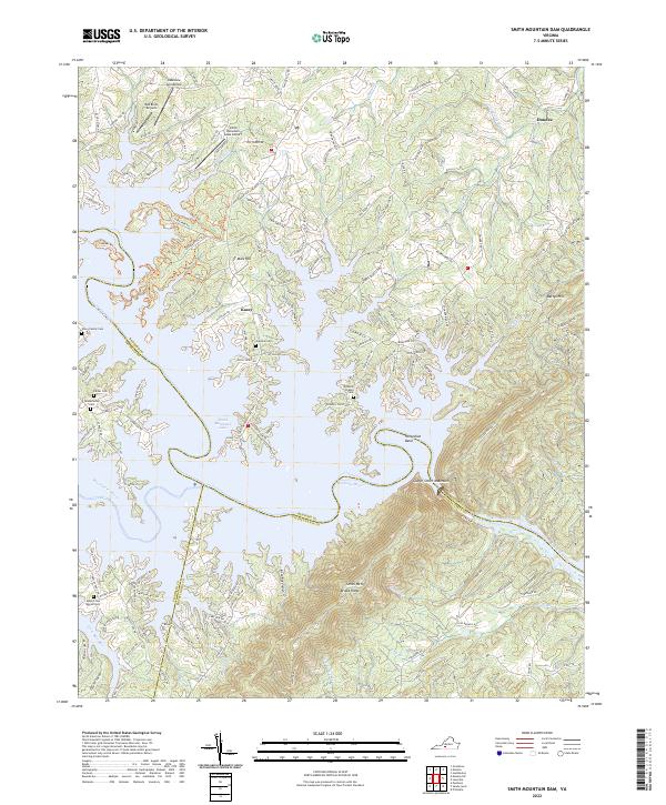 2022 Smith Mountain Dam2022 Print · USGSThe convergence of the Roanoke and Blackwater rivers in the twenty-first century reveals a landscape shaped by water and aviation. Researchers can trace family history through sites like the Toney Family Cem or locate local landmarks like the Red Birds Airyard and Mars Hill.
 - 2022 Map of Bedford, 2022 Print
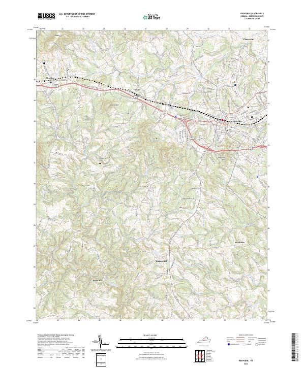 2022 Bedford2022 Print · USGSBedford and its surrounding ridges come into focus in this contemporary survey of south-central Virginia. Researchers can trace family history through numerous local sites like the McGhee Family Cem, Joppa Mill, and the community of Thaxton.
 - 2022 Map of Lynchburg, 2022 Print
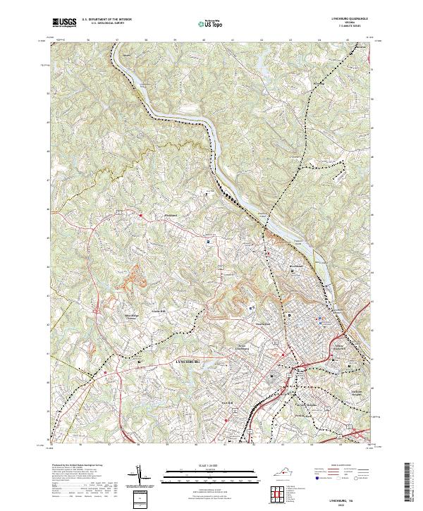 2022 Lynchburg2022 Print · USGSLynchburg and the James River corridor are shown here in the early twenty-first century, highlighting a landscape rich in academic and civic heritage. Researchers can trace historic burial grounds and institutions like Old City Cemetery, Randolph College, and the Lynchburg Courthouse.
End of results
Showing maps 1-24 of 24
Top cities of Bedford County
Frequently asked questions
- What are the different types of historical maps available for Bedford County?
- What is the oldest map of Bedford County?
- Where can I purchase historical maps of Bedford County for my home or office?
- Where can I download high-res historical maps of Bedford County?
- Are there historical topographic maps available for Bedford County?
- Is there historical aerial imagery available for Bedford County?
- Where are historical maps of Bedford County sourced from?