1960s Maps of Bland County, Virginia
Explore 13 historic maps of Bland County from the 1960s. These maps offer a rare glimpse into what life looked like during the 1960s — showing old roads, neighborhoods, homes, and landmarks that have changed or disappeared over time.
Whether you're researching your family's past, planning a metal detecting trip, or studying how Bland County's landscape evolved across the 1960s, these high-resolution maps are a powerful tool for exploring the history of this region.
- Focus on a specific era: All maps on this page are from the 1960s, giving you a focused view of this time period.
- See what’s changed: Compare century-old streets, trails, and buildings to today's modern landscape using overlays and satellite layers.
- Research with precision: Use these maps for genealogy, historical research, land use analysis, or educational projects.
- View, download, or print: Maps are fully viewable online in high resolution, and can be downloaded or printed for your own records.
Start exploring Bland County's history through authentic maps from the 1960s. This is your window into the past.
Bland County, VA maps
(13)- 1961 Map of Bluefield
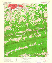
 1961 Bluefield1961 Print · USGSThe coalfields and mountain ridges of southern West Virginia and southwest Virginia are captured in the early sixties. Genealogists can trace family ties through rail-linked towns like Princeton and Richlands or along the shores of Bluestone Reservoir.
 - 1962 Map of Winston-Salem
 1962 Winston-Salem1962 Print · USGSThe North Carolina Piedmont meets the Virginia highlands in the early sixties, showing the rail corridors and mountain gaps of the southern Appalachians. Researchers can trace the Blue Ridge Parkway or locate family sites near Winston-Salem, Mount Airy, and Hanging Rock Mountain.
 - 1962 Map of Princeton, 1963 Print
 1962 Princeton1963 Print · USGSThe Princeton area in the early sixties showcases a growing West Virginia town nestled between parallel ridges. Genealogists and local historians can trace family burial sites like Harvey Cem and Shumate Cem or follow the path of the Norfolk and Western railroad through the valley.3 unique versions available
 - 1962 Map of Bluefield, 1964 Print
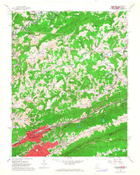 1962 Bluefield1964 Print · USGSThe rail-and-ridge country of the West Virginia-Virginia border shows its mid-century growth and industrial character in the early sixties. Genealogists can locate family names at Roselawn Memorial Gardens Cem or trace landmarks like Bluefield State Teachers College and Mountaineer Speedway.3 unique versions available
 - 1965 Map of Oakvale, 1966 Print
 1965 Oakvale1966 Print · USGSMercer County and the Virginia borderlands are documented here in the mid-sixties, following the narrow valleys carved by the East River and Wolf Creek. Researchers can trace the Norfolk and Western rail line through Oakvale or locate family sites like Hales Chapel and Beamer Cem.3 unique versions available
 - 1965 Map of Long Spur, 1967 Print
 1965 Long Spur1967 Print · USGSThe mountain valleys of Wythe and Pulaski counties are captured here in the mid-1960s as rural life persisted along the ridges. Genealogists and hikers can trace the Appalachian Trail across Walker Mountain or locate the old Spur Branch Sch and Davis Ch near Long Spur.3 unique versions available
 - 1965 Map of White Gate, 1967 Print
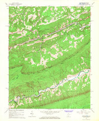
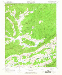
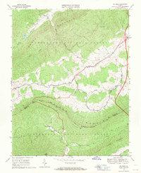
 1965 White Gate1967 Print · USGSGiles and Bland counties are captured in the mid-sixties, showing a landscape of deep ridges and the winding Walker Creek. Genealogists and hikers can trace the Appalachian Trail, locate the Bland State Correctional Farm, or find rural churches like Walkers Creek Ch.2 unique versions available
 - 1965 Map of Mechanicsburg, 1967 Print
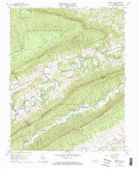
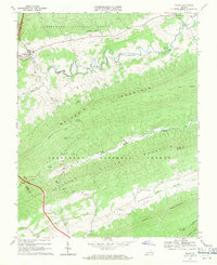
 1965 Mechanicsburg1967 Print · USGSBland County, Virginia, is shown in the mid-1960s as a landscape of valley farming and high forest ridges. Researchers can trace rural life through landmarks like Byrns Chapel, the Appalachian Trail corridor, and the State Correctional Farm.2 unique versions available
 - 1968 Map of Rocky Gap, 1970 Print
 1968 Rocky Gap1970 Print · USGSBland County's mountain gaps and forest lands are captured here in the late sixties as the region prepared for highway expansion. Genealogists and historians can trace family burial sites at Tuggle Cem and Hoges Chapel Cem or locate the community at Kimberling.2 unique versions available
 - 1968 Map of Bastian, 1971 Print
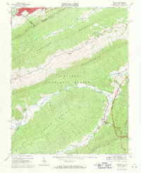 1968 Bastian1971 Print · USGSBland and Tazewell Counties are captured in the late sixties, where the urban edge of Bluefield meets the dense ridges of the Jefferson National Forest. Genealogists and historians can trace rural life at Bastian, Hicksville, and Grapefield, or locate family landmarks like Green Valley Ch and Clear Fork Ch.2 unique versions available
 - 1968 Map of Bland, 1971 Print
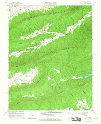
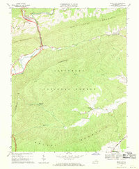
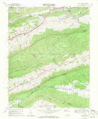
 1968 Bland1971 Print · USGSThe ridges and valleys of Bland County are captured here in the late sixties as the mountain communities remained centered around old churches and mills. Genealogists and hikers can trace the Appalachian Trail across Walker Mountain or locate Temple Hill Cem and Helveys Mill.3 unique versions available
 - 1968 Map of Big Bend, 1971 Print
 1968 Big Bend1971 Print · USGSBland and Wythe counties are shown in the late sixties as the mountain ridges remained largely forest and the valleys supported quiet rural life. Genealogists can locate several local landmarks including Community Ch, Effna, and Stony Fork Ch.2 unique versions available
 - 1968 Map of Cove Creek, 1971 Print
 1968 Cove Creek1971 Print · USGSThe Virginia mountain country near the Bland and Tazewell border is documented here in the late sixties. Genealogists and local historians can locate Maple Hill Cemetery, the Shawver Mill, and schools like Dudley Sch along the river valleys.2 unique versions available
End of results
Showing maps 1-13 of 13
Top cities of Bland County
Frequently asked questions
- What are the different types of historical maps available for Bland County?
- What is the oldest map of Bland County?
- Where can I purchase historical maps of Bland County for my home or office?
- Where can I download high-res historical maps of Bland County?
- Are there historical topographic maps available for Bland County?
- Is there historical aerial imagery available for Bland County?
- Where are historical maps of Bland County sourced from?