Old Maps of Alberta, Virginia for Hiking & Exploration
Hike through history with 12 historic maps of Alberta. Explore old trails, ghost towns, and forgotten backroads — perfect for outdoor adventurers and local explorers.
- Rediscover forgotten places: Map out old mining camps, roads, and footpaths that no longer exist on modern maps.
- Layer with modern tools: Combine with LiDAR or satellite views to plan hikes through historical terrain.
- Made for exploration: Popular among hikers, overlanders, and local history lovers.
Use these maps to find adventure and explore the hidden past of Alberta.
Alberta, VA maps
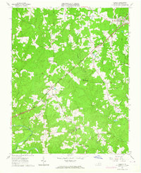
(12)- 1918 Map of Lawrenceville, 1963 Print
 1918 Lawrenceville1963 Print · USGSCovers Alberta, including Lawrenceville, Meredithville, and other nearby areas
 - 1920 Map of Lawrenceville
 1920 Lawrenceville1920 Print · USGSCovers Alberta, including Lawrenceville, Meredithville, and other nearby areas
 - 1921 Map of Lawrenceville
 1921 Lawrenceville1921 Print · USGSCovers Alberta, including Lawrenceville, Meredithville, and other nearby areas2 unique versions available
 - 1942 Map of Lawrenceville
 1942 Lawrenceville1942 Print · USGSCovers Alberta, including Lawrenceville, Meredithville, and other nearby areas
 - 1953 Map of Norfolk, 1954 Print
 1953 Norfolk1954 Print · USGSCovers Alberta, including Chesapeake, Norfolk, and other nearby areas4 unique versions available
 - 1963 Map of Alberta, 1964 Print
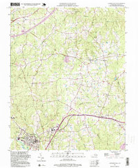
 1963 Alberta1964 Print · USGSCovers Alberta, including Meredithville, Grandy, and other nearby areas3 unique versions available
 - 1963 Map of Lawrenceville, 1964 Print
 1963 Lawrenceville1964 Print · USGSCovers Alberta, including Lawrenceville, Dolphin, and other nearby areas2 unique versions available
 - 1984 Map of Emporia, 1986 Print
 1984 Emporia1986 Print · USGSCovers Alberta, including Emporia, Courtland, and other nearby areas
 - 1990 Map of Emporia
 1990 Emporia1990 Print · USGSCovers Alberta, including Emporia, Courtland, and other nearby areas
 - 1997 Map of Lawrenceville, 1999 Print
 1997 Lawrenceville1999 Print · USGSCovers Alberta, including Lawrenceville, Dolphin, and other nearby areas
 - 2022 Map of Lawrenceville, 2022 Print
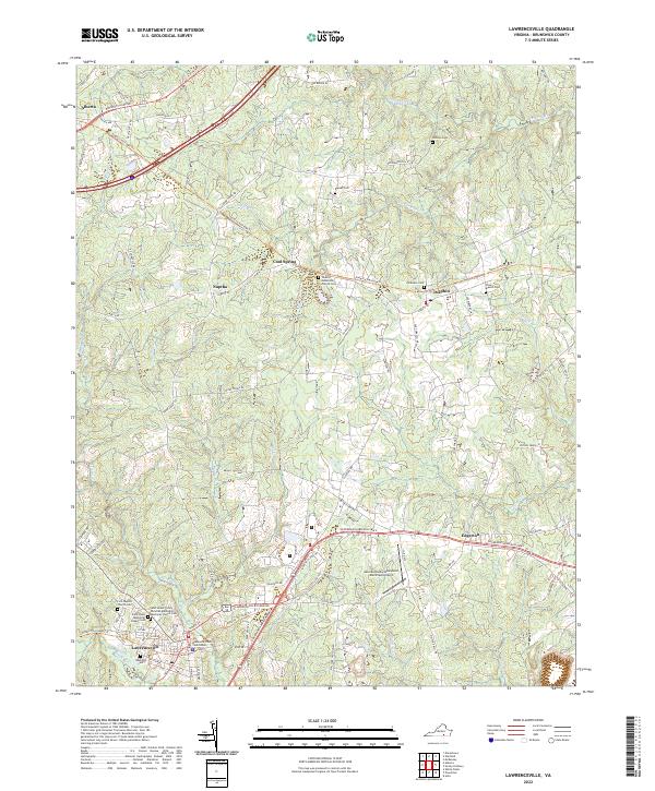 2022 Lawrenceville2022 Print · USGSCovers Alberta, including Lawrenceville, Dolphin, and other nearby areas
 - 2022 Map of Alberta, 2022 Print
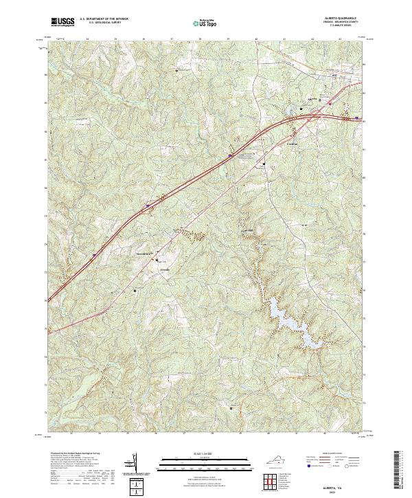 2022 Alberta2022 Print · USGSCovers Alberta, including Grandy, Meredithville, and other nearby areas
End of results
Showing maps 1-12 of 12
Top cities near Alberta
- South Hill historical maps
- Blackstone historical maps
- Kenbridge historical maps
- Lawrenceville historical maps
- La Crosse historical maps
- McKenney historical maps
See more
Top neighborhoods of Alberta
Frequently asked questions
- What are the different types of historical maps available for Alberta?
- What is the oldest map of Alberta?
- Where can I purchase historical maps of Alberta for my home or office?
- Where can I download high-res historical maps of Alberta?
- Are there historical topographic maps available for Alberta?
- Is there historical aerial imagery available for Alberta?
- Where are historical maps of Alberta sourced from?