1930s Maps of Buchanan County, Virginia
Explore 6 historic maps of Buchanan County from the 1930s. These maps offer a rare glimpse into what life looked like during the 1930s — showing old roads, neighborhoods, homes, and landmarks that have changed or disappeared over time.
Whether you're researching your family's past, planning a metal detecting trip, or studying how Buchanan County's landscape evolved across the 1930s, these high-resolution maps are a powerful tool for exploring the history of this region.
- Focus on a specific era: All maps on this page are from the 1930s, giving you a focused view of this time period.
- See what’s changed: Compare century-old streets, trails, and buildings to today's modern landscape using overlays and satellite layers.
- Research with precision: Use these maps for genealogy, historical research, land use analysis, or educational projects.
- View, download, or print: Maps are fully viewable online in high resolution, and can be downloaded or printed for your own records.
Start exploring Buchanan County's history through authentic maps from the 1930s. This is your window into the past.
Buchanan County, VA maps
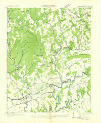
(6)- 1934 Map of Bandy
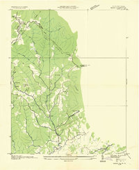 1934 Bandy1934 Print · USGSThe rugged borderlands of Tazewell County and West Virginia are captured here in the mid-1930s, showing a landscape of steep ridges and remote hollows. Researchers can trace family roots through numerous local schools like Indian Creek Sch and find old burial sites at Christian Cem.
 - 1935 Map of Jewell
 1935 Jewell1935 Print · USGSThe borderlands of Buchanan and Tazewell Counties are shown in the mid-1930s as industrial development followed the mountain hollows. Researchers can trace the rail-and-ridge economy through Jewell Ridge PO, the Norfolk and Western line, and rural schools like Smith Sch.
 - 1935 Map of Wilder
 1935 Wilder1935 Print · USGSThe coal and timber country of Southwest Virginia is captured here in the mid-1930s as the rail lines reached into the deep hollows. Genealogists can locate family-named sites and rural institutions like Hammond Sch, Rasnake Sch, and the community of Wilder along the Clinchfield tracks.
 - 1935 Map of Pistol Gap
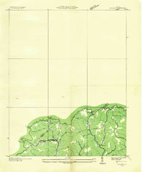
 1935 Pistol Gap1935 Print · USGSThe mountain passes of Southwest Virginia are captured in the mid-1930s as the TVA began its regional surveys. Researchers can trace early trails and family-named landmarks such as McGlothlin Hollow, Linn Spring, and Shorts Gap.
 - 1935 Map of Honaker
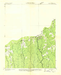
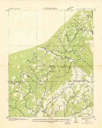
 1935 Honaker1935 Print · USGSThe Clinch River valley near the triple-county border of Russell, Buchanan, and Tazewell is documented here in the mid-1930s. Genealogists can locate family landmarks like Log Cabin Ch, Gardner Mill, and numerous rural schoolhouses including Barrett Sch.
 - 1935 Map of Big A Mountain
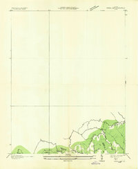
 1935 Big A Mountain1935 Print · USGSBuchanan and Russell Counties are captured here in the mid-1930s, showing a landscape of isolated ridge-top schools and creek-bottom settlements. Genealogists can locate family landmarks such as Combs Ridge Sch, Shaw Memorial Ch, and the community of Council along the Russell Fork.
End of results
Showing maps 1-6 of 6
Top cities of Buchanan County
Frequently asked questions
- What are the different types of historical maps available for Buchanan County?
- What is the oldest map of Buchanan County?
- Where can I purchase historical maps of Buchanan County for my home or office?
- Where can I download high-res historical maps of Buchanan County?
- Are there historical topographic maps available for Buchanan County?
- Is there historical aerial imagery available for Buchanan County?
- Where are historical maps of Buchanan County sourced from?