1950s Maps of Buchanan County, Virginia
Explore 11 historic maps of Buchanan County from the 1950s. These maps offer a rare glimpse into what life looked like during the 1950s — showing old roads, neighborhoods, homes, and landmarks that have changed or disappeared over time.
Whether you're researching your family's past, planning a metal detecting trip, or studying how Buchanan County's landscape evolved across the 1950s, these high-resolution maps are a powerful tool for exploring the history of this region.
- Focus on a specific era: All maps on this page are from the 1950s, giving you a focused view of this time period.
- See what’s changed: Compare century-old streets, trails, and buildings to today's modern landscape using overlays and satellite layers.
- Research with precision: Use these maps for genealogy, historical research, land use analysis, or educational projects.
- View, download, or print: Maps are fully viewable online in high resolution, and can be downloaded or printed for your own records.
Start exploring Buchanan County's history through authentic maps from the 1950s. This is your window into the past.
Buchanan County, VA maps
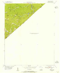
(11)- 1950 Map of Richlands
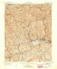 1950 Richlands1950 Print · USGSRichlands and the Clinch River valley are shown here in the late 1940s as the rail and coal industries shaped the landscape. Genealogists can trace family names through dozens of rural landmarks like Paint Lick Sch, Jewell Chapel, and the Wolfpen Ridge Cem.
 - 1954 Map of Harman, 1955 Print
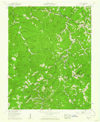
 1954 Harman1955 Print · USGSThe borderlands of Virginia and Kentucky appear in the mid-1950s as a focused corridor of river and rail activity. Genealogists and local historians can trace the Norfolk and Western line past Toghertville and the Hackney Creek Cem.
 - 1954 Map of Elkhorn City, 1955 Print
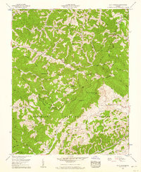
 1954 Elkhorn City1955 Print · USGSElkhorn City and the rugged Kentucky borderlands are captured here in the mid-fifties, during a peak era of rail and coal activity. Researchers can trace the junction of the Chesapeake and Ohio RR and Clinchfield RR, and locate local landmarks like the Fish Hatchery and Sulphur Springs Ch.
 - 1954 Map of Wharncliffe, 1955 Print
 1954 Wharncliffe1955 Print · USGSThe Tug Fork borderlands in the mid-1950s reveal a landscape of deep hollows and shifting state lines between West Virginia and Kentucky. Trace family roots at the Cline Cem or explore the drainage of Staggerweed Hol and Foundry Hol.
 - 1954 Map of Hurley, 1955 Print
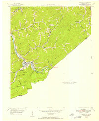
 1954 Hurley1955 Print · USGSThe Kentucky and Virginia borderlands come alive in the mid-1950s, showing a rugged landscape shaped by the Norfolk and Western railroad. Trace family roots and old homesteads near Argo, Paw Paw, and the Hurricane Sch.
 - 1954 Map of Jamboree, 1956 Print
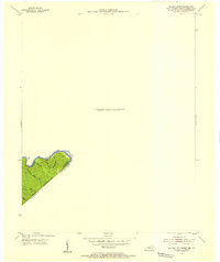
 1954 Jamboree1956 Print · USGSThe Kentucky-Virginia borderlands in the mid-fifties were defined by narrow hollows and essential rail lines. Genealogists and historians can trace the foundations of mountain life through Jamboree P O, Rowland Row Camp, and schools like Smith Fork Sch.
 - 1955 Map of Bluefield
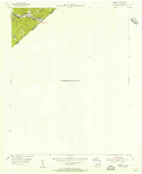
 1955 Bluefield1955 Print · USGSThe Central Appalachian borderlands come alive in the mid-fifties, showing the coal and rail networks connecting Bluefield to Beckley. Researchers can trace the industrial landscape of the New River Ordnance Plant and the terrain of Burkes Garden.
 - 1957 Map of Bluefield, 1967 Print
 1957 Bluefield1967 Print · USGSThe heart of Central Appalachia in the mid-fifties is defined by the winding rail lines and river valleys of the coalfields. Researchers can trace the industrial footprints of towns like Welch and Princeton or locate landmarks such as the Bluestone Reservoir and Claytor Lake.2 unique versions available
 - 1957 Map of Jenkins, 1974 Print
 1957 Jenkins1974 Print · USGSThe Cumberland Plateau in the mid-twentieth century reveals a complex landscape of winding river valleys and deep-seated industry. Genealogists and historians can trace the development of Hazard, Jenkins, and Pikeville alongside extensive Numerous Oil and Gas Fields and the routes of the Chesapeake & Ohio Railway.
 - 1958 Map of Duty, 1960 Print
 1958 Duty1960 Print · USGSThe tri-county borderlands of Dickenson, Buchanan, and Russell Counties are captured here in the late fifties, showing a landscape defined by coal mining and ridge-top gaps. Genealogists can trace family names through the Sutherland, Farmer, and Gilbert cemeteries, while industrial researchers can locate the Moss No 3 Mine.3 unique versions available
 - 1958 Map of Big A Mountain, 1960 Print
 1958 Big A Mountain1960 Print · USGSThe borderlands of Buchanan and Russell Counties come into focus in the late fifties, defined by isolated ridge-top schools and family hollows. Genealogists can trace deep local roots through dozens of family burial grounds like Presley Cem and Tiller Cem, alongside the Fletcher Ridge School.3 unique versions available
End of results
Showing maps 1-11 of 11
Top cities of Buchanan County
Frequently asked questions
- What are the different types of historical maps available for Buchanan County?
- What is the oldest map of Buchanan County?
- Where can I purchase historical maps of Buchanan County for my home or office?
- Where can I download high-res historical maps of Buchanan County?
- Are there historical topographic maps available for Buchanan County?
- Is there historical aerial imagery available for Buchanan County?
- Where are historical maps of Buchanan County sourced from?