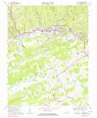
1950 Map of Richlands
USGS Topo · Published 1950About this map
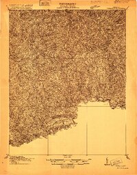
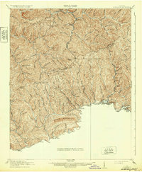
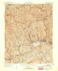
Keen Mountain and the deep valleys of the Clinch River drainage define this late-1940s landscape, where the coal and timber economies shaped the settlement of the Central Appalachians. The rugged topography of southwestern Virginia is recorded here just after the war, showing the Norfolk and Western railway lines threading through the narrow hollows to reach industrial outposts like Jewell Ridge, Red Ash, and Seaboard. The map reveals a dense network of mountain communities served by one-room schools such as Paint Lick Sch and Mill Creek Sch, along with numerous family and community burial grounds like Wolfpen Ridge Cem and Boyd Cem. The presence of the Keen Mountain Fire Towers and the Bearwallow Lookout Tower highlights the era's reliance on high-altitude observation for forestry management, while the Richlands Airport signals the growing regional importance of Richlands.
Find a feature on this map
211 named features on this map. Tap any name to fly to it.
Don’t see what you’re looking for? This feature index may not catch every label — zoom into the map to look around manually.
Map Details
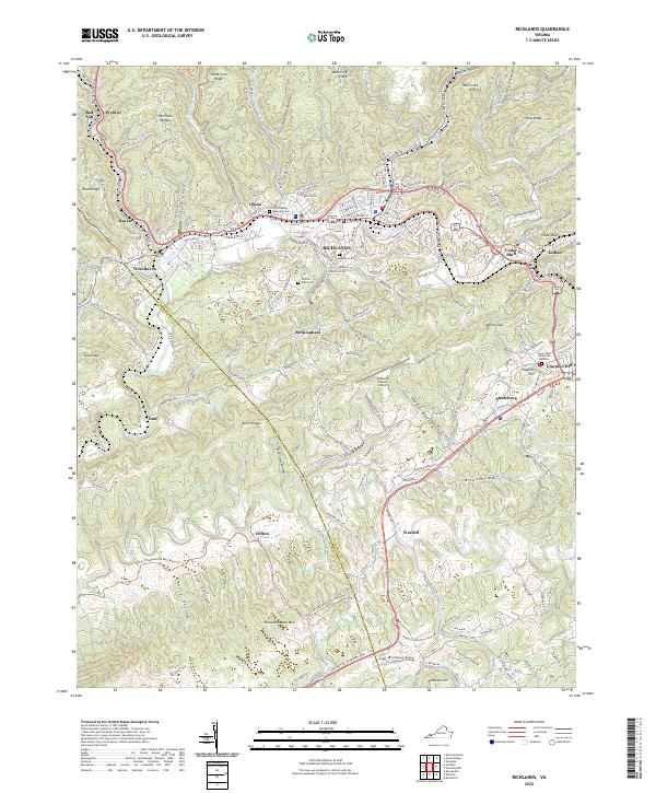
Editions of this 1950 Richlands Map
This is the sole edition of this map. No revisions or reprints were ever made.
Historical Maps of Richlands Through Time
7 maps found