Old Maps of Buchanan County, Virginia for Metal Detecting
Plan your next treasure hunt with 118 historic maps of Buchanan County. Find old homesites, ghost towns, trails, and gathering spots that may be lost to time — perfect for identifying promising metal detecting locations.
- Locate forgotten sites: Uncover places like long-lost settlements, abandoned rail lines, or gathering spots.
- Plan better hunts: Use map overlays combined with LiDAR or satellite views to narrow in on historically rich areas.
- Made for detectorists: Thousands of hobbyists use these maps to discover relics, coins, and hidden history.
Use these historic maps to boost your research and find new opportunities beneath the surface of Buchanan County.
Buchanan County, VA maps
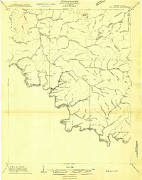
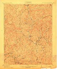
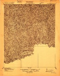
(118)- 1886 Map of Grundy
 1886 Grundy1886 Print · USGSThe Central Appalachian borderlands come alive in the late nineteenth century as small settlements and family outposts take hold in the hollows. Genealogists and historians can locate early communities like Clintwood and Grundy, or trace ancestral lands near Card P.O. and Sand Lick.
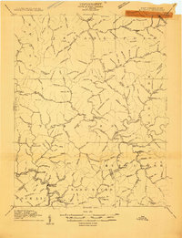
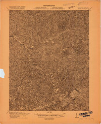
 - 1887 Map of Warfield
 1887 Warfield1887 Print · USGSThe West Virginia and Kentucky borderlands come into focus in the late nineteenth century along the winding Tug Fork of Big Sandy River. Genealogists and historians can trace early valley life through sites like Warfield, Chapmansville, and the remote White Post settlement.
 - 1890 Map of Grundy
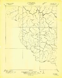
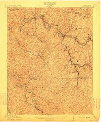
 1890 Grundy1890 Print · USGSThe Central Appalachian borderlands of Virginia and Kentucky are captured here in the late nineteenth century, showing a landscape of isolated mountain hollows. Genealogists and researchers can trace early settlements and river fords including Grundy, Clintwood, and the crossing at Fish Trap.
 - 1891 Map of Tazewell
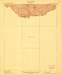
 1891 Tazewell1891 Print · USGSThe Clinch Valley highlands are shown here in the late nineteenth century, capturing the early settlement of the Virginia and West Virginia borderlands. Local historians can trace the foundations of Jeffersonville and rural outposts like Baptist Valley and Cedar Bluff.
 - 1891 Map of Oceana
 1891 Oceana1891 Print · USGSSouthern West Virginia in the late nineteenth century was a world of deep valleys and isolated mountain settlements. Genealogists and historians can trace early family sites along the Guyandotte River near Oceana, Logan C.H., and Whites Mills.
 - 1891 Map of Warfield
 1891 Warfield1891 Print · USGSThe Tug Fork valley in the 1880s is captured here at the intersection of Kentucky and West Virginia. Researchers can trace the early Appalachian landscape through riverfront settlements like Warfield and White Post, or find family-named hubs such as Hatfield and Mate.7 unique versions available
 - 1892 Map of Grundy
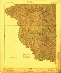
 1892 Grundy1892 Print · USGSThe Appalachian borderlands of Virginia and Kentucky appear here in the late nineteenth century, mapping the deep hollows and ridges of the coalfield region. Genealogists and historians can locate early settlement nodes like Ervinton, Sand Lick, and Grundy amidst landmarks like Pine Mountain.4 unique versions available
 - 1893 Map of Oceana
 1893 Oceana1893 Print · USGSSouthern West Virginia’s rugged coal country is captured here in the late nineteenth century, showing a landscape of deep hollows and high ridges. Researchers can trace ancestral homes and early industry at Logan C.H., Whites Mills, and Jarrold's Valley.
 - 1895 Map of Tazewell
 1895 Tazewell1895 Print · USGSSouthwest Virginia and the West Virginia coalfields are captured in the 1890s as the rail network transformed these mountain valleys. Researchers can trace early settlements and stores along the Norfolk and Western RR, from Tazewell to the mines near Welch and Vivian.
 - 1897 Map of Tazewell
 1897 Tazewell1897 Print · USGSThe rugged coal and timber lands of the border country appear here in the 1890s as the rail network expands. Genealogists can trace family roots at Mc Neil Store, follow the early growth of Welch, and locate homesteads near Shack Mills.8 unique versions available
 - 1898 Map of Oceana
 1898 Oceana1898 Print · USGSSouthern West Virginia in the late nineteenth century remains a landscape of isolated mountain settlements and complex river drainages. Genealogists can trace early homesteads and family-named landmarks near Oceana, Pineville, and Baileysville before the rise of the modern coal industry.4 unique versions available
 - 1909 Map of Matewan
 1909 Matewan1909 Print · USGSMingo County was a landscape of coal camps and rail sidings during the first decade of the twentieth century. Researchers can trace early family homesites near Thacker Mines, Red Jacket, and the small post offices at Edgarton and Okeeffe.
 - 1909 Map of Gilbert
 1909 Gilbert1909 Print · USGSSouthern West Virginia at the height of the coal and rail expansion is shown here through its dense network of river-valley settlements and mountain gaps. Genealogists can trace early homesteads and rail stops like Glenalum Sta, Wharncliffe, and Twisted Gun Gap.
 - 1910 Map of Iaeger
 1910 Iaeger1910 Print · USGSMcDowell County's steep coal country is documented here in the early twentieth century as the railroad transformed the mountain landscape. Genealogists can trace family names and early homesteads near Iaeger, Avondale PO, and Paynesville along the Norfolk and Western RR.
 - 1912 Map of Pounding Mill
 1912 Pounding Mill1912 Print · USGSThe McDowell and Tazewell borderlands appear here in the decade before the First World War, showing the early infrastructure of this mountainous region. Researchers can trace the path of Squire Jim Road and locate the settlement of Horsepen among the headwaters of Big Creek.
 - 1912 Map of Gilbert
 1912 Gilbert1912 Print · USGSThe Guyandot River valley and the industrial Tug Fork corridor define this region in the early nineteen-hundreds. Researchers can trace rail-tied settlements like Wharncliffe and War Eagle or find rural landmarks such as Twisted Gun Gap and North Spring.2 unique versions available
 - 1912 Map of Iaeger
 1912 Iaeger1912 Print · USGSMcDowell County's rugged Tug Fork valley is documented here in the early twentieth century, showing a landscape defined by rail and remote hollows. Genealogists and historians can trace the foundations of Iaeger, find the locations of Avondale PO and Bradshaw PO, and follow the Norfolk and Western tracks.
 - 1912 Map of Welch
 1912 Welch1912 Print · USGSMcDowell County's coal country comes alive in this pre-war survey, centered on the junction of the Norfolk and Western RR and the Tug Fork. Trace the early development of mining towns like Coalwood, Gary, and Kimball or locate vanished post offices such as Yukon PO.2 unique versions available
 - 1914 Map of Bucu
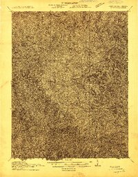
 1914 Bucu1914 Print · USGSCovers Buchanan County, including Vansant, Council, and other nearby areas
 - 1914 Map of Iaeger
 1914 Iaeger1914 Print · USGSCovers Buchanan County, including Raysal, Iaeger, and other nearby areas
 - 1914 Map of Hurley
 1914 Hurley1914 Print · USGSThe Buchanan County borderlands come to life in this early twentieth-century survey, showcasing a landscape of high ridges and deep hollows. Genealogists can trace family roots through a dense network of mountain schools like Bull Creek School and remote outposts such as Kelsa PO or Artia.
 - 1915 Map of Richlands
 1915 Richlands1915 Print · USGSThe Clinch River valley in the years before the Great War is a network of coal-country settlements and mountain passes. Genealogists can locate family schoolhouses like Drill School or trace the early Norfolk and Western rail lines through Raven and Richlands.
 - 1915 Map of Regina
 1915 Regina1915 Print · USGSPike County at the dawn of the coal boom is defined by a dense river-and-rail network along the Levisa Fork. Genealogists and historians can trace old post offices and rail stops like Shelbiana P.O., Mouthcard, and Elkhorn City.2 unique versions available
 - 1915 Map of Hurley
 1915 Hurley1915 Print · USGSBuchanan County's deep hollows and early settlements are documented in this 1910s survey along the Kentucky-Virginia border. Genealogists and local historians can locate early centers of community life including Pawpaw P O, Looneyville School, and Hurley.2 unique versions available
 - 1915 Map of Matewan
 1915 Matewan1915 Print · USGSThe industrial coalfields of Mingo County and the Kentucky border are documented here during the height of the early twentieth-century boom. Genealogists and historians can trace rail-side communities and mining operations like Thacker Mines, Red Jacket, and the Blackberry Fork School.
Showing maps 1-25 of 118
Top cities of Buchanan County
Frequently asked questions
- What are the different types of historical maps available for Buchanan County?
- What is the oldest map of Buchanan County?
- Where can I purchase historical maps of Buchanan County for my home or office?
- Where can I download high-res historical maps of Buchanan County?
- Are there historical topographic maps available for Buchanan County?
- Is there historical aerial imagery available for Buchanan County?
- Where are historical maps of Buchanan County sourced from?