1940s Maps of Daltons, Virginia
Explore 3 historic maps of Daltons from the 1940s. These maps offer a rare glimpse into what life looked like during the 1940s — showing old roads, neighborhoods, homes, and landmarks that have changed or disappeared over time.
Whether you're researching your family's past, planning a metal detecting trip, or studying how Daltons's landscape evolved across the 1940s, these high-resolution maps are a powerful tool for exploring the history of this region.
- Focus on a specific era: All maps on this page are from the 1940s, giving you a focused view of this time period.
- See what’s changed: Compare century-old streets, trails, and buildings to today's modern landscape using overlays and satellite layers.
- Research with precision: Use these maps for genealogy, historical research, land use analysis, or educational projects.
- View, download, or print: Maps are fully viewable online in high resolution, and can be downloaded or printed for your own records.
Start exploring Daltons's history through authentic maps from the 1940s. This is your window into the past.
Daltons, VA maps
(3)- 1942 Map of Guinea
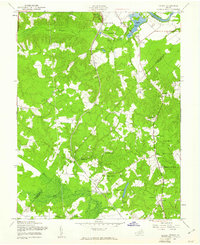
 1942 Guinea1942 Print · USGSSpotsylvania and Caroline counties are seen here in the early 1940s as the rail-driven economy of the Rappahannock valley meets the expansion of federal military lands. Genealogists can locate family-named hubs like Flippos Corner, rural schools such as New Hope School, and the crossroads at Guinea.
 - 1948 Map of Washington
 1948 Washington1948 Print · USGSThe Potomac and Chesapeake regions in the late 1940s reveal a landscape of expanding military reach and deep-rooted Tidewater settlements. Trace old rail corridors like the Richmond Fredericksburg & Potomac RR or locate landmarks like the Wakefield Washington Monument and St. Marys College.2 unique versions available
 - 1949 Map of Guinea, 1961 Print
 1949 Guinea1961 Print · USGSSpotsylvania and Caroline Counties appear here just after the war, showing a landscape of family-named crossroads and established rail corridors. Genealogists can trace rural communities like Flippos Corner and Villboro, or locate the historic Stonewall Jackson Shrine.
End of results
Showing maps 1-3 of 3
Top cities near Daltons
- Fredericksburg historical maps
- Spotsylvania Courthouse historical maps
- King George historical maps
- Falmouth historical maps
- Lake Land'Or historical maps
- Southern Gateway historical maps
See more
Frequently asked questions
- What are the different types of historical maps available for Daltons?
- What is the oldest map of Daltons?
- Where can I purchase historical maps of Daltons for my home or office?
- Where can I download high-res historical maps of Daltons?
- Are there historical topographic maps available for Daltons?
- Is there historical aerial imagery available for Daltons?
- Where are historical maps of Daltons sourced from?