1960s Maps of Carroll County, Virginia
Explore 19 historic maps of Carroll County from the 1960s. These maps offer a rare glimpse into what life looked like during the 1960s — showing old roads, neighborhoods, homes, and landmarks that have changed or disappeared over time.
Whether you're researching your family's past, planning a metal detecting trip, or studying how Carroll County's landscape evolved across the 1960s, these high-resolution maps are a powerful tool for exploring the history of this region.
- Focus on a specific era: All maps on this page are from the 1960s, giving you a focused view of this time period.
- See what’s changed: Compare century-old streets, trails, and buildings to today's modern landscape using overlays and satellite layers.
- Research with precision: Use these maps for genealogy, historical research, land use analysis, or educational projects.
- View, download, or print: Maps are fully viewable online in high resolution, and can be downloaded or printed for your own records.
Start exploring Carroll County's history through authentic maps from the 1960s. This is your window into the past.
Carroll County, VA maps
(19)- 1962 Map of Winston-Salem
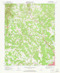
 1962 Winston-Salem1962 Print · USGSThe North Carolina Piedmont meets the Virginia highlands in the early sixties, showing the rail corridors and mountain gaps of the southern Appalachians. Researchers can trace the Blue Ridge Parkway or locate family sites near Winston-Salem, Mount Airy, and Hanging Rock Mountain.
 - 1965 Map of Austinville, 1966 Print
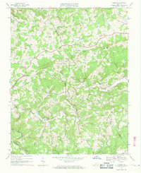
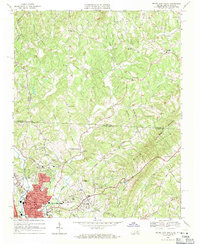
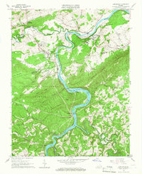 1965 Austinville1966 Print · USGSThe New River valley and its mining corridor are captured here in the mid-sixties as industry and rural life converged. Genealogists and historians can trace family roots at Bakers Chapel, locate the Van Mater Shaft mines, or follow the old Norfolk and Western line.3 unique versions available
 - 1965 Map of Galax, 1967 Print
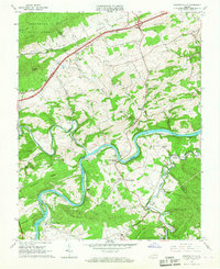
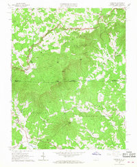
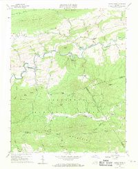
 1965 Galax1967 Print · USGSCarroll and Grayson counties come alive in this mid-sixties survey of the New River valley and the growing city of Galax. Researchers can trace family sites from Wolf Glade to Hilltown, including historic landmarks like Hebron Cem and Gladeville Sch.4 unique versions available
 - 1965 Map of Sylvatus, 1967 Print
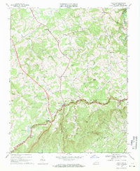
 1965 Sylvatus1967 Print · USGSCarroll and Wythe counties are captured in the mid-sixties, showing the mountainous terrain just as interstate transit began to change the rural landscape. Genealogists and local historians can locate Jackson Ferry, the Old Shot Tower, and numerous small landmarks like Beasley Hill Cem.3 unique versions available
 - 1965 Map of Fosters Falls, 1967 Print
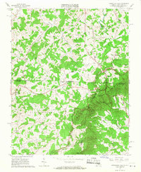
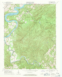
 1965 Fosters Falls1967 Print · USGSThe New River valley at the mid-century mark reveals a landscape defined by the Norfolk and Western railroad and the iron-industry legacy of Fosters Falls. Genealogists and industrial historians can trace rural life through landmarks like Boom Furnace, Oglesby Cem, and High Rocks Mill.3 unique versions available
 - 1965 Map of Lambsburg, 1968 Print
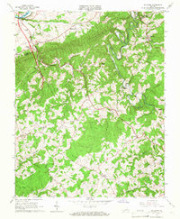
 1965 Lambsburg1968 Print · USGSThe Blue Ridge mountain border between Virginia and North Carolina is captured here in the mid-1960s, showing a landscape of high ridges and deep gaps. Genealogists can trace family footprints around Lambsburg and Lowgap, or locate rural landmarks like Blue Ridge Mill and Chestnut Grove Ch.3 unique versions available
 - 1965 Map of Woodlawn, 1968 Print
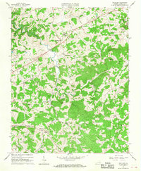 1965 Woodlawn1968 Print · USGSCarroll County's rolling hills and mountain gaps are captured here in the mid-sixties, showing a landscape of tight-knit rural communities. Genealogists can trace family roots through numerous local landmarks like Gardner Mills, Oakland Sch, and Mt Zion Ch.3 unique versions available
 - 1965 Map of Cumberland Knob, 1968 Print
 1965 Cumberland Knob1968 Print · USGSThe Virginia and North Carolina borderlands come alive in the mid-sixties, centered on the Cumberland Knob Recreation Area. Researchers can trace old family sites and mountain settlements like Edmonds, Delhart, and Ennice alongside McKnights Mill and Savannah Cem.2 unique versions available
 - 1968 Map of Meadows of Dan, 1971 Print
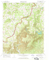 1968 Meadows of Dan1971 Print · USGSThe Blue Ridge highlands at the end of the 1960s reveal a mix of early industry and modern infrastructure. Genealogists and historians can trace family roots through sites like Mabry Mill, New Bell Spur Ch, and the high-elevation Meadows of Dan.3 unique versions available
 - 1968 Map of Fancy Gap, 1971 Print
 1968 Fancy Gap1971 Print · USGSThe Blue Ridge crest and its mountain passes dominate this late-sixties portrait of Carroll County. Genealogists and hikers can trace family sites like Webb Cem and Banks Cem, or locate landmarks such as Fancy Gap Sch and Devils Den.3 unique versions available
 - 1968 Map of Dugspur, 1971 Print
 1968 Dugspur1971 Print · USGSDugspur and the surrounding Blue Ridge highlands are captured in the late sixties as the area maintained its traditional rural character. Researchers can trace family history through a network of local landmarks like Dugspur Sch, the State Prison Camp No 5, and Buffalo Mountain Ch.2 unique versions available
 - 1968 Map of Hiwassee, 1971 Print
 1968 Hiwassee1971 Print · USGSPulaski and Carroll counties appear here in the late sixties, where the mountain terrain meets the rising waters of the New River valley. Researchers can trace the rail corridor through Hiwassee or find local landmarks like Bethel Ch and Tinytown.2 unique versions available
 - 1968 Map of Hillsville, 1971 Print
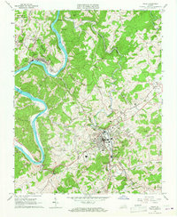
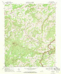
 1968 Hillsville1971 Print · USGSCarroll County's winding creek valleys and rural crossroads are captured here during the late 1960s. Family historians can locate dozens of localized sites including Jennings Cem, Mitchell Crossroads, and congregations like Bethel Ch and Goad Ch.3 unique versions available
 - 1968 Map of Cana, 1971 Print
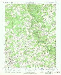
 1968 Cana1971 Print · USGSThe Virginia and North Carolina borderlands come alive in this late-sixties survey of the Piedmont foothills. Researchers can trace numerous family-named landmarks and rural institutions, from Mt View Ch and Sandy Ridge School to the communities of Cana and Toast.3 unique versions available
 - 1968 Map of Mount Airy North, 1971 Print
 1968 Mount Airy North1971 Print · USGSThe foothills of the Blue Ridge along the Virginia and North Carolina border come into focus in this late 1960s survey. Genealogists can trace family roots through numerous mountain congregations like Ararat Ch, Willis Gap Ch, and Hunter Chapel.3 unique versions available
 - 1968 Map of Laurel Fork, 1971 Print
 1968 Laurel Fork1971 Print · USGSThe Blue Ridge highlands of Carroll County are shown in the late sixties as the winding Blue Ridge Parkway traces the mountain crest. Researchers can locate remote family burial sites and rural centers like Laurel Fork, Gladesboro, and the Crooked Oak Ch.3 unique versions available
 - 1968 Map of Indian Valley, 1971 Print
 1968 Indian Valley1971 Print · USGSIndian Valley and the Blue Ridge highlands appear here in the late sixties as a network of ridge-top farms and creek-bottom settlements. Researchers can locate numerous local landmarks including Indian Valley Sch, Copper Valley Ch, and the rugged Big Tan Trough.3 unique versions available
 - 1968 Map of Cripple Creek, 1971 Print
 1968 Cripple Creek1971 Print · USGSCripple Creek and the northern ridges of the Jefferson National Forest are captured here in the late sixties as the region's industrial relics began to fade. Genealogists and historians can trace family sites at Davis Cem, old congregations like Bethany Ch, and industrial ruins at Eagle Furnace.2 unique versions available
 - 1968 Map of Willis, 1971 Print
 1968 Willis1971 Print · USGSThe Floyd County highlands are captured here in the late sixties, showing the mountain communities around Willis. Local researchers can trace family landmarks and rural centers like Mabry Mill, Slate Mtn Ch, and the high Buffalo Mtn Lookout Tower.2 unique versions available
End of results
Showing maps 1-19 of 19
Top cities of Carroll County
Frequently asked questions
- What are the different types of historical maps available for Carroll County?
- What is the oldest map of Carroll County?
- Where can I purchase historical maps of Carroll County for my home or office?
- Where can I download high-res historical maps of Carroll County?
- Are there historical topographic maps available for Carroll County?
- Is there historical aerial imagery available for Carroll County?
- Where are historical maps of Carroll County sourced from?