Old Maps of Pipers Gap, Virginia for Academic Research
Study the evolution of Pipers Gap with 16 high-resolution historic maps. Whether you're teaching, researching, or modeling changes in land use, these maps provide essential visual documentation of urban, environmental, and geographic change.
- Analyze long-term change: Track patterns in development, transportation, and natural features.
- Ideal for environmental or urban studies: Support academic projects with primary historical map data.
- Use in the classroom or lab: Educators and researchers rely on these maps to bring historical context to life.
These maps are a powerful tool for teaching, research, and visualizing how Pipers Gap has changed over the decades.
Pipers Gap, VA maps
(16)- 1889 Map of Hillsville
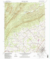
 1889 Hillsville1889 Print · USGSThe Blue Ridge Highlands and the upper New River valley are captured in the late 1880s, showcasing a landscape of iron furnaces and mountain gaps. Trace early industrial sites like Boom Furnace and Lead Mines, or locate ancestral homesteads near Hillsville and Old Town.
 - 1892 Map of Hillsville
 1892 Hillsville1892 Print · USGSSouthwest Virginia in the late nineteenth century is captured here as a landscape of iron furnaces and river crossings. Genealogists and historians can trace old family mills and ferries like Pedegos Mill, Howards Ferry, and the early settlement at Old Town.
 - 1896 Map of Hillsville
 1896 Hillsville1896 Print · USGSThe Blue Ridge Highlands and New River corridor appear here in the 1890s, when iron furnaces and river ferries dictated the pace of local life. Researchers can trace ancestral locations near Hillsville, the Lead Mines, and historic river crossings like Jackson Ferry.7 unique versions available
 - 1931 Map of Galax
 1931 Galax1931 Print · USGSThe Blue Ridge foothills of Virginia and North Carolina come into focus during the early 1930s as the rail-and-river economy develops. Genealogists and researchers can trace family landmarks like Bishop Cem, McKnights Mill, and the early river crossings at Blair Ferry.
 - 1933 Map of Galax
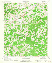
 1933 Galax1933 Print · USGSCarroll County and the surrounding Blue Ridge highlands are captured in the early 1930s, showing a landscape defined by river ferries and rail spurs. Genealogists can trace early homesteads and community hubs like Pipers Gap PO, Lambsburg, and the Dixon Ferry crossing on the New River.3 unique versions available
 - 1953 Map of Winston-Salem, 1974 Print
 1953 Winston-Salem1974 Print · USGSThe North Carolina Piedmont and Virginia highlands meet in the mid-1950s, a landscape defined by the tobacco and textile hubs of the Blue Ridge foothills. Researchers can trace the rail-and-river geography connecting Winston-Salem to mountain towns like Mount Airy and Galax.2 unique versions available
 - 1955 Map of Winston-Salem
 1955 Winston-Salem1955 Print · USGSThe Central Blue Ridge and Piedmont transition are captured here in the mid-fifties, from the industrial hub of Winston-Salem to the high peaks of Southwest Virginia. Genealogists can trace family landmarks like Richmond Hill Ch, Siloam Ch, and the old rail stops along the Southern Railway.
 - 1962 Map of Winston-Salem
 1962 Winston-Salem1962 Print · USGSThe North Carolina Piedmont meets the Virginia highlands in the early sixties, showing the rail corridors and mountain gaps of the southern Appalachians. Researchers can trace the Blue Ridge Parkway or locate family sites near Winston-Salem, Mount Airy, and Hanging Rock Mountain.
 - 1965 Map of Woodlawn, 1968 Print
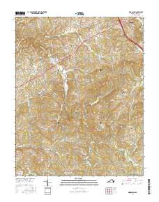
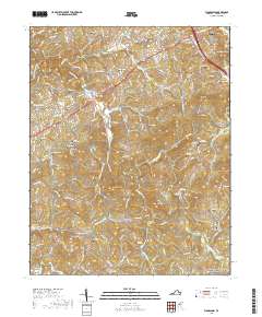
 1965 Woodlawn1968 Print · USGSCarroll County's rolling hills and mountain gaps are captured here in the mid-sixties, showing a landscape of tight-knit rural communities. Genealogists can trace family roots through numerous local landmarks like Gardner Mills, Oakland Sch, and Mt Zion Ch.3 unique versions available
 - 1986 Map of Galax
 1986 Galax1986 Print · USGSThe Virginia and North Carolina borderlands are captured here in the mid-1980s as the region balanced mountain agriculture with new recreational tourism. Researchers can locate remote family landmarks and rural institutions, from Ferrum Jr College and Siloam Ch to the Pinnacles Powerplant and Archies Mill.2 unique versions available
 - 1994 Map of Woodlawn, 1997 Print
 1994 Woodlawn1997 Print · USGSThe Virginia-West Virginia borderlands are shown here in the mid-1990s, where old iron furnace sites meet quiet valley settlements. Researchers can trace the legacy of local industry and education at the Van Buren Furnace ruins and the Massanutten Military Academy.
 - 2010 Map of Woodlawn, 2010 Print
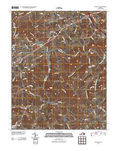 2010 Woodlawn2010 Print · USGSCovers Pipers Gap, including Hillsville, Woodlawn, and other nearby areas
 - 2013 Map of Woodlawn, 2013 Print
 2013 Woodlawn2013 Print · USGSCovers Pipers Gap, including Hillsville, Woodlawn, and other nearby areas
 - 2016 Map of Woodlawn, 2016 Print
 2016 Woodlawn2016 Print · USGSCovers Pipers Gap, including Hillsville, Woodlawn, and other nearby areas
 - 2019 Map of Woodlawn, 2019 Print
 2019 Woodlawn2019 Print · USGSCovers Pipers Gap, including Hillsville, Woodlawn, and other nearby areas
 - 2022 Map of Woodlawn, 2022 Print
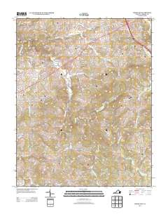
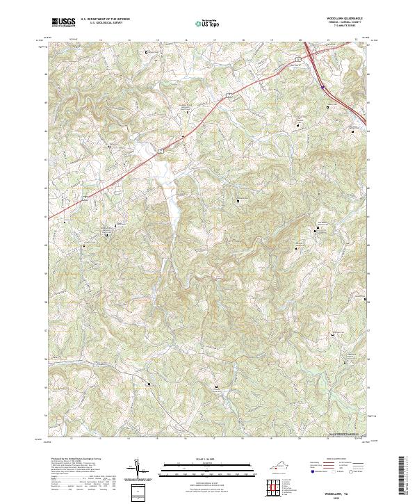 2022 Woodlawn2022 Print · USGSCarroll County, Virginia, is captured in this modern survey of its rural highlands, where ancestral cemeteries and creek-side roads define the community. Genealogists can trace family burial sites like John Henry Gardner Cem and Oakland Cem near the winding Crooked Creek.
End of results
Showing maps 1-16 of 16
Top cities near Pipers Gap
- Mount Airy historical maps
- Galax historical maps
- Hillsville historical maps
- Woodlawn historical maps
- Cana historical maps
- Ivanhoe historical maps
See more
Frequently asked questions
- What are the different types of historical maps available for Pipers Gap?
- What is the oldest map of Pipers Gap?
- Where can I purchase historical maps of Pipers Gap for my home or office?
- Where can I download high-res historical maps of Pipers Gap?
- Are there historical topographic maps available for Pipers Gap?
- Is there historical aerial imagery available for Pipers Gap?
- Where are historical maps of Pipers Gap sourced from?