1930s Maps of Dickenson County, Virginia
Explore 5 historic maps of Dickenson County from the 1930s. These maps offer a rare glimpse into what life looked like during the 1930s — showing old roads, neighborhoods, homes, and landmarks that have changed or disappeared over time.
Whether you're researching your family's past, planning a metal detecting trip, or studying how Dickenson County's landscape evolved across the 1930s, these high-resolution maps are a powerful tool for exploring the history of this region.
- Focus on a specific era: All maps on this page are from the 1930s, giving you a focused view of this time period.
- See what’s changed: Compare century-old streets, trails, and buildings to today's modern landscape using overlays and satellite layers.
- Research with precision: Use these maps for genealogy, historical research, land use analysis, or educational projects.
- View, download, or print: Maps are fully viewable online in high resolution, and can be downloaded or printed for your own records.
Start exploring Dickenson County's history through authentic maps from the 1930s. This is your window into the past.
Dickenson County, VA maps
(5)- 1934 Map of Carbo
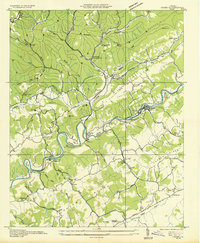 1934 Carbo1934 Print · USGSRussell County's coal and rail corridors are captured here in the mid-1930s as industrial development meets rural Appalachian life. Researchers can locate family landmarks like Jesses Mill, trace the depression-era Camp Dixie C C C, and find old stations at Carbo and Carterton.
 - 1935 Map of Indian Gap
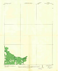 1935 Indian Gap1935 Print · USGSWise County is shown during a period of coal-driven growth in the mid-1930s. Researchers can trace the industrial landscape of Clinchfield Coal No 14 and the local community around Glamorgan, Vickers, and the Gilliam Sch.
 - 1935 Map of Wilder
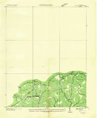 1935 Wilder1935 Print · USGSThe coal and timber country of Southwest Virginia is captured here in the mid-1930s as the rail lines reached into the deep hollows. Genealogists can locate family-named sites and rural institutions like Hammond Sch, Rasnake Sch, and the community of Wilder along the Clinchfield tracks.
 - 1935 Map of Toms Creek
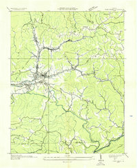 1935 Toms Creek1935 Print · USGSWise County's coal and rail economy is on full display in the mid-1930s, centered on the bustling junctions of the Guest River valley. Genealogists and historians can locate family sites like Kilgore Cem, coal operations at Clinchfield No. 21, and the strategic Beverly Tunnel.
 - 1935 Map of St Paul
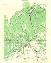 1935 St Paul1935 Print · USGSSouthwest Virginia coal country thrives in the mid-1930s as the rail networks of the Clinchfield and Norfolk and Western intersect. Genealogists can trace family landmarks like Bickley Mills, Bull Hill Sch, and the community of St Paul along the Clinch River.
End of results
Showing maps 1-5 of 5
Top cities of Dickenson County
Frequently asked questions
- What are the different types of historical maps available for Dickenson County?
- What is the oldest map of Dickenson County?
- Where can I purchase historical maps of Dickenson County for my home or office?
- Where can I download high-res historical maps of Dickenson County?
- Are there historical topographic maps available for Dickenson County?
- Is there historical aerial imagery available for Dickenson County?
- Where are historical maps of Dickenson County sourced from?