Old Maps of Dickenson County, Virginia for Metal Detecting
Plan your next treasure hunt with 123 historic maps of Dickenson County. Find old homesites, ghost towns, trails, and gathering spots that may be lost to time — perfect for identifying promising metal detecting locations.
- Locate forgotten sites: Uncover places like long-lost settlements, abandoned rail lines, or gathering spots.
- Plan better hunts: Use map overlays combined with LiDAR or satellite views to narrow in on historically rich areas.
- Made for detectorists: Thousands of hobbyists use these maps to discover relics, coins, and hidden history.
Use these historic maps to boost your research and find new opportunities beneath the surface of Dickenson County.
Dickenson County, VA maps
(123)- 1886 Map of Grundy
 1886 Grundy1886 Print · USGSThe Central Appalachian borderlands come alive in the late nineteenth century as small settlements and family outposts take hold in the hollows. Genealogists and historians can locate early communities like Clintwood and Grundy, or trace ancestral lands near Card P.O. and Sand Lick.
 - 1890 Map of Whitesburg
 1890 Whitesburg1890 Print · USGSThe Cumberland Plateau in the 1880s is a world of deep hollows and isolated mountain settlements. Genealogists can trace family roots in early communities like Whitesburgh and Pikeville or locate crossings at Pound Gap and Shelby Gap.
 - 1890 Map of Grundy
 1890 Grundy1890 Print · USGSThe Central Appalachian borderlands of Virginia and Kentucky are captured here in the late nineteenth century, showing a landscape of isolated mountain hollows. Genealogists and researchers can trace early settlements and river fords including Grundy, Clintwood, and the crossing at Fish Trap.
 - 1892 Map of Grundy
 1892 Grundy1892 Print · USGSThe Appalachian borderlands of Virginia and Kentucky appear here in the late nineteenth century, mapping the deep hollows and ridges of the coalfield region. Genealogists and historians can locate early settlement nodes like Ervinton, Sand Lick, and Grundy amidst landmarks like Pine Mountain.4 unique versions available
 - 1892 Map of Whitesburg
 1892 Whitesburg1892 Print · USGSEastern Kentucky and the Virginia borderlands appear here in the late nineteenth century as a landscape of isolated mountain hollows. Genealogists and historians can trace early family settlements along Kingdom Come Creek, Beef Hide, and the strategic passage at Pound Gap.4 unique versions available
 - 1897 Map of Bristol
 1897 Bristol1897 Print · USGSThe Tennessee-Virginia borderlands in the late nineteenth century were a landscape of steep ridges and river-dependent commerce. Genealogists can trace family homesteads near Bickley Mill, locate river crossings like Childress Ferry, or find early rail stops along the Norfolk and Western RR.
 - 1902 Map of Bristol
 1902 Bristol1902 Print · USGSThe interstate border region around Bristol appears here at the start of the twentieth century, defined by its deep mountain ridges and river valleys. Researchers can trace the early industrial footprint of the area through numerous landmarks like Bickley Mill, Kings Mill, and the Norfolk and Western RR.6 unique versions available
 - 1912 Map of Pound
 1912 Pound1912 Print · USGSThe borderlands of Wise County and Kentucky are captured in the early twentieth century before the coal industry fully reshaped the mountain hollows. Researchers can trace ancestral locations of schools and gaps, such as Upper Millstone School, Pound Gap, and the settlement of Jenkins.2 unique versions available
 - 1913 Map of Clintwood, 1962 Print
 1913 Clintwood1962 Print · USGSVirginia's rugged coal country is captured here during the early twentieth century, showing a landscape of isolated ridge-top schools and river-valley settlements. Genealogists can trace family footprints across dozens of local sites like Hatchet Church, Smith Corners, and the Nichols Gap School.
 - 1914 Map of Pound
 1914 Pound1914 Print · USGSThe Central Appalachian coal country comes alive in this survey of the Kentucky and Virginia borderlands during a period of rapid industrial growth. Genealogists can trace family roots through dozens of rural schools like Phipps School and Donald School, or follow the early path of the Lexington and Eastern RR.4 unique versions available
 - 1914 Map of Bucu
 1914 Bucu1914 Print · USGSCovers Dickenson County, including Vansant, Council, and other nearby areas
 - 1914 Map of Hurley
 1914 Hurley1914 Print · USGSThe Buchanan County borderlands come to life in this early twentieth-century survey, showcasing a landscape of high ridges and deep hollows. Genealogists can trace family roots through a dense network of mountain schools like Bull Creek School and remote outposts such as Kelsa PO or Artia.
 - 1915 Map of Clintwood
 1915 Clintwood1915 Print · USGSThe northern Virginia coalfields are captured here in the mid-1910s, revealing a landscape of winding river valleys and ridge-top gaps. Genealogists can trace dozens of early schools and family settlements such as Clintwood, Haysi, and Rainy Flat School.3 unique versions available
 - 1915 Map of Regina
 1915 Regina1915 Print · USGSPike County at the dawn of the coal boom is defined by a dense river-and-rail network along the Levisa Fork. Genealogists and historians can trace old post offices and rail stops like Shelbiana P.O., Mouthcard, and Elkhorn City.2 unique versions available
 - 1915 Map of Hurley
 1915 Hurley1915 Print · USGSBuchanan County's deep hollows and early settlements are documented in this 1910s survey along the Kentucky-Virginia border. Genealogists and local historians can locate early centers of community life including Pawpaw P O, Looneyville School, and Hurley.2 unique versions available
 - 1916 Map of Bucu
 1916 Bucu1916 Print · USGSSouthwestern Virginia in the mid-1910s was a landscape of deep hollows and timber-driven commerce where three counties meet. Genealogists can trace family roots through an exceptional density of rural landmarks, from Bucu and Davenport to the Lumber RR and Hurricane School.3 unique versions available
 - 1916 Map of Regina
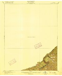 1916 Regina1916 Print · USGSThe Virginia and Kentucky borderlands are captured here in the years before the Great War, focusing on the dramatic river gorge country. Genealogists and hikers can trace the Carolina Clinchfield and Ohio rail route near The Breaks and The Towers.2 unique versions available
 - 1917 Map of Hurley
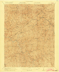 1917 Hurley1917 Print · USGSBuchanan County's mountain hollows and coal-country settlements are meticulously mapped in the years before the Great War. Genealogists can trace a dense network of early rural education sites like Rowe Mountain School and Home Creek School, alongside river points like Grundy and Levisa Fork.5 unique versions available
 - 1917 Map of Regina
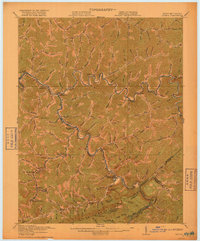 1917 Regina1917 Print · USGSThe Pike County coalfields and the winding Kentucky-Virginia border are captured here just before the close of the Great War. Genealogists can locate family homes and old post offices at Sutton PO, Regina PO, and Carmen PO along the steep hollows.3 unique versions available
 - 1918 Map of Carterton
 1918 Carterton1918 Print · USGSRussell County, Virginia, is defined by its steep coal-country ridges and the winding river corridor during the early twentieth century. Genealogists and researchers can trace the paths of the Norfolk and Western railway through Cleveland and locate vanished rural hubs like Musick School or Coulwood PO.3 unique versions available
 - 1920 Map of Coeburn
 1920 Coeburn1920 Print · USGSSouthwest Virginia during the height of its rail and timber era reveals a complex network of company towns and mountain settlements. Genealogists can trace family footprints near Dante, St Paul, and Castlewood, or locate rural institutions like the Greenwood School and Carter School.5 unique versions available
 - 1934 Map of Carbo
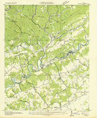 1934 Carbo1934 Print · USGSRussell County's coal and rail corridors are captured here in the mid-1930s as industrial development meets rural Appalachian life. Researchers can locate family landmarks like Jesses Mill, trace the depression-era Camp Dixie C C C, and find old stations at Carbo and Carterton.
 - 1935 Map of Indian Gap
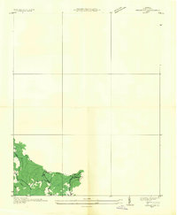 1935 Indian Gap1935 Print · USGSWise County is shown during a period of coal-driven growth in the mid-1930s. Researchers can trace the industrial landscape of Clinchfield Coal No 14 and the local community around Glamorgan, Vickers, and the Gilliam Sch.
 - 1935 Map of Wilder
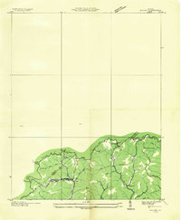 1935 Wilder1935 Print · USGSThe coal and timber country of Southwest Virginia is captured here in the mid-1930s as the rail lines reached into the deep hollows. Genealogists can locate family-named sites and rural institutions like Hammond Sch, Rasnake Sch, and the community of Wilder along the Clinchfield tracks.
 - 1935 Map of Toms Creek
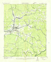 1935 Toms Creek1935 Print · USGSWise County's coal and rail economy is on full display in the mid-1930s, centered on the bustling junctions of the Guest River valley. Genealogists and historians can locate family sites like Kilgore Cem, coal operations at Clinchfield No. 21, and the strategic Beverly Tunnel.
Showing maps 1-25 of 123
Top cities of Dickenson County
Frequently asked questions
- What are the different types of historical maps available for Dickenson County?
- What is the oldest map of Dickenson County?
- Where can I purchase historical maps of Dickenson County for my home or office?
- Where can I download high-res historical maps of Dickenson County?
- Are there historical topographic maps available for Dickenson County?
- Is there historical aerial imagery available for Dickenson County?
- Where are historical maps of Dickenson County sourced from?