1960s Maps of Franklin County, Virginia
Explore 27 historic maps of Franklin County from the 1960s. These maps offer a rare glimpse into what life looked like during the 1960s — showing old roads, neighborhoods, homes, and landmarks that have changed or disappeared over time.
Whether you're researching your family's past, planning a metal detecting trip, or studying how Franklin County's landscape evolved across the 1960s, these high-resolution maps are a powerful tool for exploring the history of this region.
- Focus on a specific era: All maps on this page are from the 1960s, giving you a focused view of this time period.
- See what’s changed: Compare century-old streets, trails, and buildings to today's modern landscape using overlays and satellite layers.
- Research with precision: Use these maps for genealogy, historical research, land use analysis, or educational projects.
- View, download, or print: Maps are fully viewable online in high resolution, and can be downloaded or printed for your own records.
Start exploring Franklin County's history through authentic maps from the 1960s. This is your window into the past.
Franklin County, VA maps
(27)- 1961 Map of Bluefield
 1961 Bluefield1961 Print · USGSThe coalfields and mountain ridges of southern West Virginia and southwest Virginia are captured in the early sixties. Genealogists can trace family ties through rail-linked towns like Princeton and Richlands or along the shores of Bluestone Reservoir.
 - 1962 Map of Winston-Salem
 1962 Winston-Salem1962 Print · USGSThe North Carolina Piedmont meets the Virginia highlands in the early sixties, showing the rail corridors and mountain gaps of the southern Appalachians. Researchers can trace the Blue Ridge Parkway or locate family sites near Winston-Salem, Mount Airy, and Hanging Rock Mountain.
 - 1962 Map of Greensboro
 1962 Greensboro1962 Print · USGSThe Piedmont region along the Virginia and North Carolina border comes alive in the early 1960s, showing a landscape defined by industry and new reservoirs. Trace the path of the Virginian RR or explore the early development of Greensboro and Durham.
 - 1963 Map of Roanoke
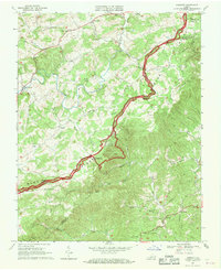
 1963 Roanoke1963 Print · USGSCentral Virginia and the Blue Ridge front appear here in the early sixties, caught between their deep railroad roots and new postwar developments. Genealogists and historians can trace the rail lines of the Norfolk and Western through towns like Bedford and Altavista, or locate family landmarks near Smith Mountain Lake.
 - 1963 Map of Hardy
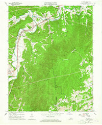
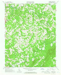
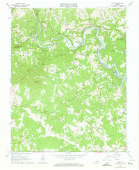 1963 Hardy1963 Print · USGSThe Roanoke River valley and the emerging Smith Mountain Lake dominate this early 1960s survey of the Franklin and Bedford county borders. Local historians can trace family land near Hardy, Red Valley, and numerous landmarks like Gravel Hill Ch and Oyler Chapel Cem.3 unique versions available
 - 1963 Map of Callaway, 1964 Print
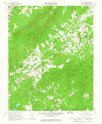
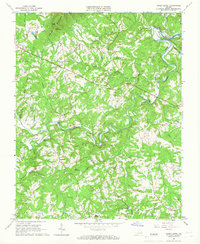
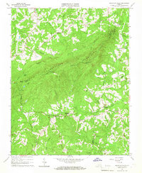
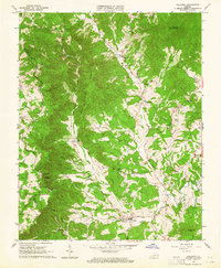 1963 Callaway1964 Print · USGSFranklin County's high ridges and hollows come into focus in the early sixties as the Blue Ridge Parkway skirts the county line. Researchers can locate dozens of family-named landmarks and cemeteries, from Dillons Mill and Algoma to the Wilson Cem and Adney Gap Fire Tower.2 unique versions available
 - 1963 Map of Check, 1965 Print
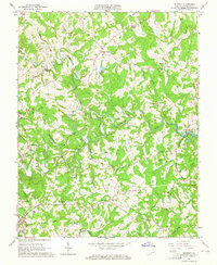
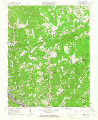
 1963 Check1965 Print · USGSFloyd County at the dawn of the 1960s shows a landscape of upland farms and tight-knit valley communities. Genealogists and local historians can trace family land via field lines and find landmarks like Willis Store, Hemlock School, and Kefauver Cemetery.3 unique versions available
 - 1963 Map of Boones Mill, 1965 Print
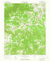
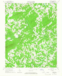
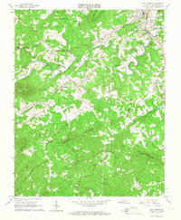
 1963 Boones Mill1965 Print · USGSFranklin County in the 1960s was a network of small rail-side communities and upland farms connected by the Norfolk and Western. Researchers can trace family history at rural landmarks like Brick Ch, Gogginsville, and the Starkey Cem.3 unique versions available
 - 1963 Map of Elliston, 1965 Print
 1963 Elliston1965 Print · USGSIn the early 1960s, the forks of the Roanoke River anchored the community life of Montgomery County. Genealogists can trace family names at Duckwiller Cem and Craighead Cem or locate the Elliston-Lafayette Sch and Wabun Bible Chapel.2 unique versions available
 - 1963 Map of Garden City, 1965 Print
 1963 Garden City1965 Print · USGSRoanoke and its southern environs were rapidly expanding into the Blue Ridge foothills in the early 1960s. Genealogists can trace family landmarks like Gearhart Cem and Plunkett Cem, or locate mid-century sites like the Roanoke Drag Strip and Roanoke Technical Institute.3 unique versions available
 - 1963 Map of Bent Mountain, 1965 Print
 1963 Bent Mountain1965 Print · USGSThe Roanoke and Franklin County borderlands meet along the Blue Ridge in the early sixties as suburban growth begins to reach toward the mountains. Genealogists can trace family roots at Lawrence Memorial Ch, Poages Mill, and the Kittinger Cem.5 unique versions available
 - 1963 Map of Redwood, 1965 Print
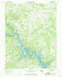
 1963 Redwood1965 Print · USGSFranklin County's rural heartland is captured in the early sixties as the Smith Mountain Lake began to influence the local landscape. Genealogists and historians can trace dozens of family sites like Harper Cem or the namesake Redwood Sch and Piedmont Mill.4 unique versions available
 - 1964 Map of Snow Creek, 1966 Print
 1964 Snow Creek1966 Print · USGSFranklin and Henry Counties are documented in the mid-1960s, showing a rural Virginia landscape shaped by the ridges of Fork Mountain. Genealogists can locate family names and sites like Dyers Store, Flatrock Ch, and the Wyatt Cem.4 unique versions available
 - 1964 Map of Gladehill, 1966 Print
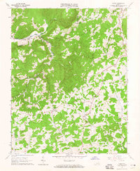
 1964 Gladehill1966 Print · USGSFranklin County's rolling highlands come into sharp focus in the mid-sixties, showing a landscape of small Piedmont communities and river-fed valleys. Genealogists and local historians can trace family locations near Sontag Sch, Hopkins Mill, and Sydnorsville.3 unique versions available
 - 1965 Map of Sandy Level, 1966 Print
 1965 Sandy Level1966 Print · USGSThe rural border of Franklin and Pittsylvania counties is captured in the mid-1960s during a period of significant hydraulic change. Genealogists and historians can trace family locations near Museville, Andersons Mill, and Carter Cem.3 unique versions available
 - 1965 Map of Bassett, 1966 Print
 1965 Bassett1966 Print · USGSHenry and Bassett thrive along the Smith River and Norfolk and Western rails during the mid-sixties. Researchers can trace family histories through numerous sites like Thornton Cem, Oak Level Ch, and the community at North Bassett.3 unique versions available
 - 1965 Map of Penhook, 1966 Print
 1965 Penhook1966 Print · USGSThe Franklin and Pittsylvania county line area is shown in the mid-sixties, just as the landscape began to change with the arrival of Smith Mountain Lake. Genealogists can trace family roots through localized sites like Laprades Mill, Adams Store, and Northfield Cem.2 unique versions available
 - 1965 Map of Mountain Valley, 1967 Print
 1965 Mountain Valley1967 Print · USGSThe rural borders of Henry and Franklin counties are captured here in the mid-1960s, showing a landscape of upland ridges and creek-side settlements. Researchers can locate historic hubs like Mountain Valley, Swansons Mill, and the Turkeycock Lookout Tower.3 unique versions available
 - 1965 Map of Rocky Mount, 1967 Print
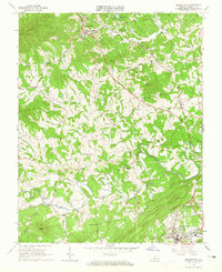
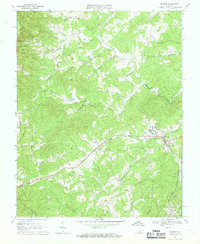
 1965 Rocky Mount1967 Print · USGSFranklin County in the mid-sixties shows a landscape of river-valley towns and upland ridges shaped by the Norfolk and Western rail line. Genealogists can trace family footprints through sites like Waidsboro, Waid Sch, and Coles Creek Ch.3 unique versions available
 - 1966 Map of Greensboro
 1966 Greensboro1966 Print · USGSThe North Carolina and Virginia Piedmont thrives during the mid-sixties, showcasing a landscape of textile hubs and expanding river reservoirs. Researchers can trace the rail corridors of the Southern Railway, find local landmarks like Elon College, or locate the extensive Camp Butner Military Reservation.
 - 1967 Map of Goodview, 1969 Print
 1967 Goodview1969 Print · USGSThe rising waters of Smith Mountain Lake meet the foothills of the Blue Ridge in the late 1960s. Genealogists can locate family lands near Goodview, Meads Store, and several rural churches like Emmaus Ch and Western Light Ch.3 unique versions available
 - 1967 Map of Philpott Reservoir, 1969 Print
 1967 Philpott Reservoir1969 Print · USGSThe foothills of the Blue Ridge in the late 1960s are defined by the winding shoreline of Philpott Reservoir and the developing Fairy Stone State Park. Trace family roots in rural settlements like Dodson and Philpott, or locate industrial landmarks in Bassett near the Norfolk and Western line.3 unique versions available
 - 1967 Map of Smith Mountain Dam, 1969 Print
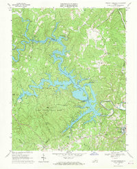
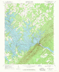 1967 Smith Mountain Dam1969 Print · USGSThe Roanoke River valley was undergoing a massive transformation in the late sixties as the new reservoir filled the surrounding gaps and hollows. Genealogists and local historians can locate established landmarks like Patmos Ch, Graves Store, and the Staunton Cem situated above the rising waters.3 unique versions available
 - 1967 Map of Ferrum, 1969 Print
 1967 Ferrum1969 Print · USGSFranklin County's foothills come alive in the late 1960s as the Norfolk and Western rail line threads through the Ferrum valley. Genealogists can locate family burial sites and rural congregations like Mountain View Ch, Republican Ch, and the small settlement of Prilliman.3 unique versions available
 - 1967 Map of Endicott, 1969 Print
 1967 Endicott1969 Print · USGSThe Virginia highlands near the Floyd and Franklin county line are captured here in the late sixties, dominated by the winding Blue Ridge Parkway. Genealogists can trace rural family life through landmarks like Kings Store, County Line Ch, and Endicott.
Showing maps 1-25 of 27
Top cities of Franklin County
- Rocky Mount historical maps
- North Shore historical maps
- Westlake Corner historical maps
- Union Hall historical maps
- Henry Fork historical maps
- Penhook historical maps
See more
Frequently asked questions
- What are the different types of historical maps available for Franklin County?
- What is the oldest map of Franklin County?
- Where can I purchase historical maps of Franklin County for my home or office?
- Where can I download high-res historical maps of Franklin County?
- Are there historical topographic maps available for Franklin County?
- Is there historical aerial imagery available for Franklin County?
- Where are historical maps of Franklin County sourced from?