1900s (20th Century) Maps of Lee County, Virginia
Explore 93 historic maps of Lee County from the 1900s (20th Century). These maps offer a rare glimpse into what life looked like during the 1900s — showing old roads, neighborhoods, homes, and landmarks that have changed or disappeared over time.
Whether you're researching your family's past, planning a metal detecting trip, or studying how Lee County's landscape evolved across the 1900s, these high-resolution maps are a powerful tool for exploring the history of this region.
- Focus on a specific era: All maps on this page are from the 1900s, giving you a focused view of this time period.
- See what’s changed: Compare century-old streets, trails, and buildings to today's modern landscape using overlays and satellite layers.
- Research with precision: Use these maps for genealogy, historical research, land use analysis, or educational projects.
- View, download, or print: Maps are fully viewable online in high resolution, and can be downloaded or printed for your own records.
Start exploring Lee County's history through authentic maps from the 1900s. This is your window into the past.
Lee County, VA maps
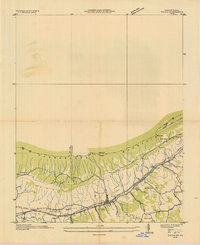
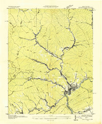
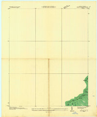
(93)- 1903 Map of Middlesboro
 1903 Middlesboro1903 Print · USGSMiddlesboro sits at the gateway to the mountains in this early century survey of the Kentucky, Tennessee, and Virginia borders. Researchers can trace early migration routes and mountain passes like the famous Cumberland Gap, Baptist Gap, and Yellow Slip Gap.
 - 1916 Map of Nolansburg
 1916 Nolansburg1916 Print · USGSThe rugged Cumberland Plateau along the Kentucky and Virginia border is captured here during the first World War. Researchers can trace early railroad history and mountain genealogy through labels like Nolansburg, Panorama Station, and the slopes of Black Mountain.
 - 1919 Map of Nolansburg
 1919 Nolansburg1919 Print · USGSHarlan County and the Virginia borderlands are captured here during the height of early twentieth-century mountain development. Local historians can trace the foundations of the Pine Mountain Settlement School and vanished industrial sites like Leona Mines PO and Bondurant.3 unique versions available
 - 1921 Map of Big Stone Gap
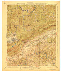
 1921 Big Stone Gap1921 Print · USGSIn the early 1920s, the coal and rail networks of Wise and Lee Counties were at their peak. Genealogists and historians can trace old settlements and rural hubs like Keokee, Johnsons Mill PO, and Stonega along the Southern RR and the Powell River.
 - 1922 Map of Big Stone Gap
 1922 Big Stone Gap1922 Print · USGSSouthwest Virginia's coal and rail corridors are captured here in the early 1920s, showing the height of industrial development in the Cumberland Mountains. Trace family roots and vanished landmarks near Appalachia, Keokee, and the historic Seminary School along the Powell River.
 - 1927 Map of Middlesboro, 1955 Print
 1927 Middlesboro1955 Print · USGSThe Cumberland Gap region comes alive in this survey from the late 1920s, showing the intersection of three states and the rugged rail networks that shaped it. Trace family roots and local industry at Gibson Station PO, Lincoln Memorial University, and Ellison Mill.
 - 1929 Map of Big Stone Gap
 1929 Big Stone Gap1929 Print · USGSThe coal and rail networks of the Kentucky-Virginia border country are frozen in time just before the Great Depression. Genealogists and historians can trace family roots through mountain settlements like Lynch, Keokee, and Appalachia, or locate landmarks such as Robbins Chapel and Cluttis Post Office.3 unique versions available
 - 1930 Map of Middlesboro
 1930 Middlesboro1930 Print · USGSThe tri-state border region comes alive in the late 1920s, centered on the strategic mountain pass at Cumberland Gap. Genealogists and historians can trace family locations near Middlesboro, early campus sites at Lincoln Memorial University, and rural landmarks like Ellison Mill.4 unique versions available
 - 1932 Map of Hagan
 1932 Hagan1932 Print · USGSThe rugged borderlands of Kentucky and Virginia come to life in this early 1930s survey of the high gaps and hollows. Researchers can locate remote mountain landmarks like Hensley Sch, Feepee Store, and the scattered cabins at Alva.3 unique versions available
 - 1935 Map of Ewing
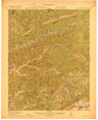
 1935 Ewing1935 Print · USGSThe Virginia-Kentucky borderlands in the mid-1930s are captured here, centered on the settlement of Ewing and the passage through Poor Valley. Trace the path of the Old Wilderness Trail and locate family landmarks like Mc Lin Cem and Arthur Chapel.
 - 1935 Map of Kyles Ford
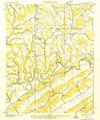
 1935 Kyles Ford1935 Print · USGSHancock County and the Clinch River are captured in the mid-1930s, documenting a time when river fords and mountain gaps defined travel. Researchers can locate remote schools and cemeteries like Wallens Bend Sch, BLEDSOE CEM, and the settlement at Eidson.
 - 1935 Map of Appalachia
 1935 Appalachia1935 Print · USGSThe Virginia-Kentucky borderlands hummed with coal and rail activity in the mid-1930s. Genealogists and industrial historians can trace family locations through numerous company towns like Roda and Arno, or locate the Interstate Shops and Yards.
 - 1935 Map of Looneys Gap
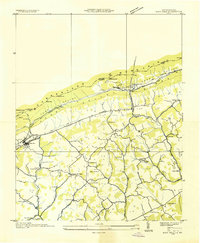
 1935 Looneys Gap1935 Print · USGSNortheast Tennessee and Southwest Virginia are captured here in the mid-1930s, showing a landscape of river-bottom farms and ridge-top gaps. Researchers can locate vanished landmarks like Donald Mill, Tignors Ford, and the old Snow Flake settlement.
 - 1935 Map of Varilla
 1935 Varilla1935 Print · USGSThe Kentucky and Virginia state line was defined by the high ridgelines of the Appalachians in the mid-1930s. Genealogists can trace family landmarks and rural infrastructure including Ely Cem, Woodvine Sch, and the Trent Siding along the rail line.
 - 1935 Map of Hubbard Springs
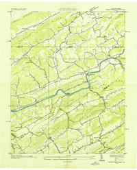
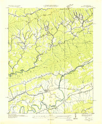
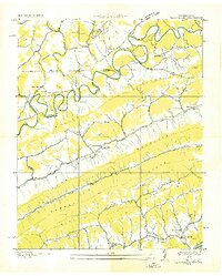
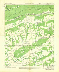 1935 Hubbard Springs1935 Print · USGSLee County, Virginia, is captured here in the mid-1930s, showing a landscape defined by mountain gaps and the winding Powell River. You can trace the historic Wilderness Trail and locate dozens of local landmarks like Spangler Cem, Ocoonita, and Hubbard Springs.
 - 1935 Map of Evarts
 1935 Evarts1935 Print · USGSThe Kentucky and Virginia borderlands appear here in the mid-1930s during an era of expanding federal utility projects. Researchers can trace the path of the Ky Util Co Trans Line and locate Nolansburg No 1 near the Stone Creek drainage.
 - 1935 Map of Ben Hur
 1935 Ben Hur1935 Print · USGSLee County, Virginia, is captured in the mid-1930s as a landscape of river crossings and mountain hollows. Researchers can trace the heritage of Jonesville and Ben Hur through local landmarks like C C C Camp No 391, Chandler Mill, and Sword Cem.
 - 1935 Map of Keokee
 1935 Keokee1935 Print · USGSThe Virginia and Kentucky borderlands in the 1930s reveal a landscape of deep valleys and coal-driven industry. Genealogists can trace family roots at Ely Memorial Ch and Mohawk Sch or locate mining operations at Stonega Coal No 73.
 - 1935 Map of Colman
 1935 Colman1935 Print · USGSThe Tennessee-Virginia borderlands in the mid-1930s show a landscape defined by the winding Powell River and the steep slopes of Wallen Ridge. Genealogists and historians can trace family locations near Brooks Cem, follow old river crossings like Brooks Ferry, or locate rural landmarks like Yeary Mill.2 unique versions available
 - 1935 Map of Rose Hill
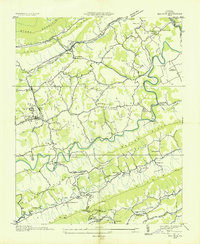
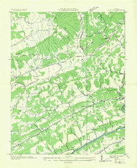
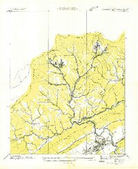
 1935 Rose Hill1935 Print · USGSLee County in the mid-1930s shows a landscape of deep-rooted settlements and early Depression-era federal projects. Researchers can trace the Old Wilderness Trail, locate the CCC Camp TVA No 5, and find family landmarks like Grabeels Mill or the Engle Cem.
 - 1935 Map of Duffield
 1935 Duffield1935 Print · USGSScott County, Virginia, is captured here in the mid-1930s as a landscape of isolated mountain settlements and riverside mills. Researchers can trace the heritage of rural communities through landmarks like Sunbright Hortons Summit P O, Lawson Mill, and Pattonsville Sch.
 - 1935 Map of Cumberland Gap
 1935 Cumberland Gap1935 Print · USGSThe tri-state corner of Tennessee, Kentucky, and Virginia comes alive in the mid-1930s as the Tennessee Valley Authority begins transforming the Powell River valley. Trace the legendary Wilderness Trail past Lincoln Memorial University or locate family sites like Minton Mill and Sproles Chapel Sch.
 - 1935 Map of Benham
 1935 Benham1935 Print · USGSThe Kentucky-Virginia state line runs along the high ridges of the Cumberland Plateau during the mid-1930s. Researchers can trace coal operations like Potato Hill Stonega Coal No 71 and topographic landmarks such as Deep Gap.
 - 1935 Map of Back Valley
 1935 Back Valley1935 Print · USGSThe Tennessee-Virginia borderlands in the mid-1930s reveal a landscape of river-bend settlements and mountain gaps. Genealogists can trace early homesteads and community centers like Wolfenbarger Ch, Mulberry Gap, and Sand Springs Sch along the river valleys.
 - 1935 Map of Pennington Gap
 1935 Pennington Gap1935 Print · USGSCoal and rail industry dominate this mid-depression landscape along the Kentucky-Virginia border. Genealogists can locate family-named landmarks and old communities like St Charles, Leona Mines PO, and Burkheart Chapel among the mountain ridges.
Showing maps 1-25 of 93
Top cities of Lee County
- Pennington Gap historical maps
- Dryden historical maps
- Jonesville historical maps
- Rose Hill historical maps
- Ewing historical maps
- Keokee historical maps
See more
Frequently asked questions
- What are the different types of historical maps available for Lee County?
- What is the oldest map of Lee County?
- Where can I purchase historical maps of Lee County for my home or office?
- Where can I download high-res historical maps of Lee County?
- Are there historical topographic maps available for Lee County?
- Is there historical aerial imagery available for Lee County?
- Where are historical maps of Lee County sourced from?