Old Maps of Mathews County, Virginia for Genealogy
Trace your family roots with 74 historic maps of Mathews County. These high-res maps reveal old neighborhoods, homesites, landmarks, and streets — helping you uncover where your ancestors lived and how the area evolved over time.
- Explore historic neighborhoods: Identify where your relatives may have lived in the 1800s or 1900s.
- Compare maps over time: Trace the changes in streets, buildings, and landmarks for multi-generational research.
- Perfect for genealogy & ancestry research: Used by family historians and researchers to map out lineage and migration.
These maps are an incredible resource for exploring your personal connection to Mathews County's past.
Mathews County, VA maps
(74)- 1916 Map of Kilmarnock
 1916 Kilmarnock1916 Print · USGSBefore the era of modern bridges, this coastal Virginia region relied on a busy steamboat route network connecting the Northern Neck and Middle Peninsula. Genealogists can locate family landmarks like Wharton Grove Camp, White Chapel Church, and numerous landings including Morattico Wharf.2 unique versions available
 - 1916 Map of Mathews, 1965 Print
 1916 Mathews1965 Print · USGSThe Virginia Middle Peninsula during the mid-1910s reveals a maritime landscape where travel centered on the water. Genealogists can trace family roots through numerous local landmarks like Lee-Jackson School, Trinity Church, and the remains of Fort Nonsense.
 - 1917 Map of Kilmarnock
 1917 Kilmarnock1917 Print · USGSThe Northern Neck and Middle Peninsula of Virginia are shown during the height of the steamboat era. Genealogists can locate family-named landmarks and essential community hubs like the Old Brick Church, Harmony Village, and Kilmarnock Wharf.4 unique versions available
 - 1917 Map of Mathews
 1917 Mathews1917 Print · USGSThe Virginia Tidewater is captured here during the First World War, showing a coastal world reliant on the Mobjack Bay and the York River. Researchers can trace old steamboat routes and locate vanished community landmarks like Fort Nonsense (Ruins) and the Lee-Jackson School.7 unique versions available
 - 1942 Map of Kilmarnock
 1942 Kilmarnock1942 Print · USGSThe Virginia Tidewater in the early 1940s was a world of steamboat routes and bustling river landings. Trace the maritime history of the Northern Neck through Whitestone Wharf, the Shipleys Ferry crossing, and the grounds of Christ Church.
 - 1943 Map of Richmond, 1972 Print
 1943 Richmond1972 Print · USGSCoastal Virginia and the state capital are shown in detail during the mid-century era of infrastructure expansion. Genealogists and historians can trace the grounds of Richmond Nat Battlefield Park, locate the Yorktown Nat Cem, or follow the many rural routes through Amelia Court House and Tappahannock.
 - 1948 Map of Ware Neck
 1948 Ware Neck1948 Print · USGSThe Gloucester and Mathews County shorelines are caught in a moment of post-war transition, where the river remained the primary highway. Genealogists and historians can trace family locations near Dixondale, Auburn Wharf, and the historical site of Fort Nonsense.
 - 1948 Map of Achilles
 1948 Achilles1948 Print · USGSCoastal Gloucester County is depicted here in the late 1940s, a period defined by the tidewater economy and maritime navigation. Genealogists and historians can trace family locations near Achilles, Naxera, and Maryus, or locate landmarks like Severn Ch and Roanes Wharf.2 unique versions available
 - 1948 Map of Deltaville
 1948 Deltaville1948 Print · USGSDeltaville and the surrounding Middlesex County shoreline are documented here in the late 1940s, showing a maritime landscape shaped by the Chesapeake Bay. Researchers can trace historic fishing communities and coastal markers such as Stingray Point LH, the village of Amburg, and Fleets Island.2 unique versions available
 - 1948 Map of New Point Comfort
 1948 New Point Comfort1948 Print · USGSCoastal Mathews County during the late 1940s reveals a maritime landscape of tidal necks and small harbor settlements. Genealogists and researchers can trace local families through landmarks like Diggs Wharf, Antioch Sch, and the New Point Comfort lighthouse.2 unique versions available
 - 1948 Map of Mathews
 1948 Mathews1948 Print · USGSCoastal Virginia life in the late 1940s is defined by the intricate peninsulas and waterways of the Chesapeake Bay. Researchers can trace ancestral roots through numerous local landmarks like Mathews Cem, the Lee-Jackson Sch, and historic landing sites including Hicks Wharf.2 unique versions available
 - 1949 Map of Wilton
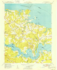 1949 Wilton1949 Print · USGSCoastal Middlesex County comes alive in this post-war survey of the peninsulas between the Rappahannock and Piankatank rivers. Genealogists and historians can trace old landings and community hubs like Blands Wharf, Old Brick Ch, and Harmony Village.
 - 1949 Map of Richmond, 1951 Print
 1949 Richmond1951 Print · USGSCoastal Virginia in the years following World War II remained a landscape of historic river towns and expanding military bases. Genealogists and historians can trace the rail lines of the Southern Ry and locate established landmarks from Camp Lee to the remote reaches of Dragon Swamp.
 - 1957 Map of New Point Comfort, 1960 Print
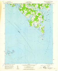 1957 New Point Comfort1960 Print · USGSThe tip of the Mathews peninsula comes into focus during the late fifties, showing a landscape defined by tidal creeks and maritime settlements. Genealogists and historians can trace family locations near Antioch Ch, find the historic Lighthouse New Point Comfort, and locate old landing sites like Diggs Wharf.
 - 1957 Map of Achilles, 1960 Print
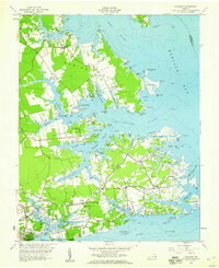 1957 Achilles1960 Print · USGSGloucester County's tidal peninsulas are captured here in the late fifties, showcasing a landscape of waterside landings and rural parishes. Genealogists can trace family sites from Warner Hall to coastal settlements like Maryus, Achilles, and Bena.
 - 1959 Map of Richmond
 1959 Richmond1959 Print · USGSMid-century Virginia is captured here at its most vital rail and river junctions, from the capital city to the Chesapeake Bay. Genealogists and historians can trace the development of colonial settlements like Williamsburg and military landmarks including Fort Monroe and Camp Lee.
 - 1964 Map of Richmond
 1964 Richmond1964 Print · USGSCoastal and central Virginia are mapped during the mid-twentieth century, showing the critical intersection of rail, river, and military life. Genealogists can trace family roots through rural county seats like Amelia or find vanished coastal neighborhoods near Phoebus and Hilton Village.
 - 1964 Map of Deltaville, 1966 Print
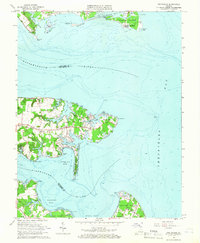 1964 Deltaville1966 Print · USGSThe Middlesex County coastline in the mid-sixties reveals a landscape defined by its relation to the Chesapeake. Genealogists and historians can trace family locations near Deltaville, find local landmarks like Philippi Ch, or locate old landings at Stingray Point and Westland.4 unique versions available
 - 1964 Map of New Point Comfort, 1966 Print
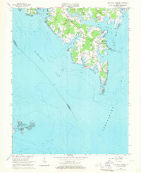 1964 New Point Comfort1966 Print · USGSThe coastal peninsula of Mathews County comes alive in this mid-century survey of the Chesapeake shoreline. Trace the family landmarks of Potato Neck and discover the location of the New Point Sch and the New Point Comfort Lighthouse.2 unique versions available
 - 1964 Map of Wilton, 1966 Print
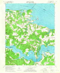 1964 Wilton1966 Print · USGSThe Virginia Middle Peninsula in the mid-1960s reveals a tidewater landscape of small settlements and riverfront landings. Genealogists and historians can locate rural landmarks such as Old Brick Ch, Stampers Wharf Sch, and Barricks Millpond.4 unique versions available
 - 1964 Map of East of New Point Comfort, 1987 Print
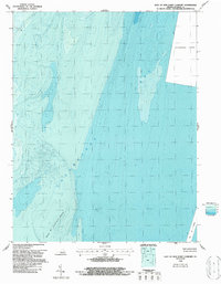 1964 East of New Point Comfort1987 Print · USGSCoastal Mathews County waters are captured during the mid-1960s, focusing on the maritime approaches and seafloor of the Chesapeake Bay. Researchers can trace the depth contours of New Pt Comfort Shoal and the critical York Spit Channel.
 - 1965 Map of Ware Neck, 1966 Print
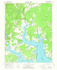 1965 Ware Neck1966 Print · USGSCoastal Gloucester and Mathews Counties are shown in the mid-1960s, documenting a landscape of tidal necks and maritime landings. Researchers can trace historic river access points and local landmarks like Auburn Wharf, Fort Nonsense, and Baileys Wharf Beacon.4 unique versions available
 - 1965 Map of Achilles, 1967 Print
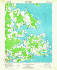 1965 Achilles1967 Print · USGSCoastal Virginia in the mid-1960s is preserved here as a landscape of tidal creeks and maritime landings. Trace the roots of local families at Roanes Wharf, Achilles, and historic sites like First Morning Star Ch.3 unique versions available
 - 1965 Map of Mathews, 1967 Print
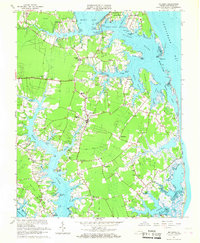 1965 Mathews1967 Print · USGSCoastal Mathews County during the mid-sixties reveals a peninsula shaped by tide and tradition, from the shores of Gwynn Island to the Mobjack waterfront. Researchers can trace family-named landmarks and community centers like Williams Wharf, Mathews Raceway, and Smither Memorial Cem.3 unique versions available
 - 1965 Map of Bethel Beach, 1987 Print
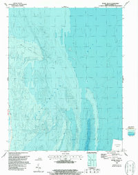 1965 Bethel Beach1987 Print · USGSThe Mathews County shoreline meets the Chesapeake Bay in this mid-century maritime survey. Researchers can trace the precise contours of Bethel Beach and Winter Harbor alongside historical Light locations and bathymetric depths.
Showing maps 1-25 of 74
Top cities of Mathews County
Frequently asked questions
- What are the different types of historical maps available for Mathews County?
- What is the oldest map of Mathews County?
- Where can I purchase historical maps of Mathews County for my home or office?
- Where can I download high-res historical maps of Mathews County?
- Are there historical topographic maps available for Mathews County?
- Is there historical aerial imagery available for Mathews County?
- Where are historical maps of Mathews County sourced from?