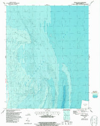
1965 Map of Bethel Beach
USGS Topo · Published 1987About this map
Bethel Beach and the intricate shoreline of Winter Harbor define this coastal landscape as it appeared during the mid-1960s. This survey is particularly notable for its integration of bathymetric data, revealing the complex underwater contours and depth gradients of the Chesapeake Bay floor. The map highlights the shifting nature of the Virginia coastline, where the Milford Haven Spit and various small lights assist in navigating the shallow, tidal-influenced waters. While primarily a study of the maritime boundary, the inclusion of a designated Disposal Area in the bay's deeper reaches reflects the era's marine management practices. For those studying the Mathews County shoreline, the distinction between mean high water and the outer edge of vegetation provides a specific record of the marshland and beach environment before decades of modern erosion and rising tides.
Find a feature on this map
6 named features on this map. Tap any name to fly to it.
Don’t see what you’re looking for? This feature index may not catch every label — zoom into the map to look around manually.
Map Details
Editions of this 1965 Bethel Beach Map
This is the sole edition of this map. No revisions or reprints were ever made.
Other maps of this area

1916 · Kilmarnock
USGS Topo · 1:48,000

1916 · Mathews
USGS Topo · 1:62,500

1917 · Kilmarnock
USGS Topo · 1:62,500

1917 · Mathews
USGS Topo · 1:62,500

1942 · Kilmarnock
USGS Topo · 1:62,500

1943 · Richmond
USGS Topo · 1:250,000

1948 · Cape Charles
USGS Topo · 1:24,000

1948 · Deltaville
USGS Topo · 1:24,000

1948 · New Point Comfort
USGS Topo · 1:24,000

1948 · Mathews
USGS Topo · 1:24,000