1960s Maps of Nelson County, Virginia
Explore 21 historic maps of Nelson County from the 1960s. These maps offer a rare glimpse into what life looked like during the 1960s — showing old roads, neighborhoods, homes, and landmarks that have changed or disappeared over time.
Whether you're researching your family's past, planning a metal detecting trip, or studying how Nelson County's landscape evolved across the 1960s, these high-resolution maps are a powerful tool for exploring the history of this region.
- Focus on a specific era: All maps on this page are from the 1960s, giving you a focused view of this time period.
- See what’s changed: Compare century-old streets, trails, and buildings to today's modern landscape using overlays and satellite layers.
- Research with precision: Use these maps for genealogy, historical research, land use analysis, or educational projects.
- View, download, or print: Maps are fully viewable online in high resolution, and can be downloaded or printed for your own records.
Start exploring Nelson County's history through authentic maps from the 1960s. This is your window into the past.
Nelson County, VA maps
(21)- 1961 Map of Shipman, 1963 Print
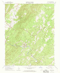
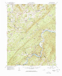 1961 Shipman1963 Print · USGSNelson County's rugged ridges and the James River corridor are captured here in the early 1960s, showing a landscape defined by rail lines and rural community life. Researchers can trace historic church sites like White Rock Ch, the rail hub at Gladstone, and the grounds of the County Training Sch.2 unique versions available
 - 1961 Map of Buckingham, 1963 Print
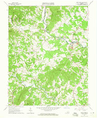
 1961 Buckingham1963 Print · USGSBuckingham County and the James River corridor are captured here in the early sixties as rural life centered on the river and rail. Genealogists can trace family roots through numerous country landmarks like Liberty Hall Cem, Midway Mills, and St Joy Sch.
 - 1963 Map of Roanoke
 1963 Roanoke1963 Print · USGSCentral Virginia and the Blue Ridge front appear here in the early sixties, caught between their deep railroad roots and new postwar developments. Genealogists and historians can trace the rail lines of the Norfolk and Western through towns like Bedford and Altavista, or locate family landmarks near Smith Mountain Lake.
 - 1963 Map of Piney River, 1965 Print
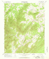
 1963 Piney River1965 Print · USGSIn the early 1960s, the Amherst and Nelson County border was a landscape of mountain hollows and industrial quarries. Researchers can trace the path of the Blue Ridge Railway or locate ancestral sites like Henleys Store and St Marys Ch.2 unique versions available
 - 1964 Map of Waynesboro West, 1966 Print
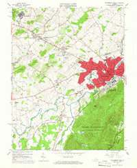 1964 Waynesboro West1966 Print · USGSWaynesboro and the surrounding Augusta County landscape are shown in the mid-sixties at a peak of industrial and transit development. Genealogists and historians can trace family-named sites like Tinkling Spring Ch or the Woodrow Wilson Educational Center.2 unique versions available
 - 1964 Map of Waynesboro East, 1966 Print
 1964 Waynesboro East1966 Print · USGSThe Blue Ridge crest marks the divide between Augusta and Albemarle counties in the mid-1960s, where engineering and nature meet. Researchers can trace historic mountain passages and early local life through the Blue Ridge Tunnel, Fairfax Hall Jr College, and Critzers Shop.2 unique versions available
 - 1965 Map of Big Levels, 1967 Print
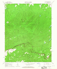 1965 Big Levels1967 Print · USGSThe Blue Ridge high country in the mid-1960s shows a landscape of federal forest land, mountain overlooks, and seasonal campgrounds. Trace local history through the White Rock Cemetery, the village of Love, and various landmarks along the Blue Ridge Parkway.4 unique versions available
 - 1965 Map of Massies Mill, 1967 Print
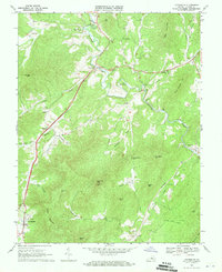
 1965 Massies Mill1967 Print · USGSNelson and Amherst Counties are captured here in the mid-1960s, showing the high ridge communities and valley settlements along the Tye River. Genealogists and hikers can trace the Appalachian Trail past peaks like The Priest or locate family sites at Sandy Ridge Cem and Massies Mill.2 unique versions available
 - 1965 Map of Montebello, 1967 Print
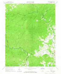
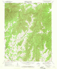
 1965 Montebello1967 Print · USGSThe high ridges of Rockbridge and Nelson counties come alive in the mid-sixties as the winding Blue Ridge Parkway meets the Appalachian Trail. Genealogists can locate family landmarks like Grant Cem and the Irish Creek settlement, or trace the remote Wiggins Spring Shelter and Fish Hatchery.4 unique versions available
 - 1965 Map of Vesuvius, 1967 Print
 1965 Vesuvius1967 Print · USGSThe Shenandoah Valley meets the Blue Ridge in the mid-sixties, showing a landscape defined by rail-side settlements and mountain gaps. Genealogists can locate family landmarks like Old Providence Ch, Spottswood Sch, and the State Prison Camp No 10.3 unique versions available
 - 1967 Map of Schuyler, 1968 Print
 1967 Schuyler1968 Print · USGSThe Rockfish River valley at the border of Nelson and Albemarle Counties was a hub of industrial and rural life during the late sixties. Genealogists and historians can trace family roots at Rock Springs Ch, locate the old Quarry in Schuyler, or follow the Old Grade Railroad through the foothills.3 unique versions available
 - 1967 Map of Covesville, 1968 Print
 1967 Covesville1968 Print · USGSAlbemarle County orchards and mountain gaps define this late-sixties landscape as it transitioned toward the modern era. Researchers can trace family history through the Red Hill Sch and numerous cemeteries like Wild Rose Cem and Rising Sun Ch Cem.3 unique versions available
 - 1967 Map of Lovingston, 1970 Print
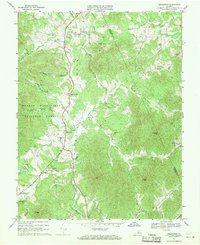
 1967 Lovingston1970 Print · USGSThe Nelson County foothills are mapped here in the late sixties, showcasing the rural heart of Virginia. Genealogists and historians can trace family locations near Lovingston, Adial Ch, and Lawhorne Mill along the Rockfish River.5 unique versions available
 - 1967 Map of Horseshoe Mountain, 1970 Print
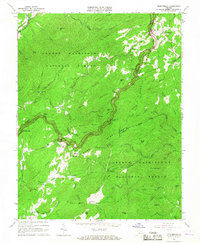
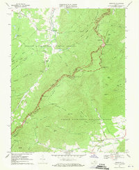
 1967 Horseshoe Mountain1970 Print · USGSNelson County in the late sixties reveals a landscape of deep hollows and high ridges centered on the Tye River valley. Genealogists and historians can trace long-standing community centers like Massies Mill, rural schools, and churches such as Bethlehem Ch.5 unique versions available
 - 1967 Map of Greenfield, 1970 Print
 1967 Greenfield1970 Print · USGSThe Rockfish River valley in Nelson and Albemarle counties was a network of small family settlements and country parishes in the late sixties. Genealogists and historians can trace local roots at Hebron Ch, Nellysford, and Durrett Town, or locate old landmarks like Stockton Mill Creek and Tool Gap.3 unique versions available
 - 1967 Map of Sherando, 1970 Print
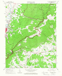
 1967 Sherando1970 Print · USGSThe Blue Ridge highlands in the late sixties reveal a landscape shaped by both early industry and the rise of forest recreation. Researchers can trace the Howardsville Turnpike, locate the Mount Torry Furnace, or find family names at Diamond Hill Cem.4 unique versions available
 - 1968 Map of Howardsville, 1971 Print
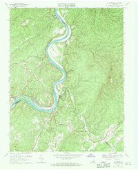
 1968 Howardsville1971 Print · USGSThe James River corridor in the late sixties reveals a network of railroad hamlets and riverside plantations. Genealogists and historians can trace family-named sites like Liberty Hall, Creasy Hill, and Grays Corner alongside the Chesapeake and Ohio line.3 unique versions available
 - 1969 Map of Gladstone, 1971 Print
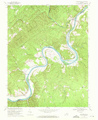
 1969 Gladstone1971 Print · USGSThe James River corridor in the late 1960s reveals a landscape defined by its winding waterway and rail lines. Genealogists can trace family landmarks and community centers like Buffalo Station, Mineral Springs Ch, and the Gladstone Sch.4 unique versions available
 - 1969 Map of Shipman, 1971 Print
 1969 Shipman1971 Print · USGSNelson County and the northern edge of Buckingham County are captured here in the late sixties as rail lines still dictated the flow of river-valley commerce. Genealogists and local historians can trace family-named gaps and rural hubs like Variety Mills, Shipman, and Ryan Hall Sch.4 unique versions available
 - 1969 Map of Arrington, 1971 Print
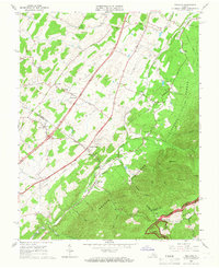
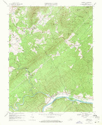
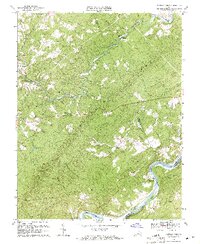
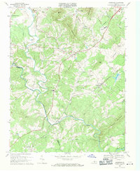 1969 Arrington1971 Print · USGSNelson County's river valleys and the Southern railroad corridor are captured here during a period of steady rural growth. Genealogists and local historians can trace family roots through numerous churches and cemeteries, from Roseland and Arrington to the Pine Hill Ch.4 unique versions available
 - 1969 Map of Buffalo Ridge, 1971 Print
 1969 Buffalo Ridge1971 Print · USGSAmherst and Nelson counties come together along the James River in the late sixties, showing a landscape of ridge-top lookouts and river-valley rails. Genealogists can locate family landmarks like Poplar Ch, St James Ch, and the rural community of Buffalo Ridge.2 unique versions available
End of results
Showing maps 1-21 of 21
Top cities of Nelson County
- Nellysford historical maps
- Arrington historical maps
- Lovingston historical maps
- Shipman historical maps
- Wintergreen historical maps
- Afton historical maps
Frequently asked questions
- What are the different types of historical maps available for Nelson County?
- What is the oldest map of Nelson County?
- Where can I purchase historical maps of Nelson County for my home or office?
- Where can I download high-res historical maps of Nelson County?
- Are there historical topographic maps available for Nelson County?
- Is there historical aerial imagery available for Nelson County?
- Where are historical maps of Nelson County sourced from?