1970s Maps of Nelson County, Virginia
Explore 10 historic maps of Nelson County from the 1970s. These maps offer a rare glimpse into what life looked like during the 1970s — showing old roads, neighborhoods, homes, and landmarks that have changed or disappeared over time.
Whether you're researching your family's past, planning a metal detecting trip, or studying how Nelson County's landscape evolved across the 1970s, these high-resolution maps are a powerful tool for exploring the history of this region.
- Focus on a specific era: All maps on this page are from the 1970s, giving you a focused view of this time period.
- See what’s changed: Compare century-old streets, trails, and buildings to today's modern landscape using overlays and satellite layers.
- Research with precision: Use these maps for genealogy, historical research, land use analysis, or educational projects.
- View, download, or print: Maps are fully viewable online in high resolution, and can be downloaded or printed for your own records.
Start exploring Nelson County's history through authentic maps from the 1970s. This is your window into the past.
Nelson County, VA maps
(10)- 1971 Map of Roanoke, 1977 Print
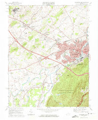
 1971 Roanoke1977 Print · USGSThe Virginia Piedmont and Blue Ridge mountains meet in this early 1970s landscape of river valleys and rail hubs. Researchers can trace historic transportation routes and landmarks like the Appomattox Court House Nat Hist Pk, the Peaks of Otter, and Amelia Court House.2 unique versions available
 - 1972 Map of Waynesboro East, 1974 Print
 1972 Waynesboro East1974 Print · USGSWaynesboro and the surrounding valley floor are captured at the start of the seventies as the city grew toward the mountains. Trace the development of Waynesboro and the wooded slopes of the Blue Ridge through detailed aerial photography.
 - 1973 Map of Waynesboro West, 1974 Print
 1973 Waynesboro West1974 Print · USGSAugusta County and the City of Waynesboro are captured in the early seventies during a period of robust industrial and educational growth. Genealogists can trace family names through rural churches like Tinkling Spring Ch and settlements such as Fishersville and Lyndhurst.4 unique versions available
 - 1973 Map of Waynesboro East, 1974 Print
 1973 Waynesboro East1974 Print · USGSThe Blue Ridge mountains meet the Shenandoah Valley in the early 1970s, showcasing a landscape defined by historic rail and high-ridge trails. Trace local genealogy and industry through the Blue Ridge Tunnel, the Greenwood School, and Critzers Shop.2 unique versions available
 - 1977 Map of Waynesboro East, 1982 Print
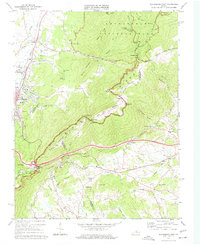
 1977 Waynesboro East1982 Print · USGSThe eastern Blue Ridge and the city of Waynesboro are captured in high detail at the end of the seventies. Genealogists and historians can trace the rural layouts of Newtown and Afton or locate landmarks like Rockfish Gap and Skyline Drive.
 - 1979 Map of Covesville, 1982 Print
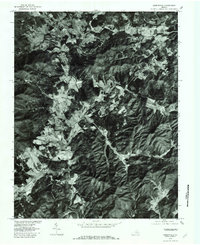
 1979 Covesville1982 Print · USGSAlbemarle County orchards and foothills are captured in high-contrast aerial detail during the late seventies. Researchers can trace the exact footprint of farms and family lands near Covesville, North Garden, and Batesville.
 - 1979 Map of Greenfield, 1982 Print
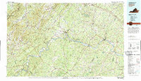
 1979 Greenfield1982 Print · USGSNelson County's agrarian landscape near Greenfield is captured in the late seventies through detailed aerial imagery. Genealogists and historians can trace property lines and family homesteads near Nelly s Ford, Avon, and the slopes of Pilot Mountain.
 - 1979 Map of Dillwyn, 1982 Print
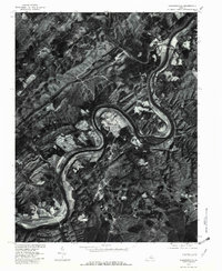
 1979 Dillwyn1982 Print · USGSCentral Virginia in the late seventies is defined by the winding James River and the rural communities of the Piedmont. Trace old transportation corridors and family-named ridges from Dillwyn and Buckingham to the Blue Ridge foothills.
 - 1979 Map of Howardsville, 1982 Print
 1979 Howardsville1982 Print · USGSThe James River corridor in the late seventies reveals a landscape of winding water and rural settlements. Genealogists and local historians can trace the riverside layouts of Howardsville, Warminster, and the community of Wingina.
 - 1979 Map of Schuyler, 1982 Print
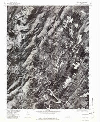 1979 Schuyler1982 Print · USGSSchuyler and the surrounding Piedmont hill country are captured in this late 1970s aerial survey. Researchers can trace the exact buildings and farm layouts of communities like Faber, Damon, and Bungletown along the Rockfish River.
End of results
Showing maps 1-10 of 10
Top cities of Nelson County
- Nellysford historical maps
- Arrington historical maps
- Lovingston historical maps
- Shipman historical maps
- Wintergreen historical maps
- Afton historical maps
Frequently asked questions
- What are the different types of historical maps available for Nelson County?
- What is the oldest map of Nelson County?
- Where can I purchase historical maps of Nelson County for my home or office?
- Where can I download high-res historical maps of Nelson County?
- Are there historical topographic maps available for Nelson County?
- Is there historical aerial imagery available for Nelson County?
- Where are historical maps of Nelson County sourced from?