Old Maps of Prince William County, Virginia for Academic Research
Study the evolution of Prince William County with 161 high-resolution historic maps. Whether you're teaching, researching, or modeling changes in land use, these maps provide essential visual documentation of urban, environmental, and geographic change.
- Analyze long-term change: Track patterns in development, transportation, and natural features.
- Ideal for environmental or urban studies: Support academic projects with primary historical map data.
- Use in the classroom or lab: Educators and researchers rely on these maps to bring historical context to life.
These maps are a powerful tool for teaching, research, and visualizing how Prince William County has changed over the decades.
Prince William County, VA maps
(161)- 1890 Map of Mt. Vernon
 1890 Mt. Vernon1890 Print · USGSNorthern Virginia and the capital region appear here in the decade before the turn of the century, showing a landscape of river estates and rail-connected villages. Researchers can trace early property sites and historic river landings from Mt. Vernon to Occoquan and Falls Church.
 - 1891 Map of Mt. Vernon
 1891 Mt. Vernon1891 Print · USGSNorthern Virginia and the D.C. area appear here in the late nineteenth century, as the rail-and-river economy connected rural counties to the capital. Researchers can trace ancestral roots through dozens of local landmarks, including Arlington National Cemetery, the Fox Ferry, and historic towns like Occoquan and Vienna.
 - 1894 Map of Warrenton
 1894 Warrenton1894 Print · USGSVirginia's northern Piedmont and mountain gaps are mapped here in the late nineteenth century as the rail-and-river economy flourished. Genealogists can trace family names and small crossroads from Warrenton and Brentsville to White Sulphur Springs.9 unique versions available
 - 1894 Map of Mt. Vernon, 1904 Print
 1894 Mt. Vernon1904 Print · USGSThe Potomac River valley south of the capital was still largely a landscape of crossroads and rail depots in the late nineteenth century. Genealogists can trace the rural reaches of Fairfax through landmarks like Arlington National Cemetery, Mt. Vernon, and Tyson Cross Roads.6 unique versions available
 - 1897 Map of Mt. Vernon
 1897 Mt. Vernon1897 Print · USGSNorthern Virginia and the Potomac River appear in the late nineteenth century as a landscape of rural crossroads and strategic fortifications. Trace the early footprints of Vienna, Herndon, and Manassas along the path of the Southern R. R.2 unique versions available
 - 1913 Map of Indian Head
 1913 Indian Head1913 Print · USGSThe Potomac River tidewater south of the capital was a region of defensive forts and busy river landings before the First World War. Researchers can trace the early layout of the Naval Proving Grounds and locate family landmarks like Mattinglys Wharf or the Granny Thompson School.2 unique versions available
 - 1915 Map of Fairfax
 1915 Fairfax1915 Print · USGSNorthern Virginia in the early twentieth century appears as a collection of quiet rail towns and farmsteads. Trace the old routes of the Southern RR and find family-named landmarks like Sideburn, Balls Ford, and Bear School.4 unique versions available
 - 1923 Map of Indian Head
 1923 Indian Head1923 Print · USGSMaryland and Virginia meet along the Potomac in the 1920s, a period when steamboats and early highways still defined regional travel. Genealogists can trace family footprints through sites like Marshall Hall PO, Pohick Church, and the Woodlawn School (Colored).2 unique versions available
 - 1925 Map of Indian Head
 1925 Indian Head1925 Print · USGSThe Potomac River corridor in the mid-1920s reveals a landscape of strategic military installations and historic river landings. Genealogists and local historians can trace the foundations of Indian Head, find local landmarks like Pohick Church, or locate defunct river hubs such as Budds Ferry.6 unique versions available
 - 1927 Map of Quantico
 1927 Quantico1927 Print · USGSPrince William County and the Potomac riverfront appear here in the late twenties, captured just as military and transit corridors began to reshape the rural landscape. Researchers can trace the early foundations of the Marine Corps Reservation and locate vanished local landmarks like Minnieville Store and the Sinclairs Mill.
 - 1933 Map of Middleburg
 1933 Middleburg1933 Print · USGSNorthern Virginia is captured here in the years following the Great War, showing a landscape defined by its ridges and historical milestones. Genealogists and historians can locate family landmarks like the Henry House, Beverly Mill, and rural centers such as Hickory Grove.
 - 1940 Map of Quantico
 1940 Quantico1940 Print · USGSCoastal Virginia and Maryland are captured here during the late pre-war era, showing the growing military footprint around the Potomac. Genealogists can trace family names and landmarks like Sinclairs Mill, Bacon Race School, and the historic Dumfries settlement.2 unique versions available
 - 1943 Map of Quantico
 1943 Quantico1943 Print · USGSCoastal Northern Virginia in the mid-1940s reveals a region transitioning from a rural riverfront to a strategic military hub. Researchers can trace the early layout of the Marine Corps Reservation or locate family sites like Shacklet PO and Old Chopawamsic Ch.
 - 1943 Map of Catlett, 1955 Print
 1943 Catlett1955 Print · USGSMid-century Fauquier and Prince William counties center on the Southern Railway as it links rural hubs and farming estates. Genealogists can trace family footprints across dozens of local landmarks, from Vint Hill Farm to Dunkard Church and Balls Mill.2 unique versions available
 - 1943 Map of Arcola, 1957 Print
 1943 Arcola1957 Print · USGSNorthern Virginia remains a landscape of quiet crossroads and family farms during the mid-1940s. Genealogists can trace rural life through landmarks like Watson Sch, Conklin Ch, and the small settlement of Lenah along the Lee-Jackson Memorial Highway.3 unique versions available
 - 1943 Map of Thorofare Gap, 1960 Print
 1943 Thorofare Gap1960 Print · USGSNorthern Virginia at the height of the Second World War shows a landscape defined by the ridgeline of the Bull Run Mountains. Genealogists and local historians can trace the foundations of communities like Haymarket and Buckland or locate specific sites like Beverly Mills and Vint Hill Farm Military Reservation.
 - 1944 Map of Belvoir
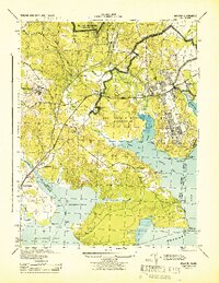 1944 Belvoir1944 Print · USGSFairfax County is shown at a pivotal moment in the 1940s, balancing its historic riverfront estates with wartime military expansion. Genealogists can trace old family sites and stations near Woodbridge, Colchester, and the landmark Gunston Hall.
 - 1944 Map of Fairfax
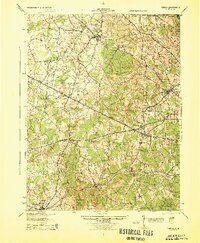 1944 Fairfax1944 Print · USGSNorthern Virginia at the height of the Second World War remains a landscape of rail-connected villages and rural schools. Genealogists and historians can trace family locations through landmarks like Oak Grove Store, Bear School, and the historic Washington and Old Dominion RR.
 - 1944 Map of Somerville
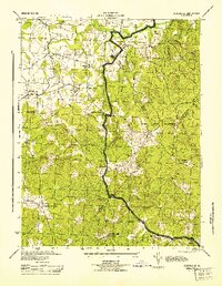 1944 Somerville1944 Print · USGSThe rural borders of Fauquier and Stafford Counties are captured here during the mid-forties. Researchers can locate family landmarks and early post offices at Somerville PO, Tacketts Mill, and Hearts Delight Ch Delight.
 - 1944 Map of Occoquan
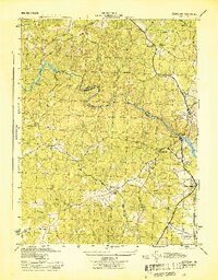 1944 Occoquan1944 Print · USGSNorthern Virginia at the peak of the war years shows a landscape of rural crossroads and riverfront settlements. Genealogists and historians can locate family-named landmarks like Davis Store, local schools such as Agnesville Sch, and the rail infrastructure of Featherstone Sta.
 - 1944 Map of Quantico
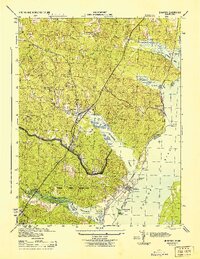 1944 Quantico1944 Print · USGSCoastal Prince William County is captured here at the height of the second World War, showing the expansion of military and transit infrastructure. Genealogists and historians can trace old landmarks like Little Union Ch, the Midway Island Housing Project, and the busy Quantico waterfront.2 unique versions available
 - 1944 Map of Indian Head
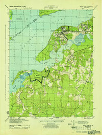 1944 Indian Head1944 Print · USGSMaryland's riverine defense and rural character are on full display during the mid-1940s as the U. S. Naval Proving Ground expands along the Potomac River. You can trace wartime infrastructure and local heritage through landmarks like Grinders Wharf, Mason Springs Sch, and the Govt RR.
 - 1944 Map of Arcola
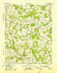 1944 Arcola1944 Print · USGSNorthern Virginia was a landscape of quiet crossroads and rural parishes during the mid-forties. Genealogists and local historians can trace family roots through landmarks like Watson-Sch, Mt Zion Ch, and the small settlement of Arcola.
 - 1944 Map of Thorofare Gap
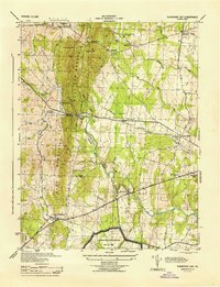 1944 Thorofare Gap1944 Print · USGSPrince William and Fauquier counties are shown here during the Second World War as the region’s strategic gaps and rail lines remained vital to Virginia's interior. Genealogists and researchers can trace rural landmarks from Vint Hill Farm to Beverly Mills and St Pauls Ch.
 - 1946 Map of Middleburg
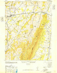 1946 Middleburg1946 Print · USGSThe Northern Virginia hunt country in the mid-1940s reveals a landscape of Piedmont villages and ridge-top gaps. Researchers can locate family landmarks and rural institutions such as Mt Pleasant Ch, Landmark Sch, and the estates surrounding Middleburg.
Showing maps 1-25 of 161
Top cities of Prince William County
- Dale City historical maps
- Lake Ridge historical maps
- Woodbridge historical maps
- Linton Hall historical maps
- Cherry Hill historical maps
- Montclair historical maps
See more
Frequently asked questions
- What are the different types of historical maps available for Prince William County?
- What is the oldest map of Prince William County?
- Where can I purchase historical maps of Prince William County for my home or office?
- Where can I download high-res historical maps of Prince William County?
- Are there historical topographic maps available for Prince William County?
- Is there historical aerial imagery available for Prince William County?
- Where are historical maps of Prince William County sourced from?