Old Maps of Rawley Springs, Virginia for Metal Detecting
Plan your next treasure hunt with 15 historic maps of Rawley Springs. Find old homesites, ghost towns, trails, and gathering spots that may be lost to time — perfect for identifying promising metal detecting locations.
- Locate forgotten sites: Uncover places like long-lost settlements, abandoned rail lines, or gathering spots.
- Plan better hunts: Use map overlays combined with LiDAR or satellite views to narrow in on historically rich areas.
- Made for detectorists: Thousands of hobbyists use these maps to discover relics, coins, and hidden history.
Use these historic maps to boost your research and find new opportunities beneath the surface of Rawley Springs.
Rawley Springs, VA maps
(15)- 1892 Map of Franklin
 1892 Franklin1892 Print · USGSPendleton County and the Potomac Highlands are shown here in the 1890s, organized by the dramatic ridges and river valleys of the Alleghanies. Researchers can trace historic homesteads and early post offices at Fort Seybert, Upper Tract, and the riverside crossroads of Kline Cross Roads.
 - 1896 Map of Franklin, 1907 Print
 1896 Franklin1907 Print · USGSThe Potomac River's headwaters and the high ridges of the Alleghenies are documented here in the final years of the nineteenth century. Genealogists and local historians can trace early valley communities like Fort Seybert, Sugar Grove, and the mills at Harper Mill.4 unique versions available
 - 1922 Map of Fort Seybert
 1922 Fort Seybert1922 Print · USGSPendleton County's South Fork Valley is captured in the early 1920s, showing a landscape of remote mountain homesteads and small valley hamlets. Genealogists can locate family landmarks like Locust Grove School, New Bethel Church, and the high peaks of Shenandoah Mountain.2 unique versions available
 - 1924 Map of Fort Seybert
 1924 Fort Seybert1924 Print · USGSIn the early 1920s, the Pendleton County highlands were defined by remote mountain gaps and close-knit valley settlements. Genealogists can locate family-named landmarks and rural hubs like Fort Seybert, Brandywine, and the Cedar Grove School.3 unique versions available
 - 1947 Map of Fort Seybert, 1958 Print
 1947 Fort Seybert1958 Print · USGSThe South Fork Potomac River highlands are captured here in the late 1940s, showing a landscape defined by isolated farmsteads and rural mountain schools. Researchers can trace family-named landmarks and community centers like Fort Seybert, Pleasant Grove Ch, and the Dale Hill Sch.2 unique versions available
 - 1949 Map of Charlottesville
 1949 Charlottesville1949 Print · USGSThe Shenandoah Valley and Blue Ridge appear in the late 1940s as a thriving corridor of rail and river commerce. Researchers can trace the mid-century footprints of Harrisonburg, Staunton, and Culpeper alongside the historic routes of the Southern Railway.2 unique versions available
 - 1951 Map of Fort Seybert
 1951 Fort Seybert1951 Print · USGSThe South Fork Potomac River valley in the early 1950s reveals a landscape of isolated mountain hollows and tight-knit highland settlements. Genealogists can locate family landmarks such as Fort Seybert, New Bethlehem Ch, and the Cedar Grove Sch.2 unique versions available
 - 1956 Map of Charlottesville, 1966 Print
 1956 Charlottesville1966 Print · USGSThe Shenandoah Valley and Blue Ridge are captured in detail during the mid-1960s as the modern interstate system began to emerge. Genealogists and historians can trace rail-connected hubs like Waynesboro or follow the river paths of the Rapidan River and Rivanna River.4 unique versions available
 - 1967 Map of Rawley Springs, 1969 Print
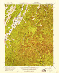
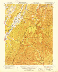
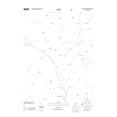
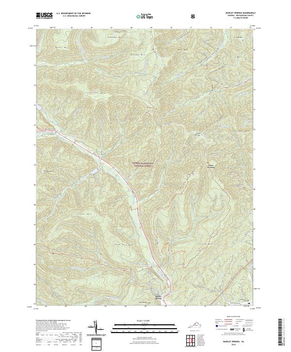
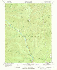 1967 Rawley Springs1969 Print · USGSThe mountain terrain of Rockingham County is captured in the late sixties, where the watershed of the Dry River meets the George Washington National Forest. Researchers can trace old mountain routes and recreation spots like Clines Hacking, the Harrisonburg Reservoir, and Rawley Springs.4 unique versions available
 - 1981 Map of Elkins, 1983 Print
 1981 Elkins1983 Print · USGSThe West Virginia mountains in the early eighties were a hub of rail-based industry and emerging conservation lands. Genealogists and historians can trace the paths of the Western Maryland RR through Elkins and locate small upland communities like Harpertown, Bowden, and Wymer.
 - 2011 Map of Rawley Springs, 2011 Print
 2011 Rawley Springs2011 Print · USGSCovers Rawley Springs, including Rockingham County, United States, and other nearby areas
 - 2013 Map of Rawley Springs, 2013 Print
 2013 Rawley Springs2013 Print · USGSCovers Rawley Springs, including Rockingham County, United States, and other nearby areas
 - 2016 Map of Rawley Springs, 2016 Print
 2016 Rawley Springs2016 Print · USGSCovers Rawley Springs, including Rockingham County, United States, and other nearby areas
 - 2019 Map of Rawley Springs, 2019 Print
 2019 Rawley Springs2019 Print · USGSCovers Rawley Springs, including Rockingham County, United States, and other nearby areas
 - 2022 Map of Rawley Springs, 2022 Print
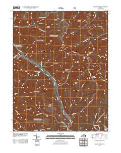
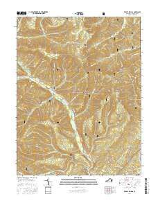
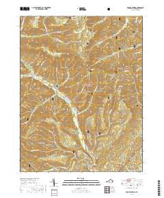
 2022 Rawley Springs2022 Print · USGSRockingham County at the edge of the national forest is mapped here in its modern form, showing the steep ridges and spring-fed runs of the Shenandoah highlands. You can trace the historic route of Rawley Pike past Rawley Springs and locate family sites like the Peake Pentecostal Church Cem.
End of results
Showing maps 1-15 of 15
Top cities near Rawley Springs
- Harrisonburg historical maps
- Massanetta Springs historical maps
- Bridgewater historical maps
- Weyers Cave historical maps
- Grottoes historical maps
- Dayton historical maps
See more
Frequently asked questions
- What are the different types of historical maps available for Rawley Springs?
- What is the oldest map of Rawley Springs?
- Where can I purchase historical maps of Rawley Springs for my home or office?
- Where can I download high-res historical maps of Rawley Springs?
- Are there historical topographic maps available for Rawley Springs?
- Is there historical aerial imagery available for Rawley Springs?
- Where are historical maps of Rawley Springs sourced from?