Old Maps of Rockingham County, Virginia
Explore 96 old maps of Rockingham County, spanning from 1892 to today. These high-resolution historic maps reveal how streets, neighborhoods, landmarks, and natural features evolved over time — perfect for genealogy, metal detecting, research, and local history exploration.
What you can do with these maps:
- See how Rockingham County changed over time: Compare historical maps to modern-day views to trace roads, homesites, rail lines & more.
- View detailed metadata: Each map includes creators, publishers, year, scale, and archive source.
- Overlay maps with satellite & LiDAR: Visualize the past alongside modern tools to explore terrain & human change.
- Trusted historical sources: Maps sourced from the USGS, Library of Congress, and other archives.
- Access maps your way: View online, download high-res files, or order prints for personal or research use.
Start exploring old maps of Rockingham County to uncover forgotten places, hidden landmarks, and the deep history beneath your feet.
Rockingham County, VA maps
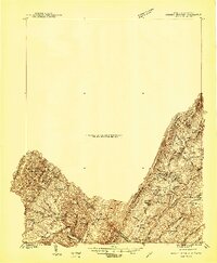
(96)- 1892 Map of Franklin
 1892 Franklin1892 Print · USGSCovers Rockingham County, including Petersburg, Franklin, and other nearby areas
 - 1892 Map of Woodstock, 1898 Print
 1892 Woodstock1898 Print · USGSCovers Rockingham County, including Woodstock, Luray, and other nearby areas5 unique versions available
 - 1892 Map of Gordonsville, 1899 Print
 1892 Gordonsville1899 Print · USGSCovers Rockingham County, including Charlottesville, Culpeper, and other nearby areas6 unique versions available
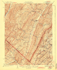
 - 1892 Map of Harrisonburg, 1901 Print
 1892 Harrisonburg1901 Print · USGSCovers Rockingham County, including Harrisonburg, Waynesboro, and other nearby areas6 unique versions available
 - 1894 Map of Staunton, 1897 Print
 1894 Staunton1897 Print · USGSCovers Rockingham County, including Staunton, Stuarts Draft, and other nearby areas8 unique versions available
 - 1896 Map of Franklin, 1907 Print
 1896 Franklin1907 Print · USGSCovers Rockingham County, including Petersburg, Franklin, and other nearby areas4 unique versions available
 - 1920 Map of Petersburg
 1920 Petersburg1920 Print · USGSCovers Rockingham County, including Petersburg, Rough Run, and other nearby areas3 unique versions available
 - 1921 Map of Orkney Springs
 1921 Orkney Springs1921 Print · USGSCovers Rockingham County, including Basye, Mathias, and other nearby areas2 unique versions available
 - 1921 Map of Petersburg
 1921 Petersburg1921 Print · USGSCovers Rockingham County, including Petersburg, Rough Run, and other nearby areas
 - 1922 Map of Fort Seybert
 1922 Fort Seybert1922 Print · USGSCovers Rockingham County, including Deer Run, Rawley Springs, and other nearby areas2 unique versions available
 - 1922 Map of Petersburg
 1922 Petersburg1922 Print · USGSCovers Rockingham County, including Petersburg, Rough Run, and other nearby areas2 unique versions available
 - 1923 Map of Orkney Springs
 1923 Orkney Springs1923 Print · USGSCovers Rockingham County, including Basye, Mathias, and other nearby areas2 unique versions available
 - 1924 Map of Fort Seybert
 1924 Fort Seybert1924 Print · USGSCovers Rockingham County, including Deer Run, Rawley Springs, and other nearby areas3 unique versions available
 - 1930 Map of Madison
 1930 Madison1930 Print · USGSCovers Rockingham County, including Stanardsville, Madison, and other nearby areas3 unique versions available
 - 1931 Map of University
 1931 University1931 Print · USGSCovers Rockingham County, including University of Virginia, Crozet, and other nearby areas2 unique versions available
 - 1933 Map of Madison
 1933 Madison1933 Print · USGSCovers Rockingham County, including Stanardsville, Madison, and other nearby areas3 unique versions available
 - 1934 Map of Waynesboro
 1934 Waynesboro1934 Print · USGSCovers Rockingham County, including Waynesboro, Crimora, and other nearby areas2 unique versions available
 - 1935 Map of University, 1962 Print
 1935 University1962 Print · USGSCovers Rockingham County, including University of Virginia, Crozet, and other nearby areas
 - 1937 Map of Elkton
 1937 Elkton1937 Print · USGSCovers Rockingham County, including Elkton, Shenandoah, and other nearby areas3 unique versions available
 - 1939 Map of Waynesboro
 1939 Waynesboro1939 Print · USGSCovers Rockingham County, including Waynesboro, Crimora, and other nearby areas3 unique versions available
 - 1940 Map of Orkney Springs
 1940 Orkney Springs1940 Print · USGSCovers Rockingham County, including Basye, Mathias, and other nearby areas2 unique versions available
 - 1941 Map of Harrisonburg, 1965 Print
 1941 Harrisonburg1965 Print · USGSCovers Rockingham County, including Harrisonburg, Massanetta Springs, and other nearby areas
 - 1942 Map of Mt Jackson, 1959 Print
 1942 Mt Jackson1959 Print · USGSCovers Rockingham County, including Luray, Shenandoah, and other nearby areas2 unique versions available
 - 1943 Map of Orkney Springs
 1943 Orkney Springs1943 Print · USGSCovers Rockingham County, including Basye, Mathias, and other nearby areas2 unique versions available
 - 1943 Map of Harrisonburg
 1943 Harrisonburg1943 Print · USGSCovers Rockingham County, including Harrisonburg, Massanetta Springs, and other nearby areas
Showing maps 1-25 of 96
Top cities of Rockingham County
- Massanetta Springs historical maps
- Bridgewater historical maps
- Broadway historical maps
- Grottoes historical maps
- Elkton historical maps
- Massanutten historical maps
See more
Frequently asked questions
- What are the different types of historical maps available for Rockingham County?
- What is the oldest map of Rockingham County?
- Where can I purchase historical maps of Rockingham County for my home or office?
- Where can I download high-res historical maps of Rockingham County?
- Are there historical topographic maps available for Rockingham County?
- Is there historical aerial imagery available for Rockingham County?
- Where are historical maps of Rockingham County sourced from?