2020s Maps of Strasburg, Virginia
Explore 4 historic maps of Strasburg from the 2020s. These maps offer a rare glimpse into what life looked like during the 2020s — showing old roads, neighborhoods, homes, and landmarks that have changed or disappeared over time.
Whether you're researching your family's past, planning a metal detecting trip, or studying how Strasburg's landscape evolved across the 2020s, these high-resolution maps are a powerful tool for exploring the history of this region.
- Focus on a specific era: All maps on this page are from the 2020s, giving you a focused view of this time period.
- See what’s changed: Compare century-old streets, trails, and buildings to today's modern landscape using overlays and satellite layers.
- Research with precision: Use these maps for genealogy, historical research, land use analysis, or educational projects.
- View, download, or print: Maps are fully viewable online in high resolution, and can be downloaded or printed for your own records.
Start exploring Strasburg's history through authentic maps from the 2020s. This is your window into the past.
Strasburg, VA maps
(4)- 2022 Map of Middletown, 2022 Print
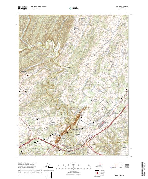 2022 Middletown2022 Print · USGSThe Shenandoah Valley corridor near Middletown and Strasburg is documented here with modern precision, detailing a landscape steeped in early Virginia history. Researchers can trace numerous family burial sites such as the Bowman Graveyard and Windle Cem alongside landmarks like Stephens Fort.
 - 2022 Map of Mountain Falls, 2022 Print
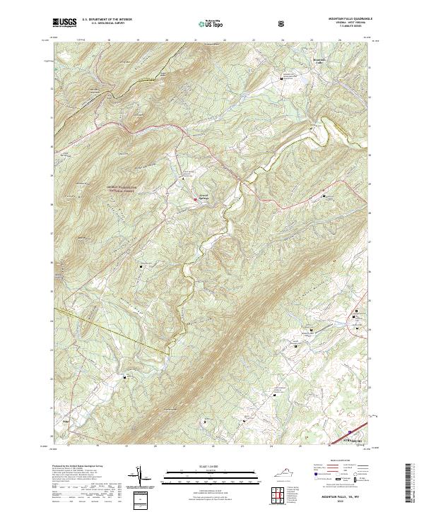 2022 Mountain Falls2022 Print · USGSThe Virginia and West Virginia borderlands are shown here in the early twenty-first century as a landscape of rural settlements and protected forest. Genealogists can trace family footprints across numerous sites like Richards Cem, Gravel Springs, and the Mulberry Run Cem.
 - 2022 Map of Strasburg, 2022 Print
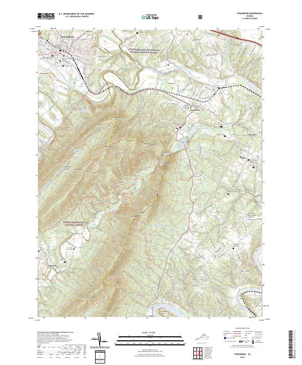 2022 Strasburg2022 Print · USGSThe Shenandoah Valley at the foot of Massanutten Mountain comes to life in this detailed recent survey of the Strasburg area. Genealogists and local historians can trace family roots through numerous sites like Hite Family Cem, Bennetts Chapel Cem, and Bethel.
 - 2022 Map of Toms Brook, 2022 Print
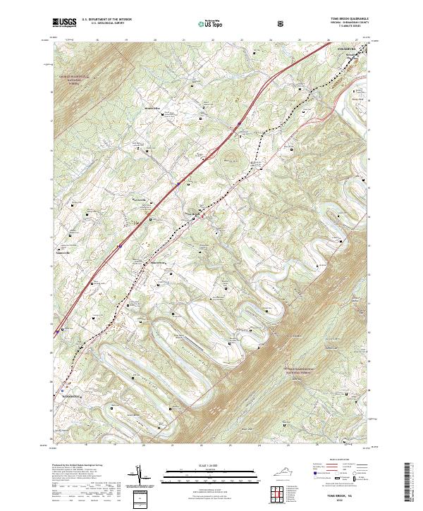 2022 Toms Brook2022 Print · USGSThe Shenandoah Valley corridor is captured here at the start of the 2020s, showing the enduring rural character of the historic Valley Pike. Researchers can trace deep family roots through numerous burial grounds like the Shenandoah County Farm Cem and Borden - Crabill Cem across Toms Brook and Maurertown.
End of results
Showing maps 1-4 of 4
Top cities near Strasburg
- Winchester historical maps
- Front Royal historical maps
- Woodstock historical maps
- Stephens City historical maps
- Shawneeland historical maps
- Middletown historical maps
See more
Frequently asked questions
- What are the different types of historical maps available for Strasburg?
- What is the oldest map of Strasburg?
- Where can I purchase historical maps of Strasburg for my home or office?
- Where can I download high-res historical maps of Strasburg?
- Are there historical topographic maps available for Strasburg?
- Is there historical aerial imagery available for Strasburg?
- Where are historical maps of Strasburg sourced from?