2020s Maps of Southampton County, Virginia
Explore 19 historic maps of Southampton County from the 2020s. These maps offer a rare glimpse into what life looked like during the 2020s — showing old roads, neighborhoods, homes, and landmarks that have changed or disappeared over time.
Whether you're researching your family's past, planning a metal detecting trip, or studying how Southampton County's landscape evolved across the 2020s, these high-resolution maps are a powerful tool for exploring the history of this region.
- Focus on a specific era: All maps on this page are from the 2020s, giving you a focused view of this time period.
- See what’s changed: Compare century-old streets, trails, and buildings to today's modern landscape using overlays and satellite layers.
- Research with precision: Use these maps for genealogy, historical research, land use analysis, or educational projects.
- View, download, or print: Maps are fully viewable online in high resolution, and can be downloaded or printed for your own records.
Start exploring Southampton County's history through authentic maps from the 2020s. This is your window into the past.
Southampton County, VA maps
(19)- 2022 Map of Raynor, 2022 Print
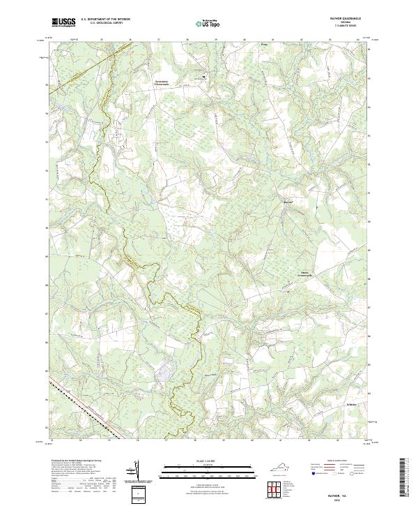 2022 Raynor2022 Print · USGSThe rural borders of Isle of Wight and Southampton counties are mapped here in the early twenty-first century, centered on the winding Blackwater River. Local historians can trace old community hubs at Sycamore Crossroads and Raynor, or locate family sites near Mill Swamp Cem.
 - 2022 Map of Sedley, 2022 Print
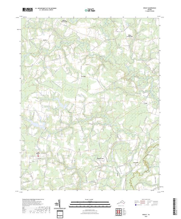 2022 Sedley2022 Print · USGSCoastal plain settlements and extensive river swamps define this Southampton County region as it appeared recently. Genealogists and local historians can trace family-named routes and hamlets like Pulleys Crossroads, Berlin, and the historic Sedley rail corridor.
 - 2022 Map of Margarettsville, 2022 Print
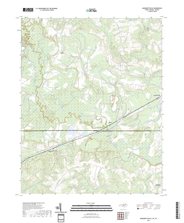 2022 Margarettsville2022 Print · USGSThe borderlands of North Carolina and Virginia appear here in the early twenty-first century, defined by the winding Meherrin River. Genealogists and local historians can trace the rural landscape around Margarettsville, Little Texas, and Branchville.
 - 2022 Map of Ivor, 2022 Print
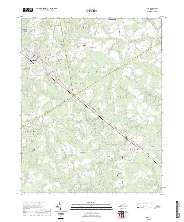 2022 Ivor2022 Print · USGSThe coastal plains of Sussex and Southampton counties are revealed in this modern era, centered on the historic rail corridors through Wakefield and Ivor. Genealogists and local historians can trace family locations near Saddlers Crossroads, Ivor Cem, and Booker T Memorial Park.
 - 2022 Map of Zuni, 2022 Print
 2022 Zuni2022 Print · USGSCoastal Virginia's riverine landscape is meticulously detailed in this recent survey of the Isle of Wight and Southampton county line. Genealogists and researchers can trace the vicinity of Antioch Christian Church Cem or locate the rural crossroads of Zuni, Walters, and Collosse.
 - 2022 Map of Sebrell, 2022 Print
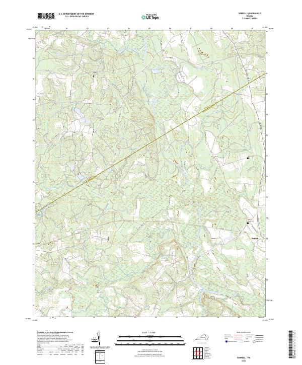 2022 Sebrell2022 Print · USGSThe rural landscapes of Sussex and Southampton counties are captured here in the early twenty-first century, centered on the riverine wetlands of the Nottoway River. Local researchers can trace family sites and historical transit routes like the Sebrell- Reese Cem and the long-established Jerusalem Plank Rd.
 - 2022 Map of Yale, 2022 Print
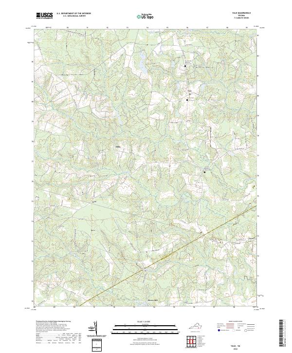 2022 Yale2022 Print · USGSSussex and Southampton counties are captured here in a quiet era of rural agriculture and wetland forest. Researchers can trace family sites near Yale and Rivers Mill or locate rural burials at the Antioch Baptist Church Cem and Calvary Cem.
 - 2022 Map of Vicksville, 2022 Print
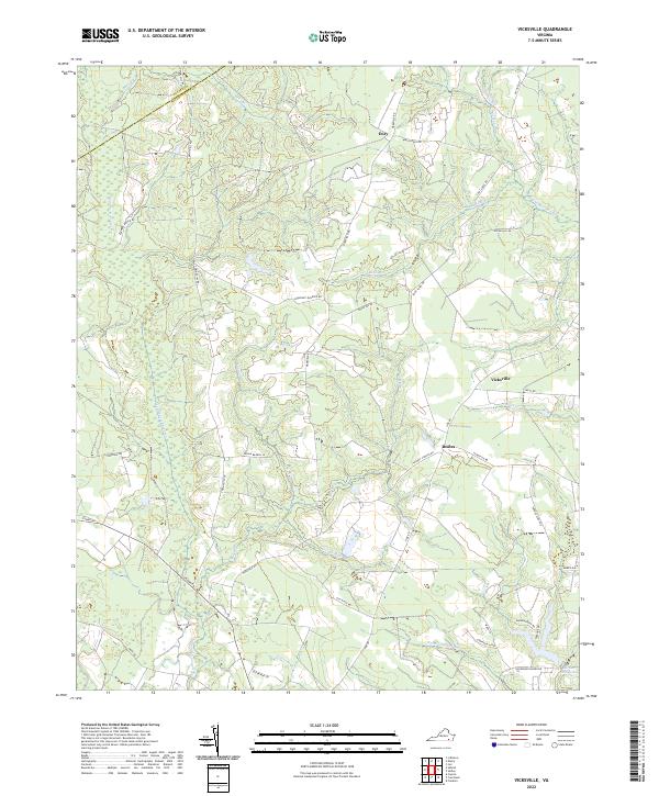 2022 Vicksville2022 Print · USGSSouthampton County and neighboring Sussex County are mapped here in the early 2020s, showing a landscape defined by expansive wetlands. Genealogists and local historians can trace the rural communities of Vicksville, Dory, and Beales, alongside family-named landmarks like Darden Millpond.
 - 2022 Map of Courtland, 2022 Print
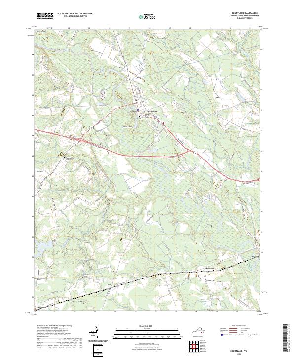 2022 Courtland2022 Print · USGSCoastal plain settlements and expansive wetlands define this Southampton County corridor in the early twenty-first century. Researchers can trace family roots and local landmarks at the Southampton County Courthouse, Riverside Cem, and the village of Handsom.
 - 2022 Map of Sunbeam, 2022 Print
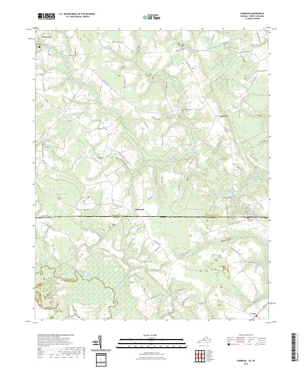 2022 Sunbeam2022 Print · USGSThe Virginia and North Carolina borderlands come alive in this recent survey of Southampton and Hertford counties. Researchers can trace local lineage through Hollywood Cemetery and Barnes Church while exploring the banks of the Meherrin River.
 - 2022 Map of Adams Grove, 2022 Print
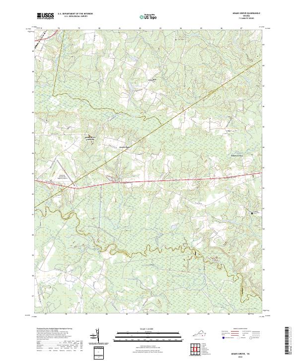 2022 Adams Grove2022 Print · USGSThe Southside Virginia borderlands are revealed in this recent survey of Southampton County and its neighbors. Researchers can trace rural settlement patterns near James River Junction, find the Pleasant Grove Cem, and map the reaches of the Meherrin River.
 - 2022 Map of Emporia, 2022 Print
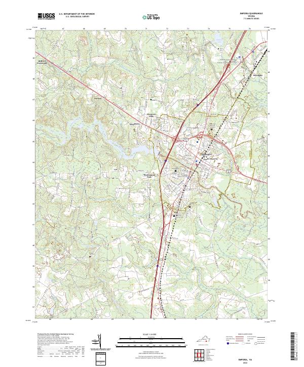 2022 Emporia2022 Print · USGSEmporia and the surrounding Greensville countryside are captured in the early 2020s as a vital crossroads along the Meherrin River. Researchers can trace local heritage through sites like the Greensville County Courthouse, Washington Park, and the Falling Run Cemetery.
 - 2022 Map of Manry, 2022 Print
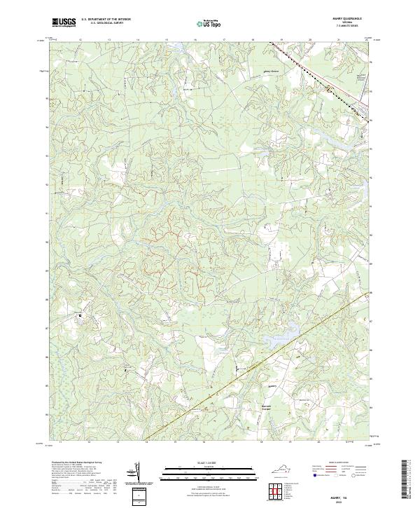 2022 Manry2022 Print · USGSSussex and Southampton counties are mapped here in the early 2020s, revealing a landscape shaped by vast swamp networks and rural outposts. Researchers can trace family history at Union Hill Cem or locate old water-industry sites like Laniers Millpond and Brittles Mill Pond.
 - 2022 Map of Boykins, 2022 Print
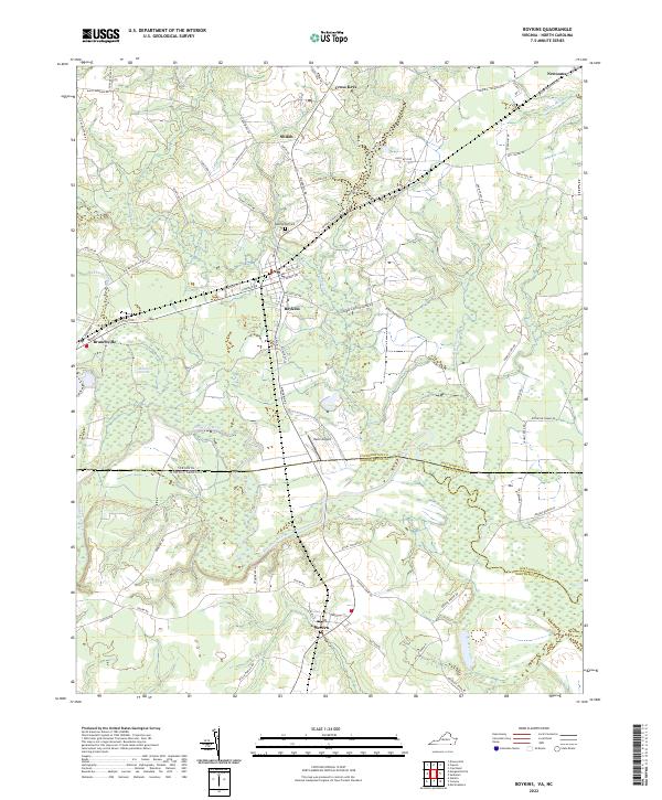 2022 Boykins2022 Print · USGSThe Virginia and North Carolina borderlands come into focus in this contemporary survey of the Meherrin River valley. Researchers can trace local history through old road networks and landmarks like Beechwood Cem, Mann Airport, and the rail-oriented town of Boykins.
 - 2022 Map of Capron, 2022 Print
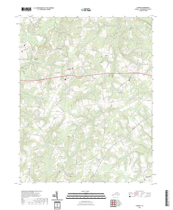 2022 Capron2022 Print · USGSSouthampton County at the start of the 2020s remains a landscape of historic crossroads and winding swamps. Researchers can trace family ties at the Capron Cem, find rural settlements like Angelico, or follow the waters of Buckhorn Swamp.
 - 2022 Map of Claresville, 2022 Print
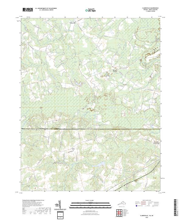 2022 Claresville2022 Print · USGSThe borderlands of Virginia and North Carolina appear here in the early twenty-first century, showcasing a rural landscape defined by slow-moving waterways and swampy lowlands. Researchers can trace local history through named roads and settlements like Claresville, Turners Crossroads, and Glover Airport.
 - 2022 Map of Drewryville, 2022 Print
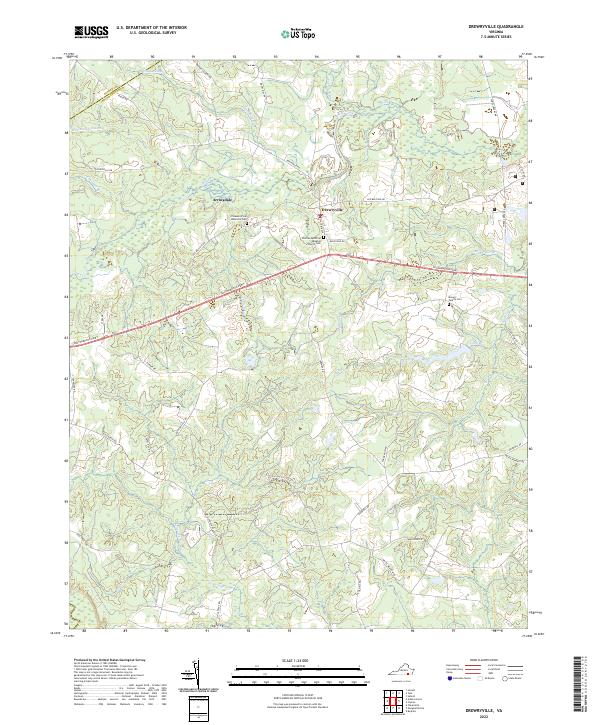 2022 Drewryville2022 Print · USGSThe borderlands of Southampton and Sussex counties are shown here as they appeared recently, centered on the community of Drewryville. Researchers can locate family landmarks such as the Drewry Family Cem and the Thomas Memorial Baptist Church Cem.
 - 2022 Map of Riverdale, 2022 Print
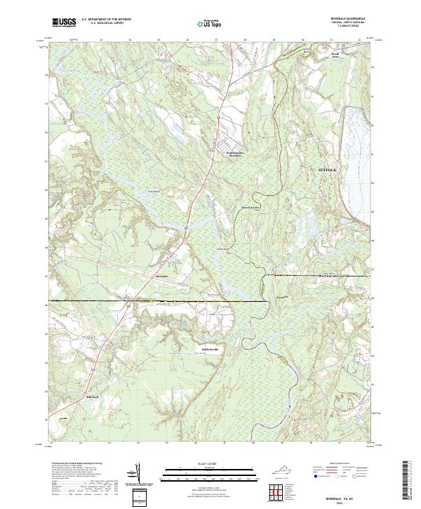 2022 Riverdale2022 Print · USGSThe Virginia-North Carolina border comes alive in this 2022 survey, showcasing the confluence of the Nottoway River and Blackwater River. Genealogists can trace family locations across the state line near Riddicksville, South Quay, and the river crossing at Riverdale.
 - 2022 Map of Franklin, 2022 Print
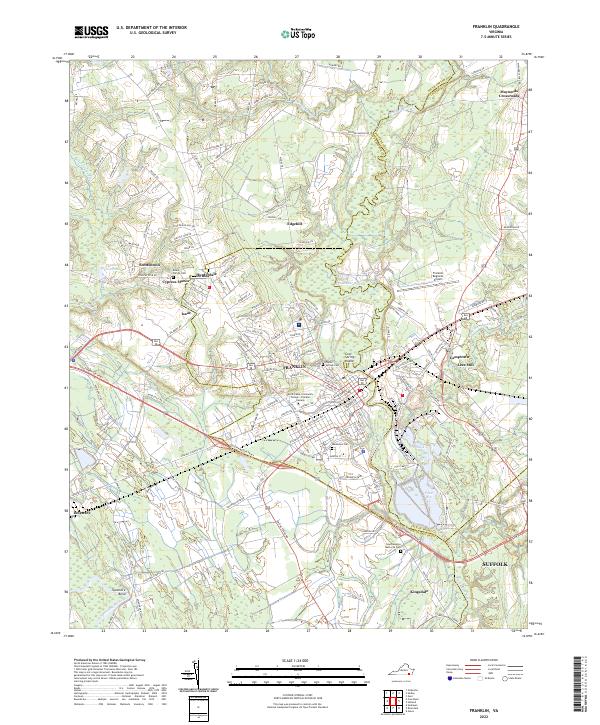 2022 Franklin2022 Print · USGSFranklin and the surrounding Southampton County landscape are shown here in the early twenty-first century. Genealogists and local historians can trace family roots through the Beale Family Cemetery or explore the riverfront heritage of Lees Mill and Camptown.
End of results
Showing maps 1-19 of 19
Top cities of Southampton County
- Courtland historical maps
- Boykins historical maps
- Sedley historical maps
- Ivor historical maps
- Newsoms historical maps
- Capron historical maps
See more
Frequently asked questions
- What are the different types of historical maps available for Southampton County?
- What is the oldest map of Southampton County?
- Where can I purchase historical maps of Southampton County for my home or office?
- Where can I download high-res historical maps of Southampton County?
- Are there historical topographic maps available for Southampton County?
- Is there historical aerial imagery available for Southampton County?
- Where are historical maps of Southampton County sourced from?