1960s Maps of Southampton County, Virginia
Explore 19 historic maps of Southampton County from the 1960s. These maps offer a rare glimpse into what life looked like during the 1960s — showing old roads, neighborhoods, homes, and landmarks that have changed or disappeared over time.
Whether you're researching your family's past, planning a metal detecting trip, or studying how Southampton County's landscape evolved across the 1960s, these high-resolution maps are a powerful tool for exploring the history of this region.
- Focus on a specific era: All maps on this page are from the 1960s, giving you a focused view of this time period.
- See what’s changed: Compare century-old streets, trails, and buildings to today's modern landscape using overlays and satellite layers.
- Research with precision: Use these maps for genealogy, historical research, land use analysis, or educational projects.
- View, download, or print: Maps are fully viewable online in high resolution, and can be downloaded or printed for your own records.
Start exploring Southampton County's history through authentic maps from the 1960s. This is your window into the past.
Southampton County, VA maps
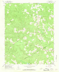
(19)- 1963 Map of Emporia, 1964 Print
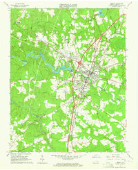 1963 Emporia1964 Print · USGSGreensville County at the dawn of the 1960s reveals a bustling rail crossroads centered on Emporia. Researchers can trace the development of local institutions like the Greensville Memorial Hospital and locate family landmarks such as Jones Cemetery and Round Hill Cemetery.5 unique versions available
 - 1966 Map of Capron, 1968 Print
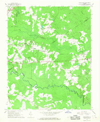
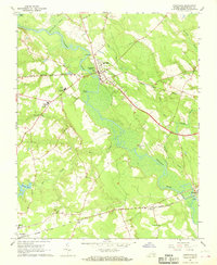
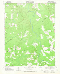
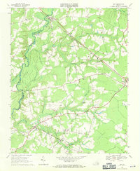
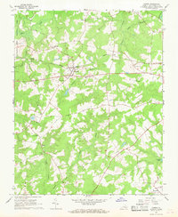 1966 Capron1968 Print · USGSSouthampton County in the mid-sixties centered on the rail-side hubs of Capron and Newsoms as timber and agriculture drove the local economy. Researchers can locate numerous country churches such as Vincent Grove Ch and Bryant Ch, or trace the winding courses of Buckhorn Swamp and Roan Swamp.3 unique versions available
 - 1966 Map of Drewryville, 1968 Print
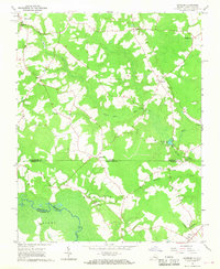
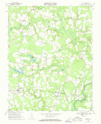
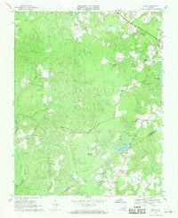
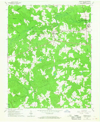 1966 Drewryville1968 Print · USGSSouthampton County during the mid-sixties reveals a landscape of rural crossroads and timbered wetlands tied together by the Norfolk and Western railway. Researchers can trace local heritage through landmarks like Persons Ch, Hebron Ch, and the brick Kilns near the eastern border.2 unique versions available
 - 1966 Map of Margarettsville, 1968 Print
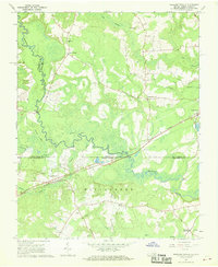 1966 Margarettsville1968 Print · USGSThe Virginia and North Carolina borderlands come alive in the 1960s, showing a landscape defined by the winding Meherrin River and the Seaboard Coast Line railroad. Researchers can trace rural life through landmarks like Margarettsville, Rising Star Ch, and the Southampton Speedway.4 unique versions available
 - 1966 Map of Adams Grove, 1968 Print
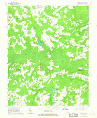
 1966 Adams Grove1968 Print · USGSSouthampton and Greensville Counties are captured here in the mid-sixties, showing a landscape defined by meandering river bends and timber-linked rail lines. Genealogists and historians can trace rural landmarks from Grizzard to Adams Grove, including Pleasant Grove Cem and the Meherrin River.3 unique versions available
 - 1966 Map of Sunbeam, 1968 Print
 1966 Sunbeam1968 Print · USGSCoastal plain life along the Virginia and North Carolina border comes into focus in the mid-1960s. Genealogists and local historians can trace rural family hubs at Newsoms, Statesville, and Como, or locate family sites near Harts Bridge and Windbourne Millpond.2 unique versions available
 - 1966 Map of Claresville, 1968 Print
 1966 Claresville1968 Print · USGSThe Virginia and North Carolina borderlands come into focus in the late 1960s, showing a landscape of timbered swamps and isolated farmsteads. Researchers can trace old family sites near Turners Crossroads, Morris Hill Ch, and the waters of Taylors Millpond.3 unique versions available
 - 1966 Map of Boykins, 1968 Print
 1966 Boykins1968 Print · USGSThe Virginia and North Carolina borderlands come to life in the 1960s, centered on the railroad crossing at Boykins. Researchers can trace the legacy of rural communities through markers like Beechwood Cem, Meherrin Sch, and the winding Meherrin River.2 unique versions available
 - 1966 Map of Yale, 1968 Print
 1966 Yale1968 Print · USGSCoastal plain Virginia in the mid-1960s reveals a landscape of isolated hamlets and active rail corridors. Researchers can trace the legacy of small communities like Hilda and Joyner, while locating landmarks such as Russian Ch and Rivers Mill.3 unique versions available
 - 1967 Map of Courtland, 1968 Print
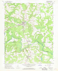
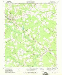
 1967 Courtland1968 Print · USGSSouthampton County during the late sixties reveals a landscape shaped by river bends and rail lines. Researchers can trace the layout of Courtland and Newsoms or locate local landmarks like Williams Chapel and Handsom.2 unique versions available
 - 1967 Map of Franklin, 1969 Print
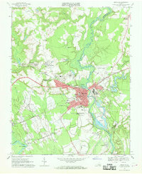 1967 Franklin1969 Print · USGSThe city of Franklin and the surrounding swamplands of the coastal plain come into sharp focus during the late sixties. Genealogists and local historians can trace rural family churches like White Oak Springs Ch and St Johns Ch or the rail-side growth of Hunterdale.5 unique versions available
 - 1967 Map of Riverdale, 1970 Print
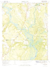 1967 Riverdale1970 Print · USGSThe convergence of the Blackwater and Nottoway Rivers at the Virginia-North Carolina border defines this late-1960s landscape. Researchers can trace the legacy of river commerce and local genealogy through numerous sites like Cobbs Wharf, Riddicksville, and Diamond Grove Ch.3 unique versions available
 - 1968 Map of Sebrell, 1970 Print
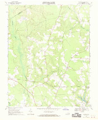
 1968 Sebrell1970 Print · USGSSouthampton County was still a quiet landscape of river crossings and small churches in the late sixties. Genealogists can locate family landmarks like Butts Cem or trace the routes of the Norfolk and Western and the Old Railroad Grade.2 unique versions available
 - 1968 Map of Sedley, 1970 Print
 1968 Sedley1970 Print · USGSCoastal Virginia's marshlands and small rail towns come to life in the late sixties as the timber and water economy thrives. Genealogists can trace family footprints through rural landmarks like Pulleys Crossroads, Ebenezer Ch, and Whitefields Millpond.2 unique versions available
 - 1968 Map of Raynor, 1970 Print
 1968 Raynor1970 Print · USGSIsle of Wight and Southampton counties are depicted in the late sixties as a landscape of interconnected wetlands and rural crossroads. Local historians can trace family locations near Raynor and Stotts Crossroads or find old community centers like Mill Swamp Ch.2 unique versions available
 - 1968 Map of Ivor, 1970 Print
 1968 Ivor1970 Print · USGSCoastal Virginia's timber and rail country comes into focus in the late sixties as the Norfolk and Western line links rural crossroads. Genealogists and historians can trace family locations from Wakefield to Ivor, finding landmarks like Berlin-Ivor Sch and Spratley Cem.4 unique versions available
 - 1969 Map of Vicksville, 1970 Print
 1969 Vicksville1970 Print · USGSSouthampton County during the late 1960s was a landscape of rail-linked hamlets and expansive wetlands. Genealogists and researchers can locate family sites near Vicksville, St Lukes Ch, and the crossings of the NORFOLK AND WESTERN railroad.3 unique versions available
 - 1969 Map of Zuni, 1971 Print
 1969 Zuni1971 Print · USGSCoastal plain Virginia life in the late sixties is centered on the rail-and-river network of the Blackwater River. Genealogists and historians can trace family locations near Collosse, rural churches like Morning Star Ch, and the State Prison Camp No 3.3 unique versions available
 - 1969 Map of Manry, 1971 Print
 1969 Manry1971 Print · USGSThe Sussex and Southampton county borderlands come into focus in the late sixties, showcasing a landscape of lowland swamps and rural crossroads. Genealogists and local historians can trace family-named landmarks like Barrett Corner, Laniers Millpond, and Hebron Ch.
End of results
Showing maps 1-19 of 19
Top cities of Southampton County
- Courtland historical maps
- Boykins historical maps
- Sedley historical maps
- Ivor historical maps
- Newsoms historical maps
- Capron historical maps
See more
Frequently asked questions
- What are the different types of historical maps available for Southampton County?
- What is the oldest map of Southampton County?
- Where can I purchase historical maps of Southampton County for my home or office?
- Where can I download high-res historical maps of Southampton County?
- Are there historical topographic maps available for Southampton County?
- Is there historical aerial imagery available for Southampton County?
- Where are historical maps of Southampton County sourced from?