Old Maps of Southampton County, Virginia for Academic Research
Study the evolution of Southampton County with 150 high-resolution historic maps. Whether you're teaching, researching, or modeling changes in land use, these maps provide essential visual documentation of urban, environmental, and geographic change.
- Analyze long-term change: Track patterns in development, transportation, and natural features.
- Ideal for environmental or urban studies: Support academic projects with primary historical map data.
- Use in the classroom or lab: Educators and researchers rely on these maps to bring historical context to life.
These maps are a powerful tool for teaching, research, and visualizing how Southampton County has changed over the decades.
Southampton County, VA maps
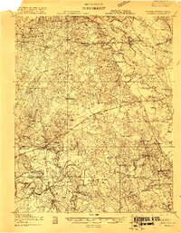
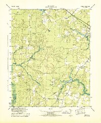
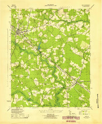
(150)- 1919 Map of Jarratt
 1919 Jarratt1919 Print · USGSSoutheastern Virginia at the close of the Great War was a busy crossroads of the Atlantic Coast Line and Virginian railroads. Genealogists and local historians can trace family locations near the Russian Church, identify the site of Harrells Mill, or locate old post offices like Comans Well.3 unique versions available
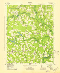
 - 1919 Map of Homeville
 1919 Homeville1919 Print · USGSCoastal Virginia during the late teens was defined by a landscape of river crossings and timbered swamplands along the Nottoway River. Genealogists and historians can trace family-named schools and vanished millponds, including Cabin Point School, Darden Millpond, and the settlement of Sebrell.
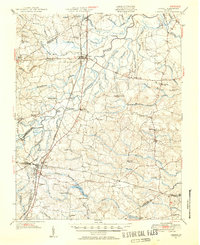
 - 1919 Map of Boykins
 1919 Boykins1919 Print · USGSSouthampton County's borderlands are captured here at the end of the Great War, showing a landscape defined by river transport and rail. Genealogists can trace family footprints at Sandy Hill School, Smiths Mill, or Zion Hill Church.
 - 1919 Map of Emporia
 1919 Emporia1919 Print · USGSSouthern Virginia and the North Carolina borderlands are captured here at the height of the railroad era. Researchers can trace family roots through rural landmarks like Hopeville (Post Store), Squire School, and the Hitchcock Quarry.3 unique versions available
 - 1919 Map of Arringdale
 1919 Arringdale1919 Print · USGSSouthampton and Greensville Counties appear at the end of the Great War, showing a landscape defined by the winding Meherrin River. Researchers can trace the legacy of family farms and rural industry through sites like Jordan Crocker Mill, Haleys Bridge, and White Meadow Store.
 - 1920 Map of Holland
 1920 Holland1920 Print · USGSCoastal plain life at the end of the Great War centers on the river-and-rail hubs of Franklin and Holland. Genealogists can trace family footprints across dozens of country schools like Holmes School and river crossings such as Joyners Bridge and Manning Ferry.2 unique versions available
 - 1920 Map of Ivor
 1920 Ivor1920 Print · USGSCoastal plain life in Southampton and Isle of Wight counties is captured here just after the Great War, when rail and river travel still shaped the landscape. Genealogists can locate family landmarks like Tucker Swamp Church, Crumplers School, and Millfield Millpond.2 unique versions available
 - 1920 Map of Homeville
 1920 Homeville1920 Print · USGSCoastal plain life in Sussex and Southampton counties thrived along the rails and rivers in the early twentieth century. Researchers can trace the legacy of small communities and crossroads schools like Sebrell, Hickory Hill School, and the Union Hill Church near the Nottoway River.3 unique versions available
 - 1920 Map of Boykins
 1920 Boykins1920 Print · USGSCoastal plain settlements near the Virginia and North Carolina line thrive along the river systems and railroads of the post-WWI era. Genealogists can trace family roots at Ebenezer Church, Johnsons School, and mills like Smiths Mill.2 unique versions available
 - 1920 Map of Arringdale
 1920 Arringdale1920 Print · USGSCoastal plain life at the state line centered on the river and rail just after the Great War. Genealogists can locate family-named landmarks like Pearsons Millpond and several rural centers including Rising Star School, Hebron Church, and Arringdale.3 unique versions available
 - 1942 Map of Arringdale
 1942 Arringdale1942 Print · USGSCrossing the Virginia and North Carolina line in the early 1940s, this area reveals a landscape of river-bottom swamps and busy rail corridors. Genealogists can trace family locations near Little Texas or find historical rural institutions like the Morris Hill Church and Faison School.
 - 1942 Map of Emporia
 1942 Emporia1942 Print · USGSThe Virginia-North Carolina borderlands are captured here during the early years of the war, centered on the rail crossroads of Emporia. Genealogists can trace family footprints through several rural landmarks, including Hobbs Chapel, Pairs Store, and Brewers Crossroads.
 - 1943 Map of Holland
 1943 Holland1943 Print · USGSThe Virginia and North Carolina borderlands come alive in this mid-century survey of the Chowan River basin. Local historians can trace a network of river landings and rural schools, from Manning Ferry to the community around Stony Branch Church.
 - 1943 Map of Sebrell
 1943 Sebrell1943 Print · USGSSoutheastern Virginia at the height of the Second World War shows a rural landscape shaped by the Nottoway River and the Virginian rail line. Genealogists can locate family-named landmarks and centers of community life like Mill Neck Church, Coopers School, and Westbrooks Bridge.
 - 1943 Map of Manry
 1943 Manry1943 Print · USGSThe Sussex and Southampton county borderlands are shown here in the early 1940s, centered on rural farming communities and timbered swamps. Genealogists can trace family landmarks like Spiveys Store, the Grist Mill at Harriels Pond, and numerous sites like Burton Grove Church.
 - 1943 Map of Vicksville
 1943 Vicksville1943 Print · USGSSouthampton County during the Second World War shows a rural landscape of small crossroads and swampy bottomlands. Researchers can trace family sites near Vicksville, Thornton Store, and a cluster of local landmarks like Cabin Point School.
 - 1944 Map of Ivor, 1961 Print
 1944 Ivor1961 Print · USGSCoastal Virginia during the mid-forties reveals a landscape of dense swamps and railroad-oriented towns. Genealogists and local historians can trace family roots through landmarks like Stephenson Cem, Mars Hill Ch, and the schools at Ivor.
 - 1944 Map of Sedley, 1961 Print
 1944 Sedley1961 Print · USGSCoastal Virginia's farming and milling communities are captured here in the mid-1940s as the rail network shaped local growth. Researchers can locate the Rosenwald Sch, early mill sites like Johnson Millpond, and crossroads hamlets such as Pulleys Crossroads.
 - 1944 Map of Raynor, 1961 Print
 1944 Raynor1961 Print · USGSCoastal Virginia during the mid-1940s reveals a landscape defined by the winding Blackwater River and its vast marshlands. Genealogists and historians can locate rural crossroads like McClelland and study the sites of Godwin Sch or Mill Swamp Ch.
 - 1944 Map of Zuni, 1961 Print
 1944 Zuni1961 Print · USGSThe Virginia Coastal Plain along the Isle of Wight and Southampton border comes alive in this mid-1940s survey. Researchers can trace rural community life through numerous local landmarks, from Tucker Swamp Ch and Gay Sch to the wetlands of Burnt Mills Swamp.
 - 1945 Map of Zuni
 1945 Zuni1945 Print · USGSCoastal Virginia during the mid-1940s reveals a rural landscape defined by the Blackwater River and the competing Norfolk and Western and Virginian rail lines. Researchers can trace local heritage through landmarks like Antioch Ch and Cem and the crossroads at Zuni and Walters.
 - 1945 Map of Ivor
 1945 Ivor1945 Print · USGSCoastal Virginia's Tidewater region comes to life in the years following the war, centered on the railroad towns of Wakefield and Ivor. Genealogists and local historians can trace rural family life through meticulously marked sites like Stephenson Cem, Keitos Mill, and the Oak Grove School.
 - 1945 Map of Raynor
 1945 Raynor1945 Print · USGSIsle of Wight County remains a landscape of deep timber and blackwater swamps at the close of World War II. Researchers can locate family landmarks like Mill Swamp Ch and Cem, McClelland Sch, and crossroads at Gwaltney Crossroads.
 - 1945 Map of Sedley
 1945 Sedley1945 Print · USGSSouthampton County was a landscape of swamp-fed millponds and rural schoolhouses during the mid-forties. Researchers can trace the heritage of local settlements from Sedley to Berlin and locate specific sites like the Rosenwald Sch or Whitefields Millpond.
 - 1951 Map of Jarratt, 1952 Print
 1951 Jarratt1952 Print · USGSThe rural Virginia landscape of Sussex and Greensville counties is shown here in the early 1950s, centered on the railroad crossing at Jarratt. Genealogists and historians can trace family locations near landmarks like Winfields Mill, Peagram Cem, and the old Fort Nottoway.2 unique versions available
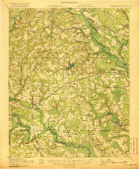
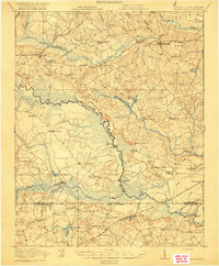
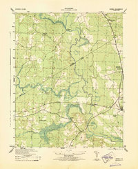
Showing maps 1-25 of 150
Top cities of Southampton County
- Courtland historical maps
- Boykins historical maps
- Sedley historical maps
- Ivor historical maps
- Newsoms historical maps
- Capron historical maps
See more
Frequently asked questions
- What are the different types of historical maps available for Southampton County?
- What is the oldest map of Southampton County?
- Where can I purchase historical maps of Southampton County for my home or office?
- Where can I download high-res historical maps of Southampton County?
- Are there historical topographic maps available for Southampton County?
- Is there historical aerial imagery available for Southampton County?
- Where are historical maps of Southampton County sourced from?