1900s (20th Century) Maps of Suffolk, Virginia
Explore 48 historic maps of Suffolk from the 1900s (20th Century). These maps offer a rare glimpse into what life looked like during the 1900s — showing old roads, neighborhoods, homes, and landmarks that have changed or disappeared over time.
Whether you're researching your family's past, planning a metal detecting trip, or studying how Suffolk's landscape evolved across the 1900s, these high-resolution maps are a powerful tool for exploring the history of this region.
- Focus on a specific era: All maps on this page are from the 1900s, giving you a focused view of this time period.
- See what’s changed: Compare century-old streets, trails, and buildings to today's modern landscape using overlays and satellite layers.
- Research with precision: Use these maps for genealogy, historical research, land use analysis, or educational projects.
- View, download, or print: Maps are fully viewable online in high resolution, and can be downloaded or printed for your own records.
Start exploring Suffolk's history through authentic maps from the 1900s. This is your window into the past.
Suffolk, VA maps
(48)- 1907 Map of Norfolk
 1907 Norfolk1907 Print · USGSCoastal Virginia is mapped here at the dawn of the twentieth century, during the bustle of the great Jamestown Exposition. Researchers can trace the early rail-and-canal economy through the Albemarle and Chesapeake Canal, the Navy Yard, and historic outposts like the Cape Henry Light.
 - 1919 Map of Smithfield
 1919 Smithfield1919 Print · USGSCoastal Virginia during the late teens was a world of steamboat routes and swamp-edge settlements. Genealogists can trace family roots through numerous local landmarks like St Johns Church, Whitley Wharf, and the rural community of Chuckatuck.4 unique versions available
 - 1919 Map of Suffolk
 1919 Suffolk1919 Print · USGSCoastal Virginia and the North Carolina borderlands are defined by the convergence of six major railroads at Suffolk during the late teens. Genealogists can trace family landmarks like Pauls Branch Church and the Franklin Grove School along the edge of the Dismal Swamp.3 unique versions available
 - 1920 Map of Holland
 1920 Holland1920 Print · USGSCoastal plain life at the end of the Great War centers on the river-and-rail hubs of Franklin and Holland. Genealogists can trace family footprints across dozens of country schools like Holmes School and river crossings such as Joyners Bridge and Manning Ferry.2 unique versions available
 - 1920 Map of Ivor
 1920 Ivor1920 Print · USGSCoastal plain life in Southampton and Isle of Wight counties is captured here just after the Great War, when rail and river travel still shaped the landscape. Genealogists can locate family landmarks like Tucker Swamp Church, Crumplers School, and Millfield Millpond.2 unique versions available
 - 1921 Map of Newport News
 1921 Newport News1921 Print · USGSThe Virginia tidewater area comes alive in the early twentieth century, showing a landscape defined by maritime industry and massive military installations. Genealogists and historians can trace rail lines and early settlements from Camp Stuart down to Jolliff School and the Dismal Swamp.4 unique versions available
 - 1940 Map of Lake Drummond, 1964 Print
 1940 Lake Drummond1964 Print · USGSThe Great Dismal Swamp and its drainage canals are captured here in the 1940s, showing a landscape defined by timber extraction and transit. Genealogists and historians can trace old schools and landings from Jacks Camp to Wallaceton Sch and the Lumber RR.
 - 1943 Map of Holland
 1943 Holland1943 Print · USGSThe Virginia and North Carolina borderlands come alive in this mid-century survey of the Chowan River basin. Local historians can trace a network of river landings and rural schools, from Manning Ferry to the community around Stony Branch Church.
 - 1944 Map of Windsor
 1944 Windsor1944 Print · USGSCoastal Virginia during the mid-forties reveals a rural landscape of timber, mills, and rail-dependent towns. Genealogists and historians can trace family locations near landmarks like the Shiloh Cem, Greshem School, and the junction at Five Forks.2 unique versions available
 - 1944 Map of Zuni, 1961 Print
 1944 Zuni1961 Print · USGSThe Virginia Coastal Plain along the Isle of Wight and Southampton border comes alive in this mid-1940s survey. Researchers can trace rural community life through numerous local landmarks, from Tucker Swamp Ch and Gay Sch to the wetlands of Burnt Mills Swamp.
 - 1945 Map of Zuni
 1945 Zuni1945 Print · USGSCoastal Virginia during the mid-1940s reveals a rural landscape defined by the Blackwater River and the competing Norfolk and Western and Virginian rail lines. Researchers can trace local heritage through landmarks like Antioch Ch and Cem and the crossroads at Zuni and Walters.
 - 1945 Map of Lake Drummond
 1945 Lake Drummond1945 Print · USGSThe Dismal Swamp straddles the Virginia-North Carolina line in the 1940s, revealing a landscape defined by timber extraction and historic waterways. Researchers can trace the Intracoastal Waterway, the Lumber RR, and local centers like Wallaceton and Deep Creek.
 - 1949 Map of Chuckatuck
 1949 Chuckatuck1949 Print · USGSCoastal Virginia in the late 1940s is shown here as a landscape of tidewater inlets and busy railroad corridors. Genealogists and local historians can trace family locations near the Rosenwald School, Canaan Cem, and rural churches like St Johns Ch or Little Bethel Ch.
 - 1950 Map of Blackstone
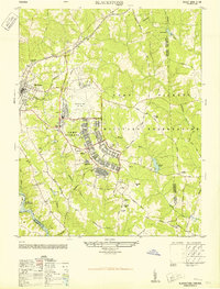 1950 Blackstone1950 Print · USGSMid-century Blackstone is captured here as a major military hub during the post-war era. Genealogists and historians can locate legacy sites like Nottoway Training School, the Cemetery, and the sprawling Camp Pickett complex.
 - 1951 Map of Blackstone, 1958 Print
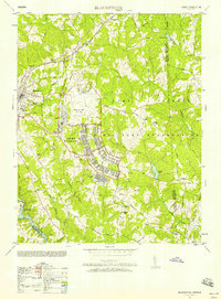 1951 Blackstone1958 Print · USGSBlackstone and the surrounding Nottoway County landscape are seen here during the height of the Cold War military expansion. Genealogists and historians can trace the transition from town life at Spring Hill Church to the sprawling barracks and ranges of Camp Pickett.
 - 1952 Map of Benns Church
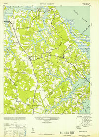 1952 Benns Church1952 Print · USGSCoastal Virginia during the mid-century was a landscape of tide-water marshes and bridge-linked communities. Genealogists can trace family names at The Old Brick Church, locate the Moonville Sch, and explore small settlements like Muddy Cross and Rescue.
 - 1952 Map of Bowers Hill
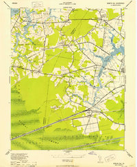 1952 Bowers Hill1952 Print · USGSIn the early 1950s, the border of Nansemond and Norfolk counties was a landscape of tide-water branches and heavy rail. Genealogists can trace family footprints around Pughsville, Sunray, and numerous rural landmarks like Glebe Ch and Florence School.
 - 1952 Map of Newport News
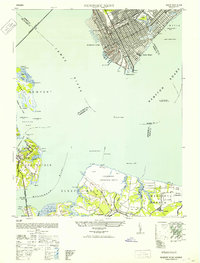 1952 Newport News1952 Print · USGSThe industrial waterfront of Hampton Roads and the James River are captured here just after the war. Local researchers can trace the rail yards of the C & O, the military grounds of Camp Stuart, and the oyster-working life at Eclipse.
 - 1953 Map of Norfolk, 1954 Print
 1953 Norfolk1954 Print · USGSCoastal Virginia and northeastern North Carolina appear here during the post-war industrial boom, showing the critical rail-and-sea connections of Hampton Roads. Genealogists can trace family roots through rural landmarks like Gethsemane Ch, the Caledonia State Prison Farm, and the vast interior of the Dismal Swamp.4 unique versions available
 - 1954 Map of Buckhorn, 1955 Print
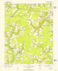 1954 Buckhorn1955 Print · USGSThe Virginia coastal plain in the mid-fifties reveals a landscape defined by industrial rail lines and rural community hubs. Trace family roots and local history at the Somerton Friends Meeting House, Savage Crossing School, or Nurneysville.6 unique versions available
 - 1954 Map of Corapeake, 1955 Print
 1954 Corapeake1955 Print · USGSThe Virginia and North Carolina borderlands in the mid-fifties are defined by the transition from rural settlements into the sprawling Dismal Swamp. Genealogists and local historians can trace family locations through Cypress Chapel, Corapeake, and small sites like Brickley Cem or Zion Tabernacle Ch.
 - 1954 Map of Lake Drummond NW, 1956 Print
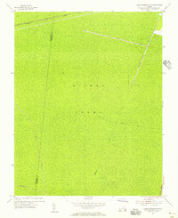 1954 Lake Drummond NW1956 Print · USGSThe Great Dismal Swamp and its historic drainage network are captured here in the mid-1950s. Trace the paths of the Washington Ditch and Big Entry Ditch or the route of the Norfolk and Western railroad.2 unique versions available
 - 1954 Map of Lake Drummond, 1956 Print
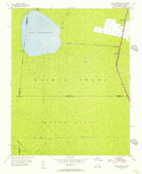 1954 Lake Drummond1956 Print · USGSThe Dismal Swamp interior and its border with North Carolina are captured here in the mid-fifties, showing the intersection of historic waterways and early settlements. Trace the vital connections between Lake Drummond, the Feeder Ditch, and the Dismal Swamp Canal near Wallaceton.2 unique versions available
 - 1954 Map of Suffolk, 1956 Print
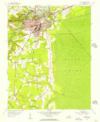 1954 Suffolk1956 Print · USGSMid-century Suffolk and the surrounding Nansemond County lowlands are captured here at a peak of rail industry. Researchers can trace the paths of the Jericho Canal into the Dismal Swamp or locate local landmarks like Skeeter Crossing and Brown Sch.2 unique versions available
 - 1954 Map of Suffolk, 1958 Print
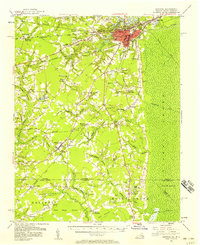 1954 Suffolk1958 Print · USGSThe rail and river hub of Suffolk met the edge of the Great Dismal Swamp in the mid-1950s. Historians and genealogists can trace the early layout of Whaleyville, the transit routes through Buckhorn, and local landmarks like Liberty Spring Ch.2 unique versions available
Showing maps 1-25 of 48
Top cities of Suffolk
Frequently asked questions
- What are the different types of historical maps available for Suffolk?
- What is the oldest map of Suffolk?
- Where can I purchase historical maps of Suffolk for my home or office?
- Where can I download high-res historical maps of Suffolk?
- Are there historical topographic maps available for Suffolk?
- Is there historical aerial imagery available for Suffolk?
- Where are historical maps of Suffolk sourced from?