2020s Maps of Suffolk, Virginia
Explore 16 historic maps of Suffolk from the 2020s. These maps offer a rare glimpse into what life looked like during the 2020s — showing old roads, neighborhoods, homes, and landmarks that have changed or disappeared over time.
Whether you're researching your family's past, planning a metal detecting trip, or studying how Suffolk's landscape evolved across the 2020s, these high-resolution maps are a powerful tool for exploring the history of this region.
- Focus on a specific era: All maps on this page are from the 2020s, giving you a focused view of this time period.
- See what’s changed: Compare century-old streets, trails, and buildings to today's modern landscape using overlays and satellite layers.
- Research with precision: Use these maps for genealogy, historical research, land use analysis, or educational projects.
- View, download, or print: Maps are fully viewable online in high resolution, and can be downloaded or printed for your own records.
Start exploring Suffolk's history through authentic maps from the 2020s. This is your window into the past.
Suffolk, VA maps
(16)- 2022 Map of Buckhorn, 2022 Print
 2022 Buckhorn2022 Print · USGSThe western outskirts of Suffolk appear in the early 2020s as a mix of growing residential corridors and deep swamp forests. Researchers can locate family burial sites like Rawles Cem and the Grasso Salvage Airport near Nurneysville.
 - 2022 Map of Corapeake, 2022 Print
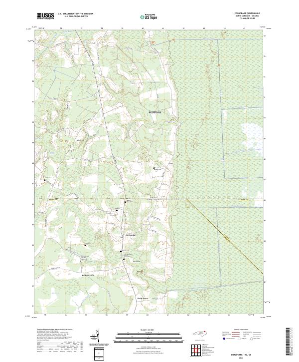 2022 Corapeake2022 Print · USGSThe borderlands of Virginia and North Carolina are captured here in a period of modern rural continuity, where the Great Dismal Swamp meets the communities of Corapeake and Parkers Fork. Researchers can trace family roots at Winslow Cem, Mathias Cem, and several historic country churches.
 - 2022 Map of Benns Church, 2022 Print
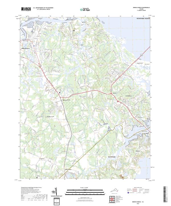 2022 Benns Church2022 Print · USGSCoastal Isle of Wight County comes into focus in this contemporary survey of the James River estuary. Genealogists and historians can locate family landmarks such as Saint Luke's Cem and trace the waterfront character of Battery Park and Crittenden.
 - 2022 Map of Gates, 2022 Print
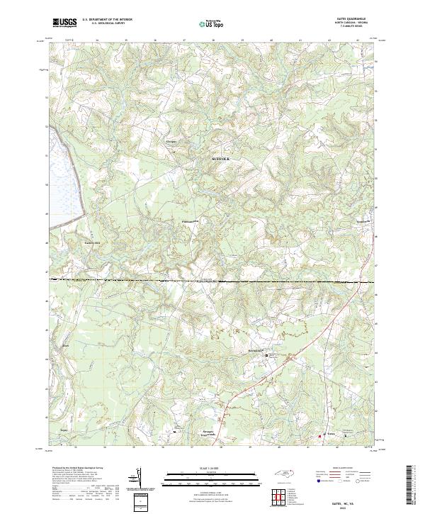 2022 Gates2022 Print · USGSThe Virginia-North Carolina border country comes alive in this 2022 survey of the swamplands and hamlets. Trace family history at Gatling Family Cem or explore crossroads like Pittmantown and Savages Crossroads.
 - 2022 Map of Zuni, 2022 Print
 2022 Zuni2022 Print · USGSCoastal Virginia's riverine landscape is meticulously detailed in this recent survey of the Isle of Wight and Southampton county line. Genealogists and researchers can trace the vicinity of Antioch Christian Church Cem or locate the rural crossroads of Zuni, Walters, and Collosse.
 - 2022 Map of Holland, 2022 Print
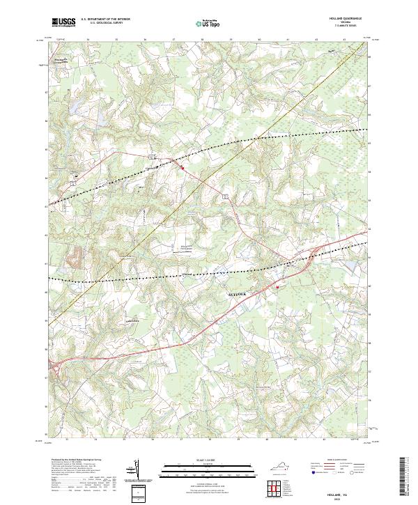 2022 Holland2022 Print · USGSThe rural borderlands of Isle of Wight County and Suffolk are captured here in the early 2020s. Researchers can locate family landmarks and modern infrastructure, from Beaver Dam Cem and Carrsville to the Brandywyne Farms Airport.
 - 2022 Map of Whaleyville, 2022 Print
 2022 Whaleyville2022 Print · USGSThe Virginia and North Carolina borderlands come alive in this recent survey, showcasing a landscape defined by expansive swamps and deep family roots. Genealogists can trace specific sites like the John Fletcher Haslett Family Cem, Willeyton, and the Black Mingle Pocosin.
 - 2022 Map of Suffolk, 2022 Print
 2022 Suffolk2022 Print · USGSThe Great Dismal Swamp and the city of Suffolk are captured in this contemporary survey of Virginia’s Tidewater region. Researchers can trace family history at Cedar Hill Cem or locate the historic bounds of rural settlements like Skeetertown and Magnolia.
 - 2022 Map of Lake Drummond, 2022 Print
 2022 Lake Drummond2022 Print · USGSThe Great Dismal Swamp and its historic waterways are preserved here at the border of Virginia and North Carolina. Trace the legacy of early engineering and timbering along Dismal Swamp Canal, S Martha Washington Ditch, and the shores of Lake Drummond.
 - 2022 Map of Chuckatuck, 2022 Print
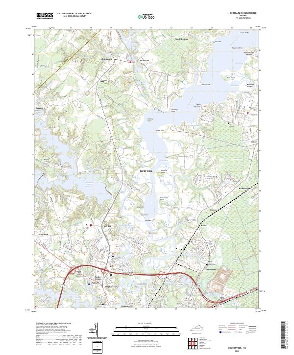 2022 Chuckatuck2022 Print · USGSCoastal Virginia's tidal riverfronts and inland marshes are captured here in the early twenty-first century as the landscape around Chuckatuck continues to evolve. Researchers can trace family sites near Canaan Baptist Church Cem, explore the reaches of the Nansemond River, and locate old crossroads like Driver and Elephant Fork.
 - 2022 Map of Bowers Hill, 2022 Print
 2022 Bowers Hill2022 Print · USGSCoastal Virginia's Tidewater region is shown here in the early twenty-first century, spanning the boundaries of three major cities. Researchers can trace local genealogy and land use through Churchland Baptist Cem, the Suffolk Seaboard Coastline Trl, and Shoulders Hill.
 - 2022 Map of Riverdale, 2022 Print
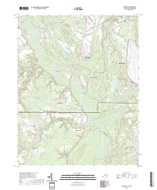 2022 Riverdale2022 Print · USGSThe Virginia-North Carolina border comes alive in this 2022 survey, showcasing the confluence of the Nottoway River and Blackwater River. Genealogists can trace family locations across the state line near Riddicksville, South Quay, and the river crossing at Riverdale.
 - 2022 Map of Newport News South, 2022 Print
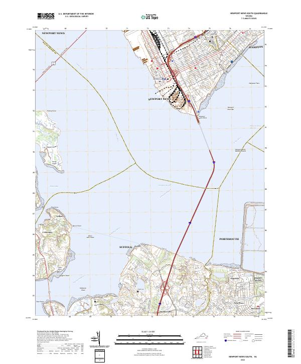 2022 Newport News South2022 Print · USGSHampton Roads and the lower James River waterfront are shown in detail during this contemporary era. Genealogists and local historians can locate smaller communities like Crittenden and Eclipse alongside landmarks like Pleasant Shade Cem.
 - 2022 Map of Windsor, 2022 Print
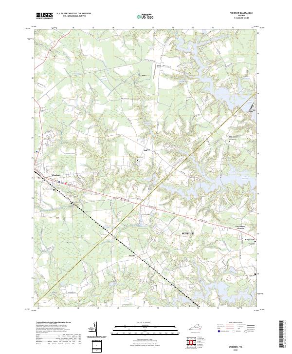 2022 Windsor2022 Print · USGSThe Isle of Wight coastal plain and the outskirts of Suffolk are documented here during the early twenty-first century. Genealogists and local historians can trace family sites from Windsor Cem and Shiloh Cem to settlements like Indika and Everets.
 - 2022 Map of Lake Drummond NW, 2022 Print
 2022 Lake Drummond NW2022 Print · USGSThe Great Dismal Swamp of southeastern Virginia is seen here in the early twenty-first century, showing the vast network of historic canals and access paths. Researchers can trace the heritage of local water management through features like Washington Ditch and the Intracoastal Waterway.
 - 2022 Map of Franklin, 2022 Print
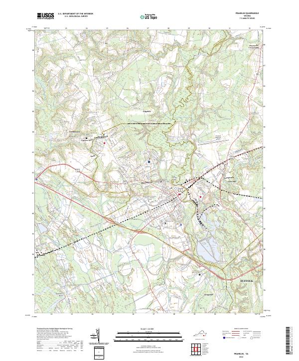 2022 Franklin2022 Print · USGSFranklin and the surrounding Southampton County landscape are shown here in the early twenty-first century. Genealogists and local historians can trace family roots through the Beale Family Cemetery or explore the riverfront heritage of Lees Mill and Camptown.
End of results
Showing maps 1-16 of 16
Top cities of Suffolk
Frequently asked questions
- What are the different types of historical maps available for Suffolk?
- What is the oldest map of Suffolk?
- Where can I purchase historical maps of Suffolk for my home or office?
- Where can I download high-res historical maps of Suffolk?
- Are there historical topographic maps available for Suffolk?
- Is there historical aerial imagery available for Suffolk?
- Where are historical maps of Suffolk sourced from?