Old Maps of Bluefield, Virginia for Hiking & Exploration
Hike through history with 45 historic maps of Bluefield. Explore old trails, ghost towns, and forgotten backroads — perfect for outdoor adventurers and local explorers.
- Rediscover forgotten places: Map out old mining camps, roads, and footpaths that no longer exist on modern maps.
- Layer with modern tools: Combine with LiDAR or satellite views to plan hikes through historical terrain.
- Made for exploration: Popular among hikers, overlanders, and local history lovers.
Use these maps to find adventure and explore the hidden past of Bluefield.
Bluefield, VA maps
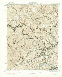
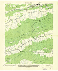
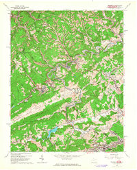
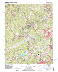
(45)- 1887 Map of Pocahontas
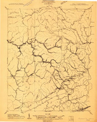
 1887 Pocahontas1887 Print · USGSThe Virginia and West Virginia borderlands are shown here in the 1880s as the coal industry and railroads began to reshape the Appalachian ridges. Genealogists can locate early settlements and landmarks like Seddon (Bland C. H.), the valley at Burks Garden, and the Concord Church congregation.
 - 1891 Map of Pocahontas
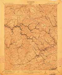
 1891 Pocahontas1891 Print · USGSThe Virginia and West Virginia borderlands are captured here during the late nineteenth-century expansion of the coal and rail industries. Genealogists and researchers can locate early settlements like Sedon (Bland CH), Spanishburg, and Pocahontas along the newly laid Norfolk and Western Railroad.
 - 1894 Map of Pocahontas
 1894 Pocahontas1894 Print · USGSThe Virginia and West Virginia borderlands are shown here during the late nineteenth-century coal boom. Researchers can trace early railroad expansion through settlements like Pocahontas or locate family roots in mountain basins such as Burke Garden and Sed Don.
 - 1895 Map of Pocahontas
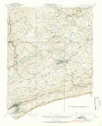
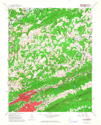
 1895 Pocahontas1895 Print · USGSCoal mining towns and the Norfolk and Western RR line the border of Virginia and West Virginia in the late nineteenth century. Genealogists can trace the early layouts of Pocahontas, Bluefield, and the unusual enclosed valley of Burke Garden.6 unique versions available
 - 1909 Map of Pocahontas Special
 1909 Pocahontas Special1909 Print · USGSThe Pocahontas coalfields are at the peak of their industrial expansion in this early century survey. Genealogists and historians can trace rail-tied communities like Switchback P O, Bramwell, and the rural Bailey Chapel along the steep mountain ridges.
 - 1911 Map of Pocahontas Special
 1911 Pocahontas Special1911 Print · USGSThe West Virginia coalfields are in full industrial bloom in this early century survey, showing the rail-dependent towns along the Norfolk & Western RR. Genealogists can trace family locations in mining hubs like Keystone, Goodwill, and Bearwallow Worth PO.
 - 1913 Map of Bluefield
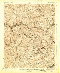
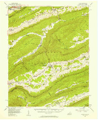
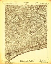 1913 Bluefield1913 Print · USGSMercer County and the Virginia borderlands are captured here just before the Great War, showing a landscape of mountain ridges and river valleys. Genealogists and historians can locate dozens of early rural schoolhouses like Sand Gap School and Grecian Bend School, alongside the developing streets of Princeton and South Bluefield.
 - 1916 Map of Bluefield
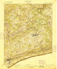 1916 Bluefield1916 Print · USGSMercer County and the Virginia border come alive in this survey of coal-country rail and mountain ridge communities. Genealogists can trace family roots through dozens of named schools like Sand Gap School and early post offices such as Hardy PO.
 - 1924 Map of Bramwell, 1956 Print
 1924 Bramwell1956 Print · USGSCoalfield life thrives along the river-and-rail corridor in the early twentieth century. Researchers can trace family roots in industrial settlements like Jenkinjones and Northfork or locate landmarks such as Bailey Chapel and Little Creek School.
 - 1924 Map of Bluefield, 1966 Print
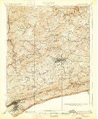
 1924 Bluefield1966 Print · USGSThe West Virginia and Virginia borderlands show significant growth in the mid-1920s as rail lines and mountain settlements expand. Genealogists can trace family names through dozens of rural landmarks like Mercer Healing Springs, Wenonah, and the Barber School.
 - 1925 Map of Bramwell
 1925 Bramwell1925 Print · USGSThe West Virginia and Virginia borderlands hum with the energy of the coal industry in the mid-twenties. Genealogists and historians can trace the bustling rail corridors connecting Keystone, Maybeury, and Goodwill alongside Bailey Chapel.3 unique versions available
 - 1926 Map of Bluefield
 1926 Bluefield1926 Print · USGSWest Virginia's southern highlands come into focus in the mid-1920s as the rail networks of the Norfolk and Western and Virginian RR expand. Family historians can trace rural life through dozens of local landmarks like Mercer Healing Springs, Pisgah Church, and the Willis White School.3 unique versions available
 - 1935 Map of Nye Cove
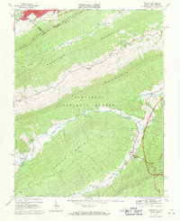
 1935 Nye Cove1935 Print · USGSTazewell and Bland counties are captured here in the mid-1930s as the rail and river economy centered on the Bluestone River shaped the borderlands. Genealogists and historians can trace family locations near West Graham P O, Shawver Mill, and local landmarks like Maple Hill Cem.
 - 1936 Map of Burkes Garden
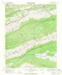
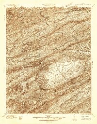 1936 Burkes Garden1936 Print · USGSTazewell and Bland Counties appear in the mid-1930s, defined by the extraordinary limestone bowl of Burkes Garden. Genealogists and historians can trace family locations near Maple Hill Cem, the Witten Mill settlement, and the industrial corridor at Bluefield.
 - 1941 Map of Burkes Garden
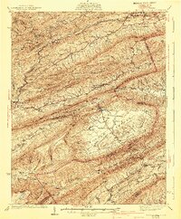 1941 Burkes Garden1941 Print · USGSTazewell County in the late nineteen-thirties reveals the distinctive enclosed valley of Burkes Garden and the rail corridors of the north. Genealogists and hikers can trace the paths to Gose Mills, rural congregations like Marys Chapel, and schools such as Redoak Sch.3 unique versions available
 - 1955 Map of Bluefield
 1955 Bluefield1955 Print · USGSThe Central Appalachian borderlands come alive in the mid-fifties, showing the coal and rail networks connecting Bluefield to Beckley. Researchers can trace the industrial landscape of the New River Ordnance Plant and the terrain of Burkes Garden.
 - 1956 Map of Bland, 1958 Print
 1956 Bland1958 Print · USGSThe Virginia-West Virginia borderlands during the mid-fifties reveal a landscape of ridge-top trails and creek-side settlements. Researchers can trace the path of the Appalachian Trail past historic sites like Original Stony Fork Ch and Newberry Chapel.2 unique versions available
 - 1957 Map of Bluefield, 1967 Print
 1957 Bluefield1967 Print · USGSThe heart of Central Appalachia in the mid-fifties is defined by the winding rail lines and river valleys of the coalfields. Researchers can trace the industrial footprints of towns like Welch and Princeton or locate landmarks such as the Bluestone Reservoir and Claytor Lake.2 unique versions available
 - 1961 Map of Bluefield
 1961 Bluefield1961 Print · USGSThe coalfields and mountain ridges of southern West Virginia and southwest Virginia are captured in the early sixties. Genealogists can trace family ties through rail-linked towns like Princeton and Richlands or along the shores of Bluestone Reservoir.
 - 1962 Map of Bramwell, 1964 Print
 1962 Bramwell1964 Print · USGSThe coal and rail corridor of the West Virginia-Virginia border is frozen in time during the early sixties. Genealogists and historians can trace family plots at Pocahontas Cem and Mt Tabor Cem or locate industrial sites like the strip mines near Bramwell.2 unique versions available
 - 1962 Map of Bluefield, 1964 Print
 1962 Bluefield1964 Print · USGSThe rail-and-ridge country of the West Virginia-Virginia border shows its mid-century growth and industrial character in the early sixties. Genealogists can locate family names at Roselawn Memorial Gardens Cem or trace landmarks like Bluefield State Teachers College and Mountaineer Speedway.3 unique versions available
 - 1968 Map of Bastian, 1971 Print
 1968 Bastian1971 Print · USGSBland and Tazewell Counties are captured in the late sixties, where the urban edge of Bluefield meets the dense ridges of the Jefferson National Forest. Genealogists and historians can trace rural life at Bastian, Hicksville, and Grapefield, or locate family landmarks like Green Valley Ch and Clear Fork Ch.2 unique versions available
 - 1968 Map of Cove Creek, 1971 Print
 1968 Cove Creek1971 Print · USGSThe Virginia mountain country near the Bland and Tazewell border is documented here in the late sixties. Genealogists and local historians can locate Maple Hill Cemetery, the Shawver Mill, and schools like Dudley Sch along the river valleys.2 unique versions available
 - 1981 Map of Bluefield
 1981 Bluefield1981 Print · USGSThe coalfields and mountain ridges of the Virginia-West Virginia border are captured here during the early eighties. Genealogists and historians can trace the rail lines of the Norfolk and Western RR connecting Coalwood, Welch, and the unique geological basin of Burkes Garden.2 unique versions available
 - 2001 Map of Bramwell, 2003 Print
 2001 Bramwell2003 Print · USGSThe West Virginia and Virginia borderlands come into focus at the turn of the millennium, revealing a landscape shaped by the coal industry and the winding Bluestone River. Genealogists can trace family names at Pocahontas Cem or find old community centers like Abbs Valley Sch and Mt Sinai Ch.
Showing maps 1-25 of 45
Top cities near Bluefield
- Bluefield historical maps
- Princeton historical maps
- Tazewell historical maps
- Brush Fork historical maps
- Springville historical maps
- Gratton historical maps
See more
Top neighborhoods of Bluefield
Frequently asked questions
- What are the different types of historical maps available for Bluefield?
- What is the oldest map of Bluefield?
- Where can I purchase historical maps of Bluefield for my home or office?
- Where can I download high-res historical maps of Bluefield?
- Are there historical topographic maps available for Bluefield?
- Is there historical aerial imagery available for Bluefield?
- Where are historical maps of Bluefield sourced from?