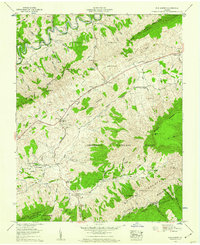
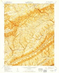
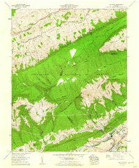
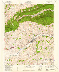
1950s Maps of Washington County, Virginia
Explore 14 historic maps of Washington County from the 1950s. These maps offer a rare glimpse into what life looked like during the 1950s — showing old roads, neighborhoods, homes, and landmarks that have changed or disappeared over time.
Whether you're researching your family's past, planning a metal detecting trip, or studying how Washington County's landscape evolved across the 1950s, these high-resolution maps are a powerful tool for exploring the history of this region.
- Focus on a specific era: All maps on this page are from the 1950s, giving you a focused view of this time period.
- See what’s changed: Compare century-old streets, trails, and buildings to today's modern landscape using overlays and satellite layers.
- Research with precision: Use these maps for genealogy, historical research, land use analysis, or educational projects.
- View, download, or print: Maps are fully viewable online in high resolution, and can be downloaded or printed for your own records.
Start exploring Washington County's history through authentic maps from the 1950s. This is your window into the past.
Washington County, VA maps
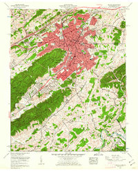
(14)- 1953 Map of Winston-Salem, 1974 Print
 1953 Winston-Salem1974 Print · USGSThe North Carolina Piedmont and Virginia highlands meet in the mid-1950s, a landscape defined by the tobacco and textile hubs of the Blue Ridge foothills. Researchers can trace the rail-and-river geography connecting Winston-Salem to mountain towns like Mount Airy and Galax.2 unique versions available
 - 1955 Map of Johnson City
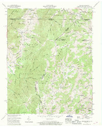
 1955 Johnson City1955 Print · USGSEast Tennessee and the bordering highlands of Virginia and Kentucky appear here during the post-war industrial boom. You can trace the complex network of mountain ridges and new TVA lakes, from Johnson City to the coalfields near Middlesboro and Lynch.
 - 1955 Map of Winston-Salem
 1955 Winston-Salem1955 Print · USGSThe Central Blue Ridge and Piedmont transition are captured here in the mid-fifties, from the industrial hub of Winston-Salem to the high peaks of Southwest Virginia. Genealogists can trace family landmarks like Richmond Hill Ch, Siloam Ch, and the old rail stops along the Southern Railway.
 - 1957 Map of Johnson City, 1966 Print
 1957 Johnson City1966 Print · USGSUpper East Tennessee and Southwest Virginia are shown here during the mid-sixties transition of the Appalachians. Researchers can trace the industrial rail hubs of Kingsport, the sprawling waters of Cherokee Lake, and the historic Cumberland Gap.
 - 1958 Map of Elk Garden, 1960 Print
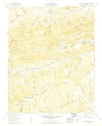
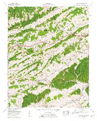
 1958 Elk Garden1960 Print · USGSRussell County's mountain landscape was defined by family homesteads and deep ridges in the late fifties. Genealogists can locate numerous family burial grounds like Ratcliff Cem and Counts Cem near the historic The Lonesome Pine Trail.6 unique versions available
 - 1958 Map of Moll Creek, 1960 Print
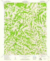
 1958 Moll Creek1960 Print · USGSSouthwest Virginia during the late fifties reveals a landscape of ridge-and-valley settlements connected by winding country roads and family ties. Researchers can trace ancestral locations across dozens of family-named burial grounds like Quillen Cem and rural landmarks such as Lawsons Store or Banners Corner.5 unique versions available
 - 1958 Map of Saltville, 1960 Print
 1958 Saltville1960 Print · USGSThe industrial corridor of the Holston River meets the ridges of the Jefferson National Forest in the late fifties. Genealogists can trace dozens of family burial sites like Vencill and Settle, while historians can locate the Olin Mathieson Chemical Corp RR and R B Worthy High Sch.4 unique versions available
 - 1958 Map of Chilhowie, 1960 Print
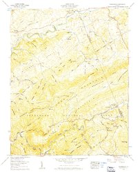
 1958 Chilhowie1960 Print · USGSSmyth and Washington counties are captured here in the late fifties, showing the mountain-and-valley landscape of Southwest Virginia. Genealogists can trace family footprints across dozens of sites like St Clair Bottom, Aspenvale Cem, and the Cleghorn Valley Sch.5 unique versions available
 - 1959 Map of Whitetop Mountain, 1960 Print
 1959 Whitetop Mountain1960 Print · USGSThe high ridges of Smyth and Grayson Counties are captured here in the late fifties, dominated by the peaks of the Blue Ridge. Researchers can trace remote mountain genealogy through sites like Stony Battery, Rowland Creek Cem, and Bethel Ch.4 unique versions available
 - 1959 Map of Konnarock, 1960 Print
 1959 Konnarock1960 Print · USGSSouthwest Virginia's high ridges were still centerpieces of the rail-and-river economy in the late fifties. Genealogists can locate family landmarks like Byars Cem and Loves Mill, or trace the Norfolk and Western rail line through Taylors Valley.6 unique versions available
 - 1959 Map of Park, 1960 Print
 1959 Park1960 Print · USGSThe mountain borderlands of North Carolina and Virginia come alive in the late fifties, showing a landscape shaped by the Norfolk and Western line. Genealogists can trace family roots through dozens of local burial sites and landmarks like Nella (PO), Apple Grove Post Office, and Byars Cem.3 unique versions available
 - 1959 Map of Bristol, 1962 Print
 1959 Bristol1962 Print · USGSBristol and the surrounding state-line hills are captured here in the late fifties, showing a bustling railroad hub at its peak. Researchers can trace family sites at Glenwood Cem or locate old community anchors like Paperville and Three Springs Ch.5 unique versions available
 - 1959 Map of Blountville, 1962 Print
 1959 Blountville1962 Print · USGSSullivan County at the edge of the Virginia border is shown here as a landscape of tight-knit valley settlements and family ridges. Genealogists can trace family names through dozens of sites like Booher Cem and Latture Ridge, or locate old landmarks like Thomas Bridge and the Walnut Hill Sch.5 unique versions available
 - 1959 Map of Grayson, 1969 Print
 1959 Grayson1969 Print · USGSIn the late 1950s, the mountain borders of Tennessee, Virginia, and North Carolina remained a patchwork of isolated family farmsteads and timbered ridges. Researchers can trace the Norfolk and Western rail corridor and find dozens of small family plots like Rye Cove Cem and Taylor Cem.3 unique versions available
End of results
Showing maps 1-14 of 14
Top cities of Washington County
- Abingdon historical maps
- Glade Spring historical maps
- Emory historical maps
- Damascus historical maps
- Meadowview historical maps
- Mendota historical maps
Frequently asked questions
- What are the different types of historical maps available for Washington County?
- What is the oldest map of Washington County?
- Where can I purchase historical maps of Washington County for my home or office?
- Where can I download high-res historical maps of Washington County?
- Are there historical topographic maps available for Washington County?
- Is there historical aerial imagery available for Washington County?
- Where are historical maps of Washington County sourced from?