2020s Maps of Port Angeles, Washington
Explore 8 historic maps of Port Angeles from the 2020s. These maps offer a rare glimpse into what life looked like during the 2020s — showing old roads, neighborhoods, homes, and landmarks that have changed or disappeared over time.
Whether you're researching your family's past, planning a metal detecting trip, or studying how Port Angeles's landscape evolved across the 2020s, these high-resolution maps are a powerful tool for exploring the history of this region.
- Focus on a specific era: All maps on this page are from the 2020s, giving you a focused view of this time period.
- See what’s changed: Compare century-old streets, trails, and buildings to today's modern landscape using overlays and satellite layers.
- Research with precision: Use these maps for genealogy, historical research, land use analysis, or educational projects.
- View, download, or print: Maps are fully viewable online in high resolution, and can be downloaded or printed for your own records.
Start exploring Port Angeles's history through authentic maps from the 2020s. This is your window into the past.
Port Angeles, WA maps
(8)- 2020 Map of Angeles Point, 2020 Print
 2020 Angeles Point2020 Print · USGSCovers Port Angeles, including Elwha Station, Coville, and other nearby areas
 - 2020 Map of Port Angeles, 2020 Print
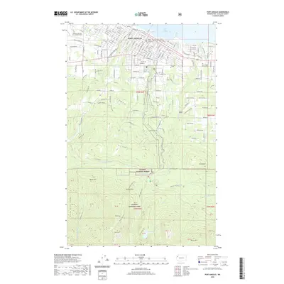 2020 Port Angeles2020 Print · USGSCovers Port Angeles, including Clallam County, United States, and other nearby areas
 - 2020 Map of Ediz Hook, 2020 Print
 2020 Ediz Hook2020 Print · USGSCovers Port Angeles, including Juan de Fuca Electoral Area, Clallam County, and other nearby areas
 - 2020 Map of Elwha, 2020 Print
 2020 Elwha2020 Print · USGSCovers Port Angeles, including Elwha, Clallam County, and other nearby areas
 - 2023 Map of Angeles Point, 2023 Print
 2023 Angeles Point2023 Print · USGSThe Olympic Peninsula coast comes into focus here, where the Elwha River reaches the Salish Sea. Researchers can trace the community layout of Lower Elwha, find family plots at Ocean View Cem, or locate the William R Fairchild International Airport.
 - 2023 Map of Ediz Hook, 2023 Print
 2023 Ediz Hook2023 Print · USGSPort Angeles and its protected harbor are documented here in the early twenty-first century, featuring the prominent natural spit of Ediz Hook. Maritime researchers can trace the Port Angeles Ferry route and locate the Port Angeles Coast Guard Air Station.
 - 2023 Map of Port Angeles, 2023 Print
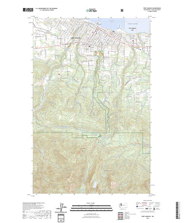 2023 Port Angeles2023 Print · USGSPort Angeles and its neighboring shoreline meet the foothills of the Olympic Mountains in this recent survey. Researchers can trace local landmarks from the Clallam County Courthouse to high-country features like Lake Angeles and Wildcat Mtn.
 - 2023 Map of Elwha, 2023 Print
 2023 Elwha2023 Print · USGSCoastal development meets the deep wilderness of the Olympic Peninsula in this modern survey. Genealogists and researchers can trace the rural communities along Eden Valley Rd and identify landmarks like William R Fairchild International Airport and the Elwha River.
End of results
Showing maps 1-8 of 8
Top neighborhoods of Port Angeles
- Pine Hill Neighborhood historical maps
- Harbor View Neighborhood historical maps
- Lincoln Park Neighborhood historical maps
Frequently asked questions
- What are the different types of historical maps available for Port Angeles?
- What is the oldest map of Port Angeles?
- Where can I purchase historical maps of Port Angeles for my home or office?
- Where can I download high-res historical maps of Port Angeles?
- Are there historical topographic maps available for Port Angeles?
- Is there historical aerial imagery available for Port Angeles?
- Where are historical maps of Port Angeles sourced from?