Old Maps of Port Angeles, Washington for Hiking & Exploration
Hike through history with 33 historic maps of Port Angeles. Explore old trails, ghost towns, and forgotten backroads — perfect for outdoor adventurers and local explorers.
- Rediscover forgotten places: Map out old mining camps, roads, and footpaths that no longer exist on modern maps.
- Layer with modern tools: Combine with LiDAR or satellite views to plan hikes through historical terrain.
- Made for exploration: Popular among hikers, overlanders, and local history lovers.
Use these maps to find adventure and explore the hidden past of Port Angeles.
Port Angeles, WA maps
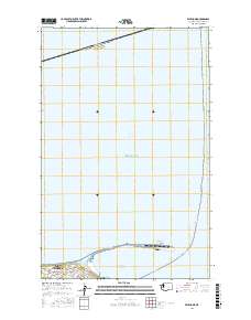
(33)- 1918 Map of Port Angeles
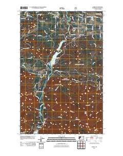
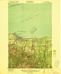 1918 Port Angeles1918 Print · USGSThe northern Olympic Peninsula comes to life in the years following the Great War, showing a landscape defined by maritime trade and logging. Genealogists and historians can locate early landmarks like Reeveton, the Ennis Creek Ranger Station, and several rural schools including Fairview School.4 unique versions available
 - 1919 Map of Port Crescent
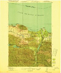 1919 Port Crescent1919 Print · USGSThe northern Olympic Peninsula comes alive in this survey, showing the shoreline from Agate Bay to Freshwater Bay. Trace the early timber economy through the Logging RR and find vanished sites like Port Crescent or the East Beach ferry landing.4 unique versions available
 - 1941 Map of Port Angeles, 1958 Print
 1941 Port Angeles1958 Print · USGSPort Angeles and its harbor stood as a gateway to the Olympic Peninsula in the early 1940s, balancing industrial shipping with rugged forest terrain. Genealogists and historians can locate family landmarks like Krajewski Ranch, the Fairview Sch, and the Angeles L H at the end of Ediz Hook.
 - 1950 Map of Elwha, 1955 Print
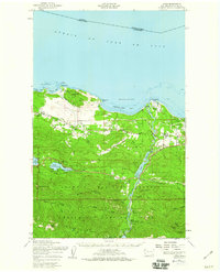
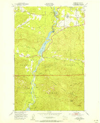 1950 Elwha1955 Print · USGSThe Olympic Peninsula wilderness comes to life in this mid-century survey of the Elwha River corridor. Researchers can trace the original reservoir footprints of Lake Aldwell and find historic sites like Waumilla Lodge and the Dry Creek Sch.5 unique versions available
 - 1950 Map of Ediz Hook, 1955 Print
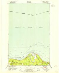
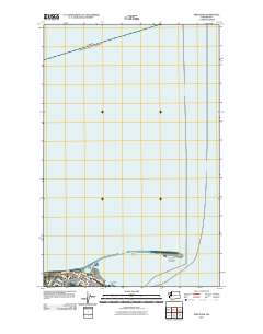
 1950 Ediz Hook1955 Print · USGSPort Angeles and its distinctive sand spit are captured during the early 1950s, showing a busy maritime and military landscape. Researchers can trace the industrial waterfront and naval presence via the U S Coast Guard Station, the Log Storage Area, and the Chicago Milwaukee St Paul and Pacific railroad.
 - 1950 Map of Angeles Point, 1955 Print
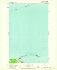
 1950 Angeles Point1955 Print · USGSThe Clallam County coast comes into focus during the early fifties, showing the busy maritime and rail activity at the mouth of the Elwha River. Genealogists and researchers can trace the rail lines through Elwha Station or locate the Ocean View Cem near the Clallam County Airport.2 unique versions available
 - 1950 Map of Port Angeles, 1955 Print
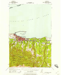
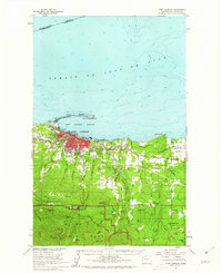
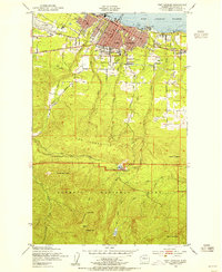 1950 Port Angeles1955 Print · USGSPort Angeles was a bustling maritime and rail hub in the fifties, nestled between the harbor and the high peaks. Trace the old rail lines of the Chicago Milwaukee St Paul and Pacific or locate the Heart of the Hills Ranger Station and Mt Angeles Cem.
 - 1950 Map of Joyce, 1960 Print
 1950 Joyce1960 Print · USGSCoastal Clallam County at mid-century reveals a landscape of working timberlands and emerging mountain parkland. Researchers can trace the Old Piedmont Railroad Grade or locate early settlements like Ramapo, Maple Grove, and Snug Harbor.2 unique versions available
 - 1957 Map of Victoria, 1960 Print
 1957 Victoria1960 Print · USGSThe San Juan Islands and the North Cascades coastline are shown in detail during the late fifties, a period of significant military and industrial presence. Researchers can trace historic rail lines like the Great Northern or locate sites such as the Whidbey Island Naval Air Sta and Friday Harbor.4 unique versions available
 - 1961 Map of Ediz Hook
 1961 Ediz Hook1961 Print · USGSPort Angeles and its protected harbor are shown in the early 1960s, dominated by the long protective reach of Ediz Hook. Local historians can trace the waterfront development, including the Coast Guard Sta and the Old Railroad Grade that served the city's early industry.2 unique versions available
 - 1961 Map of Port Angeles
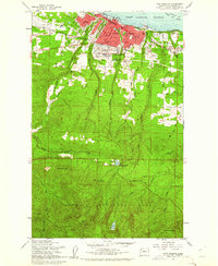 1961 Port Angeles1961 Print · USGSPort Angeles and its industrial harbor sit at the gateway to the Olympic Peninsula in the early sixties. Genealogists and local historians can trace civic growth through Port Angeles schools and landmarks, while exploring the wilderness around Lake Angeles and the Heart O The Hills Ranger Sta.3 unique versions available
 - 1961 Map of Port Angeles, 1962 Print
 1961 Port Angeles1962 Print · USGSPort Angeles and the Olympic coastline are captured here in the early sixties, showing the city's harbor-driven industry and the nearby wilderness. Researchers can trace family ranchlands like Hambly Ranch, find local landmarks like Fairview Sch, or locate the Cameron Homestead.3 unique versions available
 - 1979 Map of Port Angeles
 1979 Port Angeles1979 Print · USGSThe northern Olympic Peninsula and southern Vancouver Island are captured here in the late seventies. Family historians can trace the rail networks of the Esquimalt and Nanaimo Railway or locate old coastal settlements like Sooke, Joyce, and Agnew.
 - 2011 Map of Angeles Point, 2011 Print
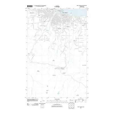
 2011 Angeles Point2011 Print · USGSCovers Port Angeles, including Elwha Station, Coville, and other nearby areas
 - 2011 Map of Ediz Hook, 2011 Print
 2011 Ediz Hook2011 Print · USGSCovers Port Angeles, including Juan de Fuca Electoral Area, Clallam County, and other nearby areas
 - 2011 Map of Port Angeles, 2011 Print
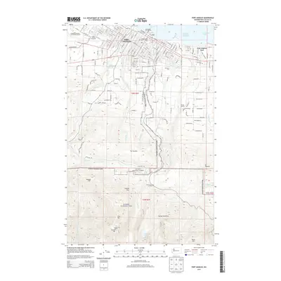
 2011 Port Angeles2011 Print · USGSCovers Port Angeles, including Clallam County, United States, and other nearby areas
 - 2011 Map of Elwha, 2011 Print
 2011 Elwha2011 Print · USGSCovers Port Angeles, including Elwha, Clallam County, and other nearby areas
 - 2014 Map of Elwha, 2014 Print
 2014 Elwha2014 Print · USGSCovers Port Angeles, including Elwha, Clallam County, and other nearby areas
 - 2014 Map of Ediz Hook, 2014 Print
 2014 Ediz Hook2014 Print · USGSCovers Port Angeles, including Juan de Fuca Electoral Area, Clallam County, and other nearby areas
 - 2014 Map of Port Angeles, 2014 Print
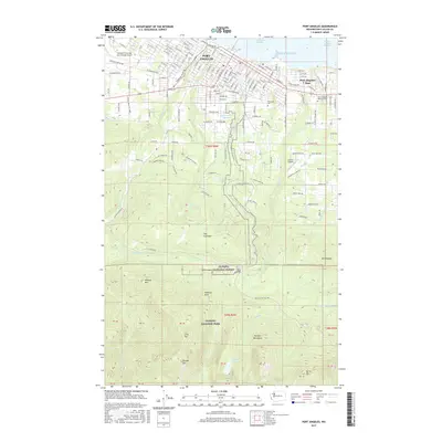
 2014 Port Angeles2014 Print · USGSCovers Port Angeles, including Clallam County, United States, and other nearby areas
 - 2014 Map of Angeles Point, 2014 Print
 2014 Angeles Point2014 Print · USGSCovers Port Angeles, including Elwha Station, Coville, and other nearby areas
 - 2017 Map of Elwha, 2017 Print
 2017 Elwha2017 Print · USGSCovers Port Angeles, including Elwha, Clallam County, and other nearby areas
 - 2017 Map of Port Angeles, 2017 Print
 2017 Port Angeles2017 Print · USGSCovers Port Angeles, including Clallam County, United States, and other nearby areas
 - 2017 Map of Angeles Point, 2017 Print
 2017 Angeles Point2017 Print · USGSCovers Port Angeles, including Elwha Station, Coville, and other nearby areas
 - 2017 Map of Ediz Hook, 2017 Print
 2017 Ediz Hook2017 Print · USGSCovers Port Angeles, including Juan de Fuca Electoral Area, Clallam County, and other nearby areas
Showing maps 1-25 of 33
Top neighborhoods of Port Angeles
- Pine Hill Neighborhood historical maps
- Harbor View Neighborhood historical maps
- Lincoln Park Neighborhood historical maps
Frequently asked questions
- What are the different types of historical maps available for Port Angeles?
- What is the oldest map of Port Angeles?
- Where can I purchase historical maps of Port Angeles for my home or office?
- Where can I download high-res historical maps of Port Angeles?
- Are there historical topographic maps available for Port Angeles?
- Is there historical aerial imagery available for Port Angeles?
- Where are historical maps of Port Angeles sourced from?