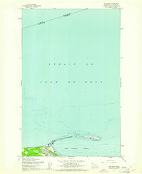
1961 Map of Ediz Hook
USGS Topo · Published 1961About this map
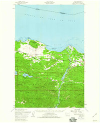
Port Angeles and its sheltered harbor are defined by the remarkable three-mile sand spit of Ediz Hook, which forms a natural breakwater against the Strait of Juan de Fuca. This 1961 edition reveals the maritime and industrial layout of the city before significant modern waterfront redevelopment, showing the concentration of shipping and infrastructure along the shoreline. The hook itself is dominated by the Coast Guard Sta at its eastern tip, while the interior curve protects Port Angeles Harbor and a small interior body of water known simply as The Lagoon.
Find a feature on this map
15 named features on this map. Tap any name to fly to it.
Don’t see what you’re looking for? This feature index may not catch every label — zoom into the map to look around manually.
Map Details
Editions of this 1961 Ediz Hook Map
2 editions found
Other maps of this area

1918 · Port Angeles
USGS Topo · 1:62,500

1919 · Port Crescent
USGS Topo · 1:62,500

1941 · Port Angeles
USGS Topo · 1:62,500

1950 · Elwha
USGS Topo · 1:24,000

1950 · Ediz Hook
USGS Topo · 1:24,000
1950 · Angeles Point
USGS Topo · 1:24,000
1950 · Port Angeles
USGS Topo · 1:24,000
1950 · Joyce
USGS Topo · 1:62,500
1956 · Morse Creek
USGS Topo · 1:24,000

1957 · Victoria
USGS Topo · 1:250,000