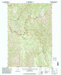
1990s Maps of Columbia County, Washington
Explore 13 historic maps of Columbia County from the 1990s. These maps offer a rare glimpse into what life looked like during the 1990s — showing old roads, neighborhoods, homes, and landmarks that have changed or disappeared over time.
Whether you're researching your family's past, planning a metal detecting trip, or studying how Columbia County's landscape evolved across the 1990s, these high-resolution maps are a powerful tool for exploring the history of this region.
- Focus on a specific era: All maps on this page are from the 1990s, giving you a focused view of this time period.
- See what’s changed: Compare century-old streets, trails, and buildings to today's modern landscape using overlays and satellite layers.
- Research with precision: Use these maps for genealogy, historical research, land use analysis, or educational projects.
- View, download, or print: Maps are fully viewable online in high resolution, and can be downloaded or printed for your own records.
Start exploring Columbia County's history through authentic maps from the 1990s. This is your window into the past.
Columbia County, WA maps
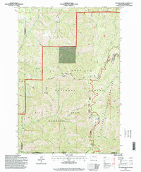
(13)- 1995 Map of Wenaha Forks, 1998 Print
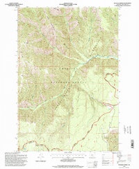 1995 Wenaha Forks1998 Print · USGSWallowa County and the Umatilla National Forest are seen here in the mid-1990s, a period of established wilderness preservation and backcountry trail networks. Trace the path of the Sawtooth Ridge Trail or locate isolated water sources like Godman Spring and Peerless Spring.
 - 1995 Map of Eckler Mountain, 1998 Print
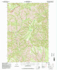
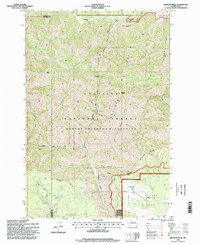
 1995 Eckler Mountain1998 Print · USGSThe high ridges of the Blue Mountains in the mid-nineties are mapped here in detail within the Umatilla National Forest. Outdoor historians and researchers can trace the Kendall Skyline Road past landmarks like Kendall Monument and the site of Camp Mead.
 - 1995 Map of Oregon Butte, 1998 Print
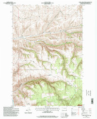
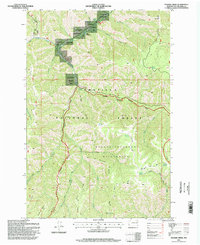
 1995 Oregon Butte1998 Print · USGSThe Blue Mountains of Columbia County remained a rugged wilderness in the mid-1990s, dominated by the ridges of the Umatilla National Forest. Researchers can trace the drainage of Panjab Creek and locate historic high points like the Oregon Butte Lookout and Danger Point.
 - 1995 Map of Hopkins Ridge, 1998 Print
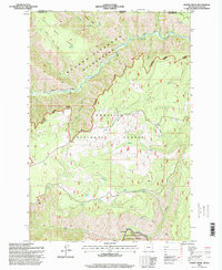
 1995 Hopkins Ridge1998 Print · USGSSoutheast Washington’s Blue Mountain foothills were managed for conservation and wildlife in the mid-nineties, centering on the Tucannon River corridor. Genealogists and researchers can trace local landmarks like the Cem near the river or the Tucannon Guard Station and Fish Hatchery.
 - 1995 Map of Deadman Peak, 1998 Print
 1995 Deadman Peak1998 Print · USGSThe high Blue Mountains in the mid-1990s appear here at the intersection of the Walla Walla and Columbia county lines. Researchers can trace the rugged drainage systems of the South Fork Touchet River and locate historic points like Indian Camp or Table Rock.
 - 1995 Map of Diamond Peak, 1998 Print
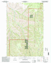
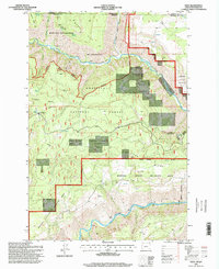
 1995 Diamond Peak1998 Print · USGSGarfield and Columbia counties in the mid-1990s are shown here as a wilderness of high ridges and isolated forest outposts. Researchers can trace remote mountain activity through features like Kelly Camp, the F Kessler Ranch, and the Sheephead Corral.
 - 1995 Map of Cahill Mountain, 1998 Print
 1995 Cahill Mountain1998 Print · USGSThe high ridges and deep gulches of Columbia County are captured here in the mid-1990s. Researchers can trace the high-elevation Kendall Skyline Road past the Thorn Lookout or locate the historic Patit (Site).
 - 1995 Map of Elbow Creek, 1998 Print
 1995 Elbow Creek1998 Print · USGSWallowa County and the Oregon-Washington borderlands are shown in the mid-1990s as a complex of wilderness and national forest lands. Researchers can trace remote backcountry water sources like Jacks Spring and the steep terrain of Grizzly Bear Ridge near the Wenaha River.
 - 1995 Map of Panjab Creek, 1998 Print
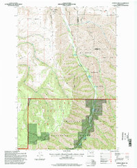
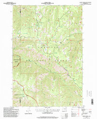
 1995 Panjab Creek1998 Print · USGSThe Blue Mountains of Columbia County are shown here in the mid-1990s, dominated by public lands and wilderness. Traces of high-country recreation and conservation are visible at Camp Wooten State Park and along the Rattlesnake Trail.
 - 1995 Map of Stentz Spring, 1998 Print
 1995 Stentz Spring1998 Print · USGSThe high ridges of Garfield and Columbia Counties are captured here in the mid-1990s as the wilderness boundary meets the national forest. Researchers can trace seasonal encampments like Powell Camp and administrative landmarks such as the Clearwater Guard Station.
 - 1995 Map of Eden, 1998 Print
 1995 Eden1998 Print · USGSThe Oregon-Washington borderlands near the Grande Ronde come alive in the mid-nineties, showing a landscape of wilderness and forestry. Genealogists and hikers can trace the Eden Cemetery, locate the Eden Community Hall, and follow the Smooth Ridge Trail through the Wenaha-Tucannon Wilderness.
 - 1995 Map of Rose Springs, 1998 Print
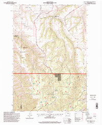 1995 Rose Springs1998 Print · USGSThe high ridges of Garfield County are captured here in the mid-1990s, showing a landscape defined by forest management and wildlife areas. Genealogists and historians can trace the paths of Bosley Grade and find named water sources like Rose Springs and Lanzie Spring.
 - 1995 Map of Godman Spring, 1998 Print
 1995 Godman Spring1998 Print · USGSHigh in the Blue Mountains in the mid-nineties, this survey details a landscape of wilderness ridges and remote forestry outposts. Researchers can trace historic access routes like the Skyline Road and locate sites like Godman Guard Station and Lady Camp.
End of results
Showing maps 1-13 of 13
Top cities of Columbia County
Frequently asked questions
- What are the different types of historical maps available for Columbia County?
- What is the oldest map of Columbia County?
- Where can I purchase historical maps of Columbia County for my home or office?
- Where can I download high-res historical maps of Columbia County?
- Are there historical topographic maps available for Columbia County?
- Is there historical aerial imagery available for Columbia County?
- Where are historical maps of Columbia County sourced from?