1960s Maps of Columbia County, Washington
Explore 23 historic maps of Columbia County from the 1960s. These maps offer a rare glimpse into what life looked like during the 1960s — showing old roads, neighborhoods, homes, and landmarks that have changed or disappeared over time.
Whether you're researching your family's past, planning a metal detecting trip, or studying how Columbia County's landscape evolved across the 1960s, these high-resolution maps are a powerful tool for exploring the history of this region.
- Focus on a specific era: All maps on this page are from the 1960s, giving you a focused view of this time period.
- See what’s changed: Compare century-old streets, trails, and buildings to today's modern landscape using overlays and satellite layers.
- Research with precision: Use these maps for genealogy, historical research, land use analysis, or educational projects.
- View, download, or print: Maps are fully viewable online in high resolution, and can be downloaded or printed for your own records.
Start exploring Columbia County's history through authentic maps from the 1960s. This is your window into the past.
Columbia County, WA maps
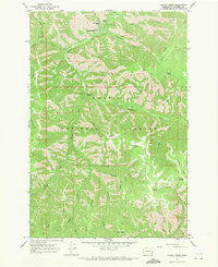
(23)- 1966 Map of Coppei, 1967 Print
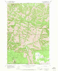
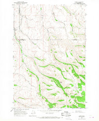 1966 Coppei1967 Print · USGSWalla Walla and Columbia counties are shown here in the mid-1960s, where the grain-heavy economy meets the headwaters of the Blue Mountains. Locate Bundy Hollow Cem, the Northern Pacific tracks at Coppei, and high-country routes like Lewis Peak Road.2 unique versions available
 - 1967 Map of Robinette Mtn.
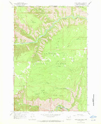
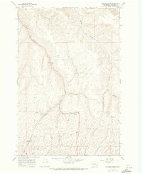
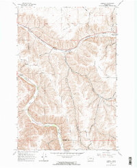
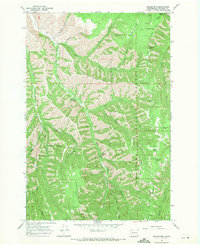
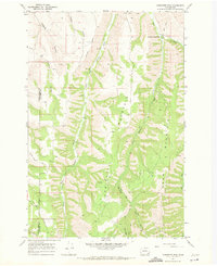 1967 Robinette Mtn.1967 Print · USGSThe high ridges and river forks of the Columbia and Walla Walla county line are captured here in the late sixties. Researchers can trace the winding South Fork Touchet River and locate historic upland landmarks like Mountain Home Park and Robinette Mountain.2 unique versions available
 - 1967 Map of Rose Springs, 1971 Print
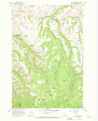 1967 Rose Springs1971 Print · USGSIn the foothills of the Blue Mountains during the late sixties, this area shows the rugged interface between livestock grazing lands and the forest. You can trace early mountain routes like Bosley Grade and locate numerous historic water sources including Rose Springs and Sawmill Spring.3 unique versions available
 - 1967 Map of Eden, 1971 Print
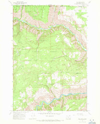 1967 Eden1971 Print · USGSThe Oregon and Washington borderlands in the late 1960s reveal a landscape of deep river canyons and high timbered ridges. Genealogists and historians can locate remote landmarks like Eden Cem, Eden Community Hall, and the Hoodoo Lookout Tower.2 unique versions available
 - 1967 Map of Elbow Creek, 1971 Print
 1967 Elbow Creek1971 Print · USGSThe Oregon-Washington borderlands appear here in the late 1960s, showing a landscape defined by the Wenaha River and national forest boundaries. Researchers can trace historic access routes via the Pack Trails and locate named water sources like Mosier Spring and Squaw Falls.3 unique versions available
 - 1967 Map of Hopkins Ridge, 1971 Print
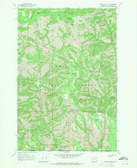
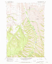 1967 Hopkins Ridge1971 Print · USGSThe Blue Mountains of Columbia and Garfield counties appear in the late sixties as a landscape of deep river canyons and high timbered ridges. Researchers can trace the Tucannon River past the Fish Hatchery, Tucannon Guard Sta, and remote points like Jumpoff Joe.4 unique versions available
 - 1967 Map of Cahill Mtn, 1971 Print
 1967 Cahill Mtn1971 Print · USGSThe northern Blue Mountains come into sharp focus in the late sixties as the high ridges of the Umatilla N F are mapped in detail. Genealogists and historians can trace the Patit (Site) and the fire-watch history at Thorn Lookout Tower.2 unique versions available
 - 1967 Map of Waitsburg NW, 1971 Print
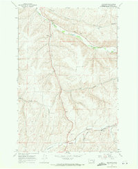
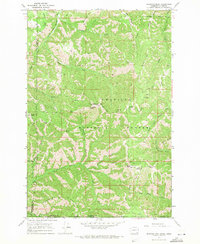
 1967 Waitsburg NW1971 Print · USGSColumbia and Walla Walla counties meet in this high-plateau landscape during the late sixties. Researchers can trace the Old RR Grade and locate historical water sources like Lost Springs Ranch and Smith Springs.
 - 1967 Map of Waitsburg, 1971 Print
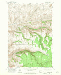
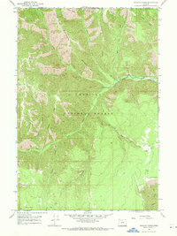
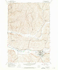 1967 Waitsburg1971 Print · USGSWaitsburg and the surrounding Touchet Valley are captured in the late sixties as the region’s grain-shipping infrastructure was fully established. Genealogists and historians can trace the paths of the Union Pacific, locate the Cem, and see the rail spurs serving the McKay Grain Elevators.
 - 1967 Map of Oregon Butte, 1971 Print
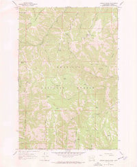
 1967 Oregon Butte1971 Print · USGSThe high backcountry of the Blue Mountains comes into focus in the late 1960s, showing a rugged landscape at the junction of three counties. Trace the paths of the PACK TRAIL and JEEP TRAIL past high-elevation points like Oregon Butte and Ant Flat.3 unique versions available
 - 1967 Map of Stentz Spring, 1971 Print
 1967 Stentz Spring1971 Print · USGSThe Umatilla National Forest in the late sixties is a landscape of high ridges and forest service outposts. Researchers can trace remote mountain geography through the Clearwater Guard Station, the Tucannon River, and the steep Hard-to-get-to Ridge.3 unique versions available
 - 1967 Map of Huntsville, 1971 Print
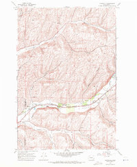 1967 Huntsville1971 Print · USGSThe Touchet Valley in the late 1960s was a bustling corridor where competing railroads traced the river through the heart of the wheat country. Genealogists and local historians can locate the Huntsville Cem, Pioneer Cem, and the small siding at Dumas along the Union Pacific line.
 - 1967 Map of Diamond Peak, 1971 Print
 1967 Diamond Peak1971 Print · USGSThe high timber and deep canyons of the Washington and Oregon border are captured here in the late sixties. Researchers can trace remote forest outposts like First Creek Cabin and Kelly Camp or follow the high-altitude Pack Trail across Monument Ridge.3 unique versions available
 - 1967 Map of Kellogg Creek, 1971 Print
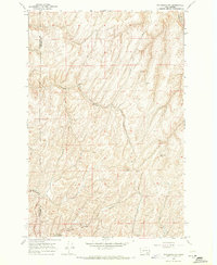
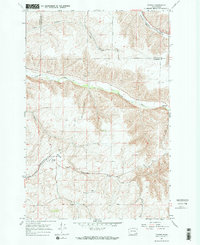
 1967 Kellogg Creek1971 Print · USGSThe dryland wheat country of Columbia County is shown in the late sixties as a landscape of rail-served hills and winding hollows. Researchers can trace the Old Railroad Grade and locate old rural landmarks like Relief and the Grain Elevator at Alto.
 - 1967 Map of Turner, 1971 Print
 1967 Turner1971 Print · USGSColumbia County’s high plateau and river canyons are captured here in the late sixties, showcasing the remote rail-and-river economy of southeastern Washington. Genealogists can trace family ties at Turner Cem or locate the historic Covello (Site) and the Union Pacific line.2 unique versions available
 - 1967 Map of Dayton, 1971 Print
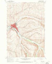 1967 Dayton1971 Print · USGSDayton and the Touchet River valley are shown in the late 1960s during a period of steady agricultural and civic growth. Researchers can trace historic rail lines like the Burlington Northern and locate community landmarks such as the Dayton High Sch and the local Cemetery.2 unique versions available
 - 1967 Map of Panjab Creek, 1971 Print
 1967 Panjab Creek1971 Print · USGSThe Umatilla National Forest back-country and the Tucannon River valley are shown here in the late sixties. Researchers can trace the network of springs and pack trails that connected Panjab Campground, Indian Corral, and the heights of Williams Ridge.3 unique versions available
 - 1967 Map of Zumwalt, 1971 Print
 1967 Zumwalt1971 Print · USGSThe rural valleys of Garfield and Columbia Counties are captured here during the late sixties, highlighting the deep gulches and river bottoms. Family historians and researchers can trace the Union Pacific line, locate the Owsley Cem, and find local landmarks like the Grange Hall and Marengo.2 unique versions available
 - 1967 Map of Tucannon, 1971 Print
 1967 Tucannon1971 Print · USGSThe Tucannon River valley and its surrounding hollows are captured here in the late sixties. Researchers can trace rural landmarks like the Harmony Community Hall, the Tucannon settlement, and the UNION PACIFIC rail line through Whetstone.
 - 1967 Map of Wenaha Forks, 1971 Print
 1967 Wenaha Forks1971 Print · USGSWallowa County in the late sixties remains a wilderness landscape of high ridges and deep canyons along the Oregon-Washington border. Researchers can trace historic access routes via pack trails and jeep trails to landmarks like Elk Flat, Wenaha Forks, and Sawtooth Ridge.3 unique versions available
 - 1967 Map of Eckler Mtn, 1971 Print
 1967 Eckler Mtn1971 Print · USGSColumbia County’s high ridge country is captured here in the late sixties, a period of established forest management and remote backcountry access. Researchers can locate family-named landmarks and water sources like the Kendall Monument, Spoonamore Canyon, and Gilbreath Spring.2 unique versions available
 - 1967 Map of Deadman Peak, 1971 Print
 1967 Deadman Peak1971 Print · USGSThe high ridges of the Blue Mountains in the late 1960s are revealed here through a network of remote pack trails and lookout points. Researchers can trace the rugged headwaters of the South Fork Touchet River and locate specific backcountry sites like Indian Camp and Table Rock.3 unique versions available
 - 1967 Map of Godman Spring, 1972 Print
 1967 Godman Spring1972 Print · USGSThe Blue Mountains backcountry comes alive in this late-sixties survey of the borderlands between Washington and Oregon. Researchers can trace the remote operations of the Umatilla National Forest through landmarks like Godman Guard Sta, Touchet Corral, and the Kendall Skyline Road.3 unique versions available
End of results
Showing maps 1-23 of 23
Top cities of Columbia County
Frequently asked questions
- What are the different types of historical maps available for Columbia County?
- What is the oldest map of Columbia County?
- Where can I purchase historical maps of Columbia County for my home or office?
- Where can I download high-res historical maps of Columbia County?
- Are there historical topographic maps available for Columbia County?
- Is there historical aerial imagery available for Columbia County?
- Where are historical maps of Columbia County sourced from?