Old Maps of Columbia County, Washington for Genealogy
Trace your family roots with 195 historic maps of Columbia County. These high-res maps reveal old neighborhoods, homesites, landmarks, and streets — helping you uncover where your ancestors lived and how the area evolved over time.
- Explore historic neighborhoods: Identify where your relatives may have lived in the 1800s or 1900s.
- Compare maps over time: Trace the changes in streets, buildings, and landmarks for multi-generational research.
- Perfect for genealogy & ancestry research: Used by family historians and researchers to map out lineage and migration.
These maps are an incredible resource for exploring your personal connection to Columbia County's past.
Columbia County, WA maps
(195)- 1919 Map of Walla Walla, 1964 Print
 1919 Walla Walla1964 Print · USGSSoutheast Washington at the close of the First World War shows a thriving agricultural hub connected by the Oregon-Washington Railroad. Genealogists can trace family names across dozens of rural sites, from College Place and Dixie to the Kellogg School and Kibler Mill.
 - 1921 Map of Walla Walla
 1921 Walla Walla1921 Print · USGSSoutheastern Washington at the height of its rail-era agricultural expansion reveals a landscape of thriving wheat towns and mountain foothills. Genealogists can trace family footprints across dozens of rural landmarks, from the Whitman Monument to the Kellogg School and the early streets of Walla Walla.2 unique versions available
 - 1937 Map of Pomeroy
 1937 Pomeroy1937 Print · USGSGarfield and Columbia Counties appear in the late thirties as a patchwork of upland farms and forest outposts. Genealogists and historians can locate rural landmarks like Pataha Cem, the Tucannon Guard Sta, and various country schools including Pine Grove Sch.3 unique versions available
 - 1942 Map of Pomeroy
 1942 Pomeroy1942 Print · USGSThe foothills of the Blue Mountains are captured here in the late 1930s, showing the settled valleys of Garfield and Columbia Counties. Genealogists and local historians can locate early rural landmarks like Pataha City, Jackson Sch, and the UNION PACIFIC rail line serving Dayton.2 unique versions available
 - 1948 Map of Starbuck, 1968 Print
 1948 Starbuck1968 Print · USGSThe Snake River canyon and Palouse coulees defined this rail-and-ranching corridor in the late 1940s. Genealogists and historians can trace the foundations of Starbuck, the riverside settlement of Riparia, and family sites like Gordon Farm.
 - 1950 Map of Starbuck
 1950 Starbuck1950 Print · USGSSoutheast Washington during the late 1940s is defined by the winding Snake River and its rugged canyons. Genealogists and historians can trace the rail-and-river network of Starbuck and Riparia, or locate family sites like Gordon Farm and McGregor Ranch.
 - 1950 Map of Hay, 1956 Print
 1950 Hay1956 Print · USGSWhitman and Garfield counties are captured here in the mid-twentieth century as the regional economy revolved around the Snake River and its rail corridors. Genealogists and local historians can locate rural landmarks like the Selbu Church, the Pataha Valley Grange, and the Central Ferry crossing.2 unique versions available
 - 1952 Map of Hay
 1952 Hay1952 Print · USGSThe Snake River corridor in the early fifties shows a landscape of isolated ferry crossings and canyon-side rail lines. Genealogists can locate family landmarks like Selbu Church, the Pataha Valley Grange, and the old Central Ferry School.
 - 1953 Map of Walla Walla, 1964 Print
 1953 Walla Walla1964 Print · USGSSoutheast Washington enters the atomic and hydroelectric age in the mid-twentieth century as new dams reshape the desert landscape. You can trace the development of the Hanford Works, identify remote rail stops like Novara Siding, and locate the historic Dry Creek Cem.3 unique versions available
 - 1955 Map of Pullman, 1963 Print
 1955 Pullman1963 Print · USGSThe Palouse and Clearwater regions are captured here in the mid-1950s, showing the height of the rail-and-river economy. Genealogists and historians can trace rail lines like the Camas Prairie RR, find local landmarks like Whitman County Memorial Cem, and locate early academic centers at Washington State University and the University of Idaho.3 unique versions available
 - 1955 Map of Grangeville, 1964 Print
 1955 Grangeville1964 Print · USGSThe high country of the Idaho-Oregon border comes alive in the mid-1950s, showing the deep river canyons and mountain peaks. Trace the Union Pacific RR through the valleys or locate settlements like Grangeville, Joseph, and the shoreline of Wallowa Lake.4 unique versions available
 - 1958 Map of Pullman
 1958 Pullman1958 Print · USGSThe Palouse and Clearwater regions are captured here in the late fifties, showing the vital river-and-rail connection between eastern Washington and northern Idaho. Local historians can trace the paths of the Camas Prairie RR and Union Pacific RR as they serve towns like Colfax, Kamiah, and Nezperce.2 unique versions available
 - 1958 Map of Walla Walla
 1958 Walla Walla1958 Print · USGSThe Tri-Cities and Walla Walla region are captured here during the mid-century expansion of atomic energy and river infrastructure. Genealogists and historians can trace the early layout of Richland (AEC), the rural Hatton and Washtucna settlements, and landmarks like Palouse Falls State Park.
 - 1959 Map of Grangeville
 1959 Grangeville1959 Print · USGSThe high alpine peaks and deep river canyons of the Idaho-Oregon borderlands are captured in the late fifties. Researchers can trace the Union Pacific RR through the valleys to settlements like Enterprise, Union, and Grangeville.2 unique versions available
 - 1966 Map of Coppei, 1967 Print
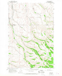 1966 Coppei1967 Print · USGSWalla Walla and Columbia counties are shown here in the mid-1960s, where the grain-heavy economy meets the headwaters of the Blue Mountains. Locate Bundy Hollow Cem, the Northern Pacific tracks at Coppei, and high-country routes like Lewis Peak Road.2 unique versions available
 - 1967 Map of Robinette Mtn.
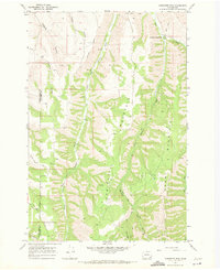 1967 Robinette Mtn.1967 Print · USGSThe high ridges and river forks of the Columbia and Walla Walla county line are captured here in the late sixties. Researchers can trace the winding South Fork Touchet River and locate historic upland landmarks like Mountain Home Park and Robinette Mountain.2 unique versions available
 - 1967 Map of Rose Springs, 1971 Print
 1967 Rose Springs1971 Print · USGSIn the foothills of the Blue Mountains during the late sixties, this area shows the rugged interface between livestock grazing lands and the forest. You can trace early mountain routes like Bosley Grade and locate numerous historic water sources including Rose Springs and Sawmill Spring.3 unique versions available
 - 1967 Map of Eden, 1971 Print
 1967 Eden1971 Print · USGSThe Oregon and Washington borderlands in the late 1960s reveal a landscape of deep river canyons and high timbered ridges. Genealogists and historians can locate remote landmarks like Eden Cem, Eden Community Hall, and the Hoodoo Lookout Tower.2 unique versions available
 - 1967 Map of Elbow Creek, 1971 Print
 1967 Elbow Creek1971 Print · USGSThe Oregon-Washington borderlands appear here in the late 1960s, showing a landscape defined by the Wenaha River and national forest boundaries. Researchers can trace historic access routes via the Pack Trails and locate named water sources like Mosier Spring and Squaw Falls.3 unique versions available
 - 1967 Map of Hopkins Ridge, 1971 Print
 1967 Hopkins Ridge1971 Print · USGSThe Blue Mountains of Columbia and Garfield counties appear in the late sixties as a landscape of deep river canyons and high timbered ridges. Researchers can trace the Tucannon River past the Fish Hatchery, Tucannon Guard Sta, and remote points like Jumpoff Joe.4 unique versions available
 - 1967 Map of Cahill Mtn, 1971 Print
 1967 Cahill Mtn1971 Print · USGSThe northern Blue Mountains come into sharp focus in the late sixties as the high ridges of the Umatilla N F are mapped in detail. Genealogists and historians can trace the Patit (Site) and the fire-watch history at Thorn Lookout Tower.2 unique versions available
 - 1967 Map of Waitsburg NW, 1971 Print
 1967 Waitsburg NW1971 Print · USGSColumbia and Walla Walla counties meet in this high-plateau landscape during the late sixties. Researchers can trace the Old RR Grade and locate historical water sources like Lost Springs Ranch and Smith Springs.
 - 1967 Map of Waitsburg, 1971 Print
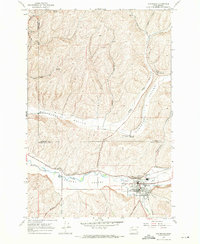 1967 Waitsburg1971 Print · USGSWaitsburg and the surrounding Touchet Valley are captured in the late sixties as the region’s grain-shipping infrastructure was fully established. Genealogists and historians can trace the paths of the Union Pacific, locate the Cem, and see the rail spurs serving the McKay Grain Elevators.
 - 1967 Map of Oregon Butte, 1971 Print
 1967 Oregon Butte1971 Print · USGSThe high backcountry of the Blue Mountains comes into focus in the late 1960s, showing a rugged landscape at the junction of three counties. Trace the paths of the PACK TRAIL and JEEP TRAIL past high-elevation points like Oregon Butte and Ant Flat.3 unique versions available
 - 1967 Map of Stentz Spring, 1971 Print
 1967 Stentz Spring1971 Print · USGSThe Umatilla National Forest in the late sixties is a landscape of high ridges and forest service outposts. Researchers can trace remote mountain geography through the Clearwater Guard Station, the Tucannon River, and the steep Hard-to-get-to Ridge.3 unique versions available
Showing maps 1-25 of 195
Top cities of Columbia County
Frequently asked questions
- What are the different types of historical maps available for Columbia County?
- What is the oldest map of Columbia County?
- Where can I purchase historical maps of Columbia County for my home or office?
- Where can I download high-res historical maps of Columbia County?
- Are there historical topographic maps available for Columbia County?
- Is there historical aerial imagery available for Columbia County?
- Where are historical maps of Columbia County sourced from?