Old Maps of Wanapum Village, Washington for Genealogy
Trace your family roots with 13 historic maps of Wanapum Village. These high-res maps reveal old neighborhoods, homesites, landmarks, and streets — helping you uncover where your ancestors lived and how the area evolved over time.
- Explore historic neighborhoods: Identify where your relatives may have lived in the 1800s or 1900s.
- Compare maps over time: Trace the changes in streets, buildings, and landmarks for multi-generational research.
- Perfect for genealogy & ancestry research: Used by family historians and researchers to map out lineage and migration.
These maps are an incredible resource for exploring your personal connection to Wanapum Village's past.
Wanapum Village, WA maps
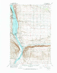
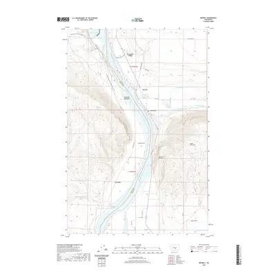
(13)- 1912 Map of Beverly
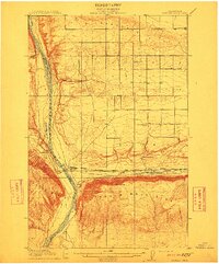 1912 Beverly1912 Print · USGSCentral Washington is captured here at a pivotal moment just after the arrival of the railroad. You can trace the path of the Chicago Milwaukee and Puget Sound RR through riverfront settlements like Beverly and Cohassett.6 unique versions available
 - 1953 Map of Walla Walla, 1964 Print
 1953 Walla Walla1964 Print · USGSSoutheast Washington enters the atomic and hydroelectric age in the mid-twentieth century as new dams reshape the desert landscape. You can trace the development of the Hanford Works, identify remote rail stops like Novara Siding, and locate the historic Dry Creek Cem.3 unique versions available
 - 1954 Map of Beverly, 1955 Print
 1954 Beverly1955 Print · USGSCentral Washington in the mid-1950s was a landscape of rail-and-river logistics dominated by the Columbia River and the Saddle Mountains. Researchers can trace the path of the Milwaukee Road through Beverly and identify landmarks like Sentinel Bluffs and Priest Rapids.
 - 1954 Map of Beverly, 1956 Print
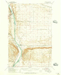 1954 Beverly1956 Print · USGSCentral Washington's Columbia River corridor is captured here in the mid-fifties, just as the region's agricultural and military footprint was expanding. Researchers can trace the Milwaukee Road rail line through Beverly and Jericho, or find cultural landmarks like the Indian Petroglyphs near Vantage.
 - 1958 Map of Walla Walla
 1958 Walla Walla1958 Print · USGSThe Tri-Cities and Walla Walla region are captured here during the mid-century expansion of atomic energy and river infrastructure. Genealogists and historians can trace the early layout of Richland (AEC), the rural Hatton and Washtucna settlements, and landmarks like Palouse Falls State Park.
 - 1965 Map of Beverly, 1966 Print
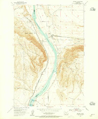
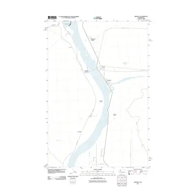
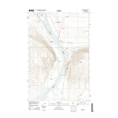
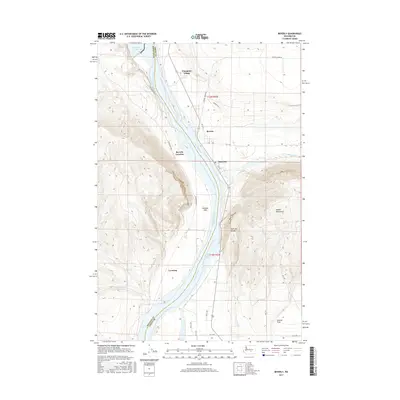
 1965 Beverly1966 Print · USGSThe mid-Columbia River valley comes alive in this mid-sixties survey of the Sentinel Gap and Saddle Mountains. Researchers can trace the railroad operations at Beverly Junction and the infrastructure of the newly built Wanapum Dam.
 - 1965 Map of Beverly, 1966 Print
 1965 Beverly1966 Print · USGSCentral Washington during the mid-sixties reveals a river landscape transformed by hydroelectric power and irrigation. You can trace the rail corridor of the Chicago Milwaukee St Paul and Pacific and locate settlements like Wanapum Village and Vantage.
 - 1979 Map of Priest Rapids
 1979 Priest Rapids1979 Print · USGSThe Columbia River basin in the late seventies reveals a landscape shaped by massive federal projects and rail expansion. Trace the Hanford Works perimeter, the Priest Rapids Dam, and the early growth of Royal City and Othello.2 unique versions available
 - 2011 Map of Beverly, 2011 Print
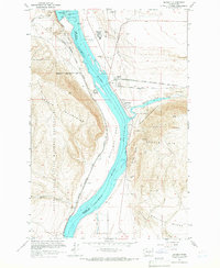
 2011 Beverly2011 Print · USGSCovers Wanapum Village, including Beverly, Levering, and other nearby areas
 - 2014 Map of Beverly, 2014 Print
 2014 Beverly2014 Print · USGSCovers Wanapum Village, including Beverly, Levering, and other nearby areas
 - 2017 Map of Beverly, 2017 Print
 2017 Beverly2017 Print · USGSCovers Wanapum Village, including Beverly, Levering, and other nearby areas
 - 2020 Map of Beverly, 2020 Print
 2020 Beverly2020 Print · USGSCovers Wanapum Village, including Beverly, Levering, and other nearby areas
 - 2023 Map of Beverly, 2023 Print
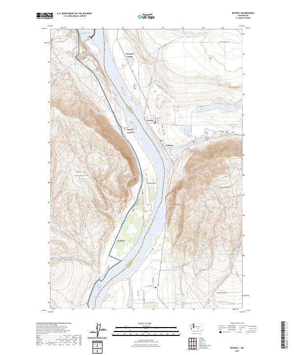 2023 Beverly2023 Print · USGSThe Columbia River corridor is captured here in the early twenty-first century, showing the intersection of hydro-infrastructure and natural preserves. Researchers can trace the river from Wanapum Lake through Sentinel Gap past settlements like Beverly and Schwana.
End of results
Showing maps 1-13 of 13
Top cities near Wanapum Village
Frequently asked questions
- What are the different types of historical maps available for Wanapum Village?
- What is the oldest map of Wanapum Village?
- Where can I purchase historical maps of Wanapum Village for my home or office?
- Where can I download high-res historical maps of Wanapum Village?
- Are there historical topographic maps available for Wanapum Village?
- Is there historical aerial imagery available for Wanapum Village?
- Where are historical maps of Wanapum Village sourced from?