Old Maps of Jefferson County, Washington for Academic Research
Study the evolution of Jefferson County with 199 high-resolution historic maps. Whether you're teaching, researching, or modeling changes in land use, these maps provide essential visual documentation of urban, environmental, and geographic change.
- Analyze long-term change: Track patterns in development, transportation, and natural features.
- Ideal for environmental or urban studies: Support academic projects with primary historical map data.
- Use in the classroom or lab: Educators and researchers rely on these maps to bring historical context to life.
These maps are a powerful tool for teaching, research, and visualizing how Jefferson County has changed over the decades.
Jefferson County, WA maps
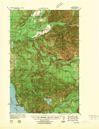
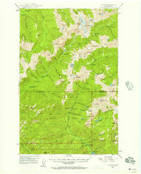
(199)- 1935 Map of Mount Olympus, 1954 Print
 1935 Mount Olympus1954 Print · USGSThe high peaks and glaciers of the Olympic Range are shown here as they appeared in the 1930s. Researchers can locate remote backcountry landmarks like Michaels Ranch, the Olympus Guard Station, and the old Hurricane Hill Lookout.
 - 1936 Map of Point Misery, 1958 Print
 1936 Point Misery1958 Print · USGSCommunities along the Hood Canal thrived on timber and maritime trade in the mid-1930s. Genealogists and historians can trace local landmarks like Seabeck, the Lewis Lumber Co, and the Brinnon Seabeck Ferry route.3 unique versions available
 - 1937 Map of Port Orchard, 1960 Print
 1937 Port Orchard1960 Print · USGSBremerton and the Kitsap Peninsula were defined by their deep-water naval facilities and ferry networks in the years preceding World War II. Local historians can trace the early footprints of the Puget Sound Navy Yard, the Port Madison Indian Reservation, and the Fort Ward coastal defenses.2 unique versions available
 - 1937 Map of Port Gamble, 1964 Print
 1937 Port Gamble1964 Print · USGSPuget Sound and the Hood Canal meet in the 1930s, showing a world of timber mills and vital ferry crossings. Trace the old routes of the Port Gamble-Shine Auto Ferry and locate historic landmarks like the Point No Point Lighthouse and Indianola.
 - 1938 Map of Mt Constance
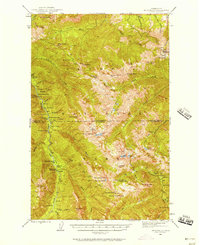
 1938 Mt Constance1938 Print · USGSThe eastern Olympic Peninsula comes into focus in the 1930s as a land of massive peaks and nascent federal parks. Trace the early mining efforts at the Tubal Cain Mine, lookouts like Deer Park Lookout, and the shoreline at Eldon.4 unique versions available
 - 1939 Map of Port Townsend
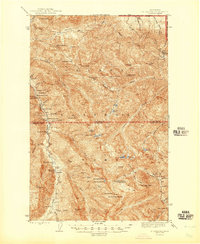
 1939 Port Townsend1939 Print · USGSCoastal Jefferson County in the late 1930s serves as a vital maritime and military hub at the edge of the Strait of Juan de Fuca. Genealogists and historians can trace family-named sites like Clark Farm alongside major landmarks like Fort Worden and the busy docks of Irondale.
 - 1939 Map of Forks
 1939 Forks1939 Print · USGSThe Olympic Peninsula logging and oil frontier comes into focus here just before the Second World War. Researchers can trace family homesteads like the Otto Dimmel Ranch alongside industrial landmarks like the Bloedel Donovan Beaver Camp and Oil City Camp.
 - 1939 Map of Coupeville
 1939 Coupeville1939 Print · USGSWhidbey and Marrowstone Islands are captured in the late 1930s when military forts and ferry lines still dictated the rhythm of Puget Sound. Researchers can trace the grounds of Fort Casey, locate the Island County Courthouse, and find vanished coastal landmarks like Pratts Resort.
 - 1939 Map of Mount Tom
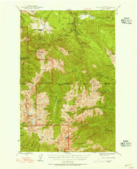
 1939 Mount Tom1939 Print · USGSThe Olympic Peninsula wilderness comes into sharp focus during the late 1930s as park and forest boundaries are established. Researchers can trace early trail networks connecting Sol Duc Hot Springs, Mt Tom Shelter, and remote guard stations like Eagle GS.
 - 1940 Map of Port Gamble
 1940 Port Gamble1940 Print · USGSThe Kitsap Peninsula and Hood Canal are seen here in the final years before the bridge era, when a complex network of ferries was the lifeblood of the sound. Genealogists and local historians can trace the early footprints of Port Gamble, Hansville, and the Port Madison Indian Reservation.
 - 1940 Map of Point Misery
 1940 Point Misery1940 Print · USGSCoastal life along the Hood Canal and Dabob Bay is caught in detail just before the mid-century, from timber operations to maritime crossings. Genealogists and historians can trace the Brinnon Seabeck Ferry, identify the Barney White Ranch, and locate the Seabeck Sch.
 - 1940 Map of Quilcene
 1940 Quilcene1940 Print · USGSThe Olympic Peninsula shoreline and timbered foothills are captured here during the late pre-war era, from the heights of Mt Walker to the depths of Dabob Bay. Researchers can trace early logging operations at Mc Cormack Lumber Co or locate civic landmarks like the Port Townsend Dam and US Fish Hatchery.
 - 1942 Map of Mount Olympus
 1942 Mount Olympus1942 Print · USGSThe high peaks and glaciers of the Olympic Peninsula are captured here during the 1930s, showing a land of deep ice and early mountain outposts. Researchers can trace historic backcountry sites like Olympic Hot Springs, Humes Ranch, and the Olympus Guard Station.
 - 1943 Map of Richardson
 1943 Richardson1943 Print · USGSLopez Island and the surrounding San Juan archipelago are captured here in the early forties, showing a coastal landscape of maritime hamlets and isolated island life. You can trace early school sites like Center Sch and the harbor at Richardson, or locate the remote Smith Island National Wild Life Refuge.
 - 1943 Map of Spruce Mountain
 1943 Spruce Mountain1943 Print · USGSJefferson and Clallam Counties during the wartime era show a landscape of deep timber and isolated homesteads. Researchers can locate remote family holdings like the Huelsdonk Ranch and Schmidt Ranch or trace trails to the Bogachiel Guard Station.
 - 1943 Map of Copalis Beach
 1943 Copalis Beach1943 Print · USGSThe Washington coast in the 1940s is detailed here from the Olympic Peninsula to the Columbia River. Trace old beach settlements like Moclips and Copalis Beach alongside landmarks like the Willapa Bay Lighthouse.
 - 1944 Map of Mt. Angeles, 1957 Print
 1944 Mt. Angeles1957 Print · USGSThe Olympic Peninsula interior was a network of remote ranger stations and wilderness camps during the mid-twentieth century. Researchers can locate early backcountry infrastructure including Elkhorn Guard Sta, Drums Cabin, and the high-elevation Deer Park Lookout.3 unique versions available
 - 1946 Map of Mt. Angeles
 1946 Mt. Angeles1946 Print · USGSThe Olympic interior in the mid-forties remains a wilderness of remote ranger outposts and mountaineer camps. Trace early park infrastructure from Deer Park Lookout to isolated sites like Remanns Cabin and Drums Cabin.2 unique versions available
 - 1946 Map of Tyler Peak, 1955 Print
 1946 Tyler Peak1955 Print · USGSThe high Olympic wilderness of the mid-forties is documented here just as backcountry recreation and park administration were expanding. Researchers can trace historic shelters and mining interests like the Tubal Cain Mine, Camp Mystery, and Slab Camp Guard Sta.3 unique versions available
 - 1947 Map of The Brothers, 1957 Print
 1947 The Brothers1957 Print · USGSThe Olympic Peninsula wilderness meets the shoreline in the late 1940s, showing the rugged interior before modern expansion. Researchers can locate the John Ahl Sch near Eldon or trace mountain trails to the Webb Lookout and The Brothers.3 unique versions available
 - 1947 Map of Mt. Steel, 1957 Print
 1947 Mt. Steel1957 Print · USGSThe high Olympic wilderness appears here in the late 1940s, a period of remote mountaineering and early trail development. Researchers can locate isolated mountain outposts such as Chalet and the Nine Stream Shelter among the headwaters of the Skokomish River.3 unique versions available
 - 1947 Map of Mt Christie, 1959 Print
 1947 Mt Christie1959 Print · USGSThe Jefferson County high country in the late 1940s shows the early development of the national park system before modern road networks expanded. Researchers can trace historic mountain infrastructure including the Graves Creek Inn, Chicago Camp, and the Muncaster Sch.3 unique versions available
 - 1948 Map of Tyler Peak
 1948 Tyler Peak1948 Print · USGSThe high Olympic wilderness of the late 1940s is shown here through its network of forest guard stations and remote backcountry camps. Researchers can trace historic trails to the Tubal Cain Mine, Royal Creek Cabin, and Louella Guard Sta.
 - 1950 Map of The Brothers
 1950 The Brothers1950 Print · USGSThe Jefferson County coast meets the Olympic peaks in the mid-century, capturing the area's transition from the Hood Canal shoreline to high wilderness. Researchers can trace early backcountry camps and coastal landmarks like John Ahl Sch, Camp Collins, and the Hamma Hamma Guard Sta.2 unique versions available
 - 1950 Map of Mt Christie
 1950 Mt Christie1950 Print · USGSJefferson and Grays Harbor counties appear here during the mid-century, showing a landscape of backcountry shelters and mountain trails. You can trace the routes of early hikers and rangers through Graves Creek Inn, the Muncaster Sch, and Chicago Camp.2 unique versions available
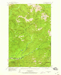
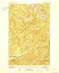
Showing maps 1-25 of 199
Top cities of Jefferson County
- Port Townsend historical maps
- Port Hadlock historical maps
- Port Ludlow historical maps
- Brinnon historical maps
- Quilcene historical maps
Frequently asked questions
- What are the different types of historical maps available for Jefferson County?
- What is the oldest map of Jefferson County?
- Where can I purchase historical maps of Jefferson County for my home or office?
- Where can I download high-res historical maps of Jefferson County?
- Are there historical topographic maps available for Jefferson County?
- Is there historical aerial imagery available for Jefferson County?
- Where are historical maps of Jefferson County sourced from?