Old Maps of Greenwater, Washington for Academic Research
Study the evolution of Greenwater with 10 high-resolution historic maps. Whether you're teaching, researching, or modeling changes in land use, these maps provide essential visual documentation of urban, environmental, and geographic change.
- Analyze long-term change: Track patterns in development, transportation, and natural features.
- Ideal for environmental or urban studies: Support academic projects with primary historical map data.
- Use in the classroom or lab: Educators and researchers rely on these maps to bring historical context to life.
These maps are a powerful tool for teaching, research, and visualizing how Greenwater has changed over the decades.
Greenwater, WA maps
(10)- 1913 Map of Cedar Lake
 1913 Cedar Lake1913 Print · USGSThe foothills and peaks of the Cascades appear here just before World War I as industry pushed into the wilderness. Trace early timber and rail history through Kerriston, Selleck, and the Cedar Falls Power Plant.5 unique versions available
 - 1956 Map of Greenwater, 1958 Print
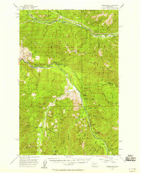 1956 Greenwater1958 Print · USGSThe Green River and White River valleys in the mid-1950s reveal a landscape of timber-rail settlements and mountain camps. Genealogists and historians can trace the Northern Pacific line through Nagrom or locate sites like Hot Springs and the Camp Sheppard Boy Scout Camp.4 unique versions available
 - 1957 Map of Wenatchee, 1973 Print
 1957 Wenatchee1973 Print · USGSThe northern Cascades and Columbia River valley appear here in the mid-fifties, showing the region's critical rail and transit corridors. Researchers can trace the routes of the Great Northern RR and Milwaukee Road through settlements like Skykomish, Baring, and Dryden.2 unique versions available
 - 1975 Map of Snoqualmie Pass, 1977 Print
 1975 Snoqualmie Pass1977 Print · USGSThe central Cascades are shown here in the mid-seventies, just as the regional balance between industrial timber, rail transport, and recreation was shifting. Genealogists and hikers can trace old rail stops like Lester and Nagrom, or follow the Pacific Crest National Scenic Trail past Keechelus Lake.
 - 1986 Map of Greenwater
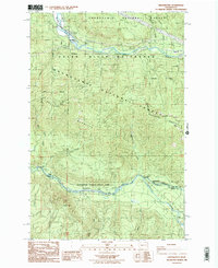 1986 Greenwater1986 Print · USGSGreenwater and the high ridges of the Snoqualmie National Forest appear here in the mid-1980s, before modern development shifted the mountain landscape. Trace the former location of Humphrey (Site), explore Federation Forest State Park, and find the remote Mule Spring.2 unique versions available
 - 2011 Map of Greenwater, 2011 Print
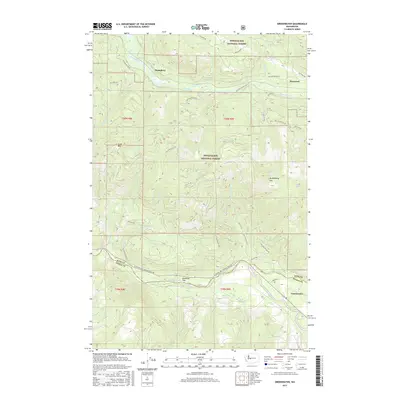
 2011 Greenwater2011 Print · USGSCovers Greenwater, including King County, Pierce County, and other nearby areas
 - 2014 Map of Greenwater, 2014 Print
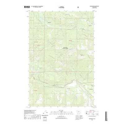
 2014 Greenwater2014 Print · USGSCovers Greenwater, including King County, Pierce County, and other nearby areas
 - 2017 Map of Greenwater, 2017 Print
 2017 Greenwater2017 Print · USGSCovers Greenwater, including King County, Pierce County, and other nearby areas
 - 2020 Map of Greenwater, 2020 Print
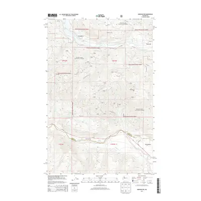
 2020 Greenwater2020 Print · USGSCovers Greenwater, including King County, Pierce County, and other nearby areas
 - 2023 Map of Greenwater, 2023 Print
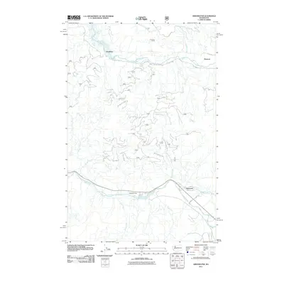
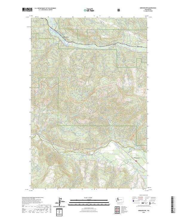 2023 Greenwater2023 Print · USGSThe mountain terrain of eastern Pierce and King Counties is mapped here in the early twenty-first century. Researchers can trace forest development along the Green River and identify local landmarks like Deadman Flat, Humphrey, and Maywood.
End of results
Showing maps 1-10 of 10
Frequently asked questions
- What are the different types of historical maps available for Greenwater?
- What is the oldest map of Greenwater?
- Where can I purchase historical maps of Greenwater for my home or office?
- Where can I download high-res historical maps of Greenwater?
- Are there historical topographic maps available for Greenwater?
- Is there historical aerial imagery available for Greenwater?
- Where are historical maps of Greenwater sourced from?