Old Maps of Ravensdale, Washington for Metal Detecting
Plan your next treasure hunt with 10 historic maps of Ravensdale. Find old homesites, ghost towns, trails, and gathering spots that may be lost to time — perfect for identifying promising metal detecting locations.
- Locate forgotten sites: Uncover places like long-lost settlements, abandoned rail lines, or gathering spots.
- Plan better hunts: Use map overlays combined with LiDAR or satellite views to narrow in on historically rich areas.
- Made for detectorists: Thousands of hobbyists use these maps to discover relics, coins, and hidden history.
Use these historic maps to boost your research and find new opportunities beneath the surface of Ravensdale.
Ravensdale, WA maps
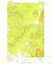
(10)- 1913 Map of Cedar Lake
 1913 Cedar Lake1913 Print · USGSThe foothills and peaks of the Cascades appear here just before World War I as industry pushed into the wilderness. Trace early timber and rail history through Kerriston, Selleck, and the Cedar Falls Power Plant.5 unique versions available
 - 1953 Map of Cumberland, 1955 Print
 1953 Cumberland1955 Print · USGSKing County’s mining and rail corridors are captured here in the early 1950s, showing a landscape of coal towns and mountain transit. Researchers can trace the industrial footprints of Cumberland, Black Diamond, and Bayne alongside the Northern Pacific railroad.4 unique versions available
 - 1957 Map of Wenatchee, 1973 Print
 1957 Wenatchee1973 Print · USGSThe northern Cascades and Columbia River valley appear here in the mid-fifties, showing the region's critical rail and transit corridors. Researchers can trace the routes of the Great Northern RR and Milwaukee Road through settlements like Skykomish, Baring, and Dryden.2 unique versions available
 - 1975 Map of Snoqualmie Pass, 1977 Print
 1975 Snoqualmie Pass1977 Print · USGSThe central Cascades are shown here in the mid-seventies, just as the regional balance between industrial timber, rail transport, and recreation was shifting. Genealogists and hikers can trace old rail stops like Lester and Nagrom, or follow the Pacific Crest National Scenic Trail past Keechelus Lake.
 - 1993 Map of Cumberland
 1993 Cumberland1993 Print · USGSKing County's industrial and natural borders come into focus in the early 1990s as the Green River winds past established mining and rail towns. Genealogists and historians can trace the layouts of Cumberland, Black Diamond, and Ravensdale, or locate landmarks like the Black Diamond Bridge and Nolte State Park.
 - 2011 Map of Cumberland, 2011 Print
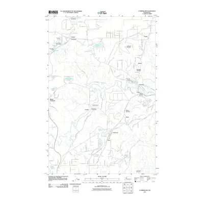 2011 Cumberland2011 Print · USGSCovers Ravensdale, including Kent, Black Diamond, and other nearby areas
 - 2014 Map of Cumberland, 2014 Print
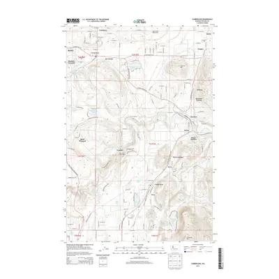 2014 Cumberland2014 Print · USGSCovers Ravensdale, including Kent, Black Diamond, and other nearby areas
 - 2017 Map of Cumberland, 2017 Print
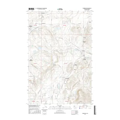 2017 Cumberland2017 Print · USGSCovers Ravensdale, including Kent, Black Diamond, and other nearby areas
 - 2020 Map of Cumberland, 2020 Print
 2020 Cumberland2020 Print · USGSCovers Ravensdale, including Kent, Black Diamond, and other nearby areas
 - 2023 Map of Cumberland, 2023 Print
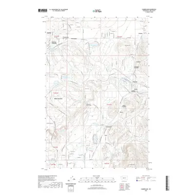
 2023 Cumberland2023 Print · USGSKing County's coal mining and timber heritage is visible in this contemporary survey of the foothills near Black Diamond and Cumberland. Researchers can locate family sites at Ravensdale Cem, trace industrial landmarks like Ravensdale Pit, or explore the riparian geography of the Green River.
End of results
Showing maps 1-10 of 10
Top cities near Ravensdale
- Bellevue historical maps
- Kent historical maps
- Renton historical maps
- Auburn historical maps
- Sammamish historical maps
- Issaquah historical maps
See more
Frequently asked questions
- What are the different types of historical maps available for Ravensdale?
- What is the oldest map of Ravensdale?
- Where can I purchase historical maps of Ravensdale for my home or office?
- Where can I download high-res historical maps of Ravensdale?
- Are there historical topographic maps available for Ravensdale?
- Is there historical aerial imagery available for Ravensdale?
- Where are historical maps of Ravensdale sourced from?