2020s Maps of Seattle, Washington
Explore 18 historic maps of Seattle from the 2020s. These maps offer a rare glimpse into what life looked like during the 2020s — showing old roads, neighborhoods, homes, and landmarks that have changed or disappeared over time.
Whether you're researching your family's past, planning a metal detecting trip, or studying how Seattle's landscape evolved across the 2020s, these high-resolution maps are a powerful tool for exploring the history of this region.
- Focus on a specific era: All maps on this page are from the 2020s, giving you a focused view of this time period.
- See what’s changed: Compare century-old streets, trails, and buildings to today's modern landscape using overlays and satellite layers.
- Research with precision: Use these maps for genealogy, historical research, land use analysis, or educational projects.
- View, download, or print: Maps are fully viewable online in high resolution, and can be downloaded or printed for your own records.
Start exploring Seattle's history through authentic maps from the 2020s. This is your window into the past.
Seattle, WA maps
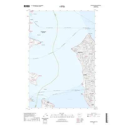
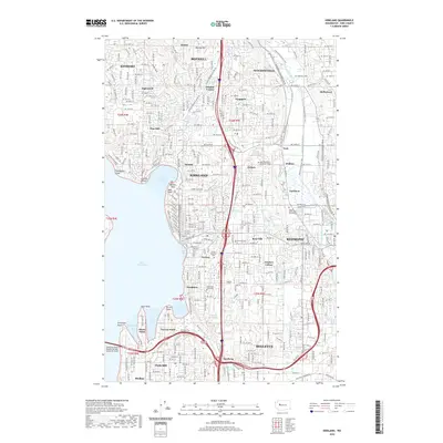
(18)- 2020 Map of Shilshole Bay, 2020 Print
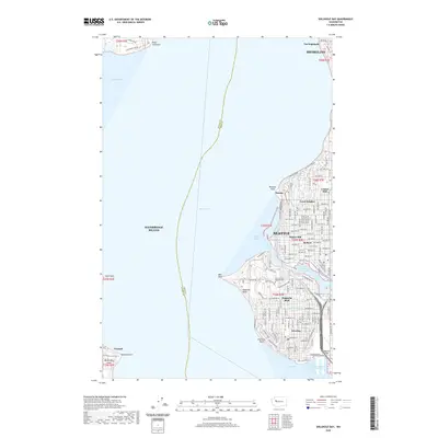 2020 Shilshole Bay2020 Print · USGSCovers Seattle, including Shoreline, Bainbridge Island, and other nearby areas
 - 2020 Map of Renton, 2020 Print
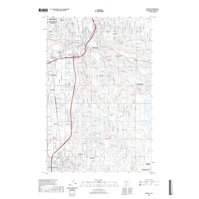 2020 Renton2020 Print · USGSCovers Seattle, including Kent, Renton, and other nearby areas
 - 2020 Map of Des Moines, 2020 Print
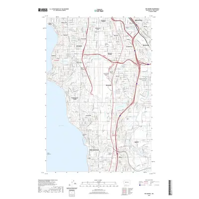 2020 Des Moines2020 Print · USGSCovers Seattle, including Kent, Renton, and other nearby areas
 - 2020 Map of Mercer Island, 2020 Print
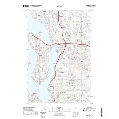 2020 Mercer Island2020 Print · USGSCovers Seattle, including Bellevue, Renton, and other nearby areas
 - 2020 Map of Seattle South, 2020 Print
 2020 Seattle South2020 Print · USGSCovers Seattle, including Burien, Mercer Island, and other nearby areas
 - 2020 Map of Duwamish Head, 2020 Print
 2020 Duwamish Head2020 Print · USGSCovers Seattle, including Bainbridge Island, Vashon Heights, and other nearby areas
 - 2020 Map of Vashon, 2020 Print
 2020 Vashon2020 Print · USGSCovers Seattle, including Burien, Vashon, and other nearby areas
 - 2020 Map of Seattle North, 2020 Print
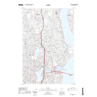 2020 Seattle North2020 Print · USGSCovers Seattle, including Kirkland, Shoreline, and other nearby areas
 - 2020 Map of Kirkland, 2020 Print
 2020 Kirkland2020 Print · USGSCovers Seattle, including Bellevue, Kirkland, and other nearby areas
 - 2023 Map of Kirkland, 2023 Print
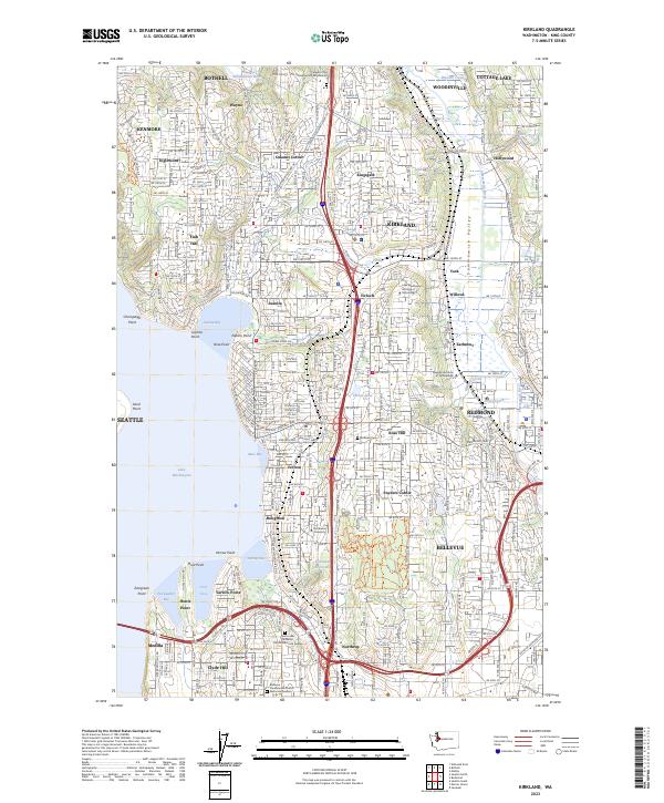 2023 Kirkland2023 Print · USGSThe eastern shores of Lake Washington and the Sammamish Valley are captured here during a period of intense suburban maturity. Researchers can trace local landmarks like Kirkland Cem, Northwest University, and neighborhood hubs like Finn Hill and Houghton.
 - 2023 Map of Seattle South, 2023 Print
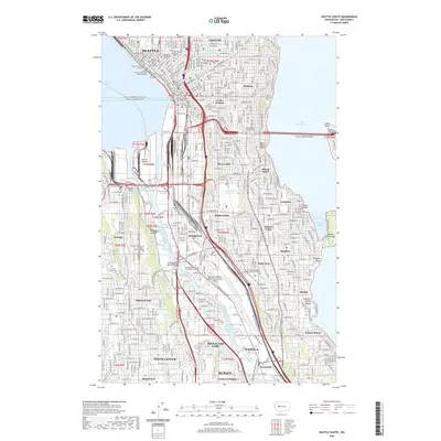
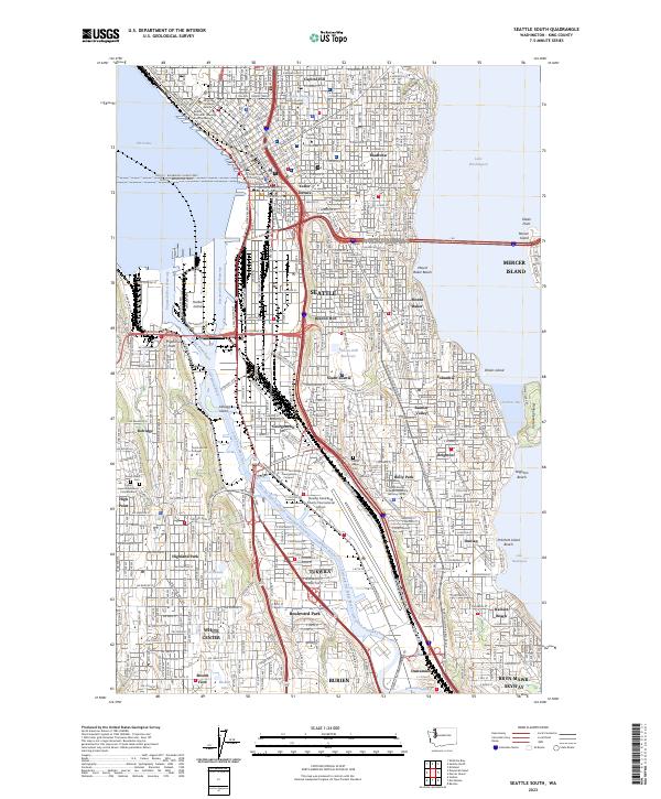 2023 Seattle South2023 Print · USGSThe industrial corridor of South Seattle comes alive in this 2023 survey, detailing the neighborhoods and waterways between Elliott Bay and Lake Washington. Researchers can trace the boundaries of historic Georgetown, locate the Comet Lodge Cem, and explore the infrastructure surrounding Boeing Field.
 - 2023 Map of Seattle North, 2023 Print
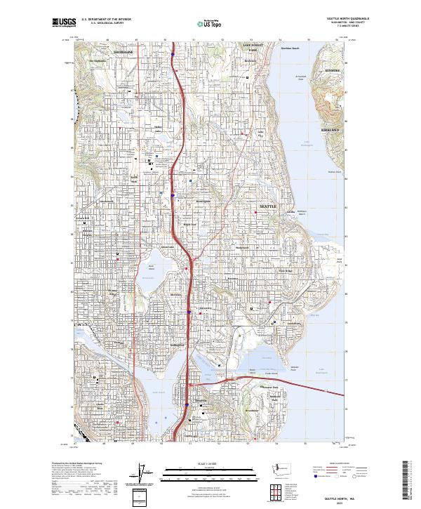 2023 Seattle North2023 Print · USGSNorthern Seattle and the surrounding communities of Shoreline and Lake Forest Park are shown in high detail during the 2020s. Researchers can locate specific sites from the University of Washington to historic burial grounds like Evergreen-Washelli Memorial Park West and Calvary Cem.
 - 2023 Map of Mercer Island, 2023 Print
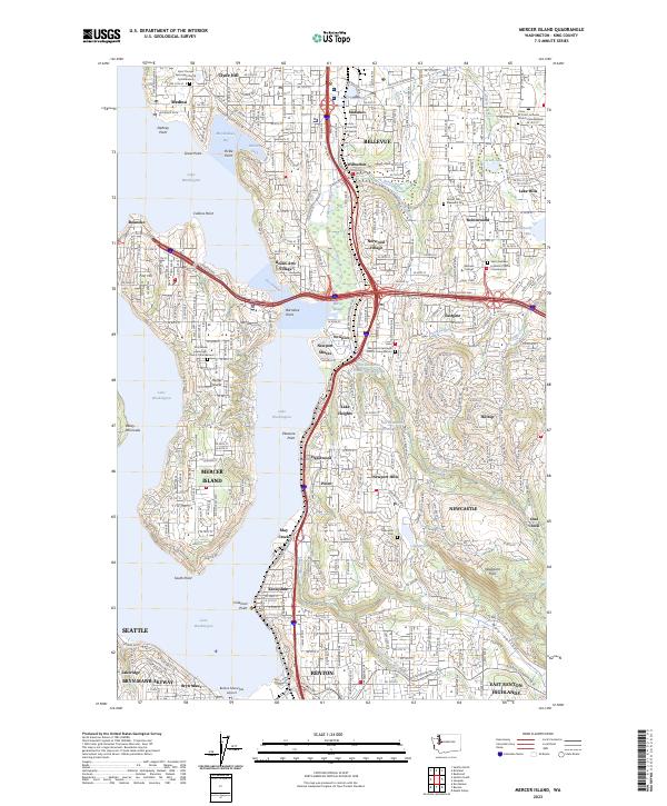 2023 Mercer Island2023 Print · USGSMercer Island and the Bellevue shoreline are captured here in the early twenty-first century as suburban growth reaches the Newcastle Hills. Genealogists and historians can trace Newcastle Cem, Sunset Hills Memorial Park, and the unique Beaux Arts Village waterfront.
 - 2023 Map of Vashon, 2023 Print
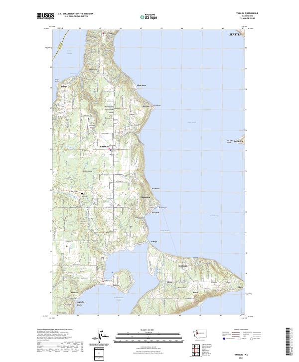 2023 Vashon2023 Print · USGSVashon and Maury Islands are shown in their modern state, defined by a landscape of coastal settlements and intricate harbors. Genealogists and local historians can trace residential hubs from Cedarhurst down to Burton, or locate landmarks like the Vashon Island Cemetery.
 - 2023 Map of Des Moines, 2023 Print
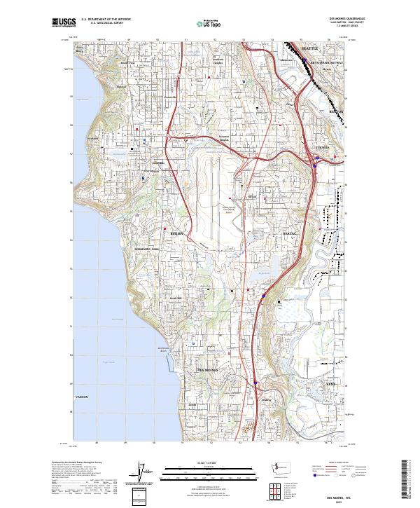 2023 Des Moines2023 Print · USGSThe South Sound shoreline and the busy SeaTac corridor are shown here in modern detail, spanning from the East Passage to the Green River valley. Researchers can locate family sites and local landmarks like Saint Patrick Cem, Washington Memorial Park, and Highline Community College.
 - 2023 Map of Renton, 2023 Print
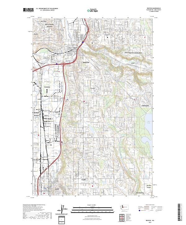 2023 Renton2023 Print · USGSThe Renton and Kent corridors are shown in high detail at the start of the 2020s, revealing the dense intersection of industrial and residential growth. Researchers can trace local heritage at Saar Pioneer Cem or study the protected landscape around Lake Youngs.
 - 2023 Map of Shilshole Bay, 2023 Print
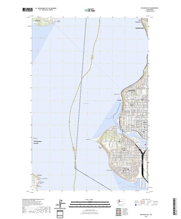 2023 Shilshole Bay2023 Print · USGSThe maritime gateway of Northwest Seattle and the Kitsap Peninsula is captured here in the early 2020s. Trace the complex shoreline from the Fort Lawton Military Cemetery to the industrial docks of Ballard and the Smith Cove Waterway.
 - 2023 Map of Duwamish Head, 2023 Print
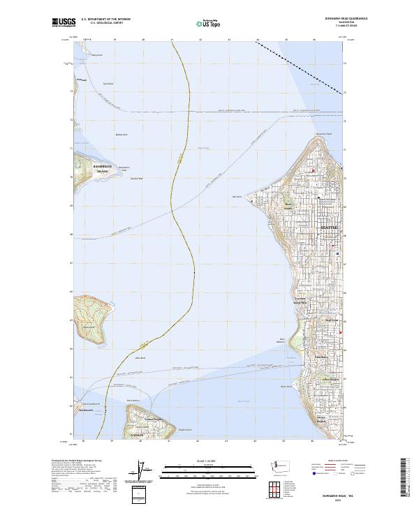 2023 Duwamish Head2023 Print · USGSThe maritime crossroads of the Puget Sound come alive here, showing the intricate ferry systems connecting West Seattle to Bainbridge and Vashon Islands. Researchers can trace local neighborhoods and landmarks like Alki Beach, Fauntleroy, and the Saint John the Baptist Episcopal Churchyard Memorial Garden.
End of results
Showing maps 1-18 of 18
Top cities near Seattle
- Bellevue historical maps
- Kent historical maps
- Renton historical maps
- Kirkland historical maps
- Redmond historical maps
- Shoreline historical maps
See more
Top neighborhoods of Seattle
- Chinatown International District historical maps
- Capitol Hill historical maps
- Harrison/Denny–Blaine historical maps
- Leschi historical maps
- Beacon Hill historical maps
- Belltown historical maps
See more
Frequently asked questions
- What are the different types of historical maps available for Seattle?
- What is the oldest map of Seattle?
- Where can I purchase historical maps of Seattle for my home or office?
- Where can I download high-res historical maps of Seattle?
- Are there historical topographic maps available for Seattle?
- Is there historical aerial imagery available for Seattle?
- Where are historical maps of Seattle sourced from?