Old Maps of Thorp, Washington for Academic Research
Study the evolution of Thorp with 11 high-resolution historic maps. Whether you're teaching, researching, or modeling changes in land use, these maps provide essential visual documentation of urban, environmental, and geographic change.
- Analyze long-term change: Track patterns in development, transportation, and natural features.
- Ideal for environmental or urban studies: Support academic projects with primary historical map data.
- Use in the classroom or lab: Educators and researchers rely on these maps to bring historical context to life.
These maps are a powerful tool for teaching, research, and visualizing how Thorp has changed over the decades.
Thorp, WA maps
(11)- 1897 Map of Mount Stuart
 1897 Mount Stuart1897 Print · USGSThe Kittitas Valley and Wenatchee Mountains are captured here at the end of the nineteenth century as coal and gold mining began to transform the frontier. Researchers can trace the early rail networks of the Northern Pacific and locate historic mining camps like Liberty, Meaghersville, and the remote Blewett station.2 unique versions available
 - 1902 Map of Mount Stuart, 1908 Print
 1902 Mount Stuart1908 Print · USGSThe Kittitas Valley and Wenatchee Mountains are shown here during the height of the early twentieth-century rail and mining era. Researchers can trace the industrial landscape through the Roslyn Branch and mountain camps like Liberty and Blewett.5 unique versions available
 - 1957 Map of Wenatchee, 1973 Print
 1957 Wenatchee1973 Print · USGSThe northern Cascades and Columbia River valley appear here in the mid-fifties, showing the region's critical rail and transit corridors. Researchers can trace the routes of the Great Northern RR and Milwaukee Road through settlements like Skykomish, Baring, and Dryden.2 unique versions available
 - 1958 Map of Thorp, 1960 Print
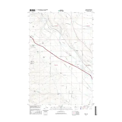
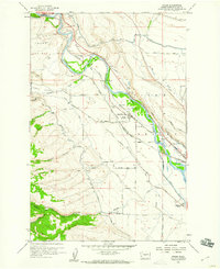 1958 Thorp1960 Print · USGSSettled between the prairie and the river, this late-fifties view of the Kittitas Valley shows an era of bustling rail traffic and irrigation. Genealogists can trace family landmarks like the Thorp Cem, Ridgeway School, and the Thorp Depot.2 unique versions available
 - 1958 Map of Thorp, 1960 Print
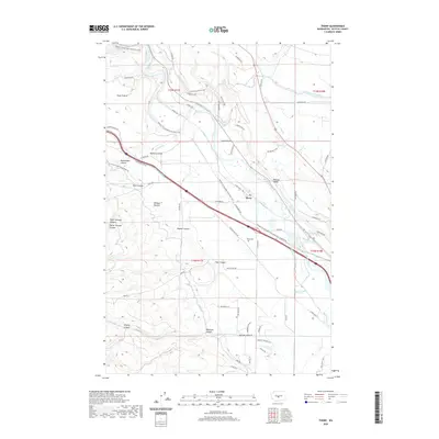
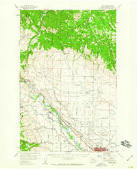 1958 Thorp1960 Print · USGSKittitas County at the close of the 1950s shows a landscape shaped by competing rail lines and high-country forestry. Genealogists and historians can trace family locations near Thorp Cem, rural education at Woldale Sch, or the old mining works at Old Placer Mine.2 unique versions available
 - 1975 Map of Wenatchee, 1977 Print
 1975 Wenatchee1977 Print · USGSCentral Washington in the mid-seventies shows a landscape of deep mountain valleys and bustling river towns. Trace the industrial and agricultural backbone of the region along the Yakima River and Columbia River, from the mining history of Roslyn to the rail hubs at Cle Elum and Appleyard.
 - 2011 Map of Thorp, 2011 Print
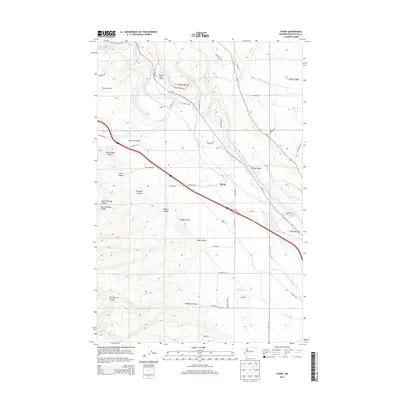
 2011 Thorp2011 Print · USGSCovers Thorp, including Kittitas County, United States, and other nearby areas
 - 2014 Map of Thorp, 2014 Print
 2014 Thorp2014 Print · USGSCovers Thorp, including Kittitas County, United States, and other nearby areas
 - 2017 Map of Thorp, 2017 Print
 2017 Thorp2017 Print · USGSCovers Thorp, including Kittitas County, United States, and other nearby areas
 - 2020 Map of Thorp, 2020 Print
 2020 Thorp2020 Print · USGSCovers Thorp, including Kittitas County, United States, and other nearby areas
 - 2023 Map of Thorp, 2023 Print
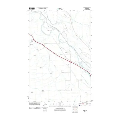
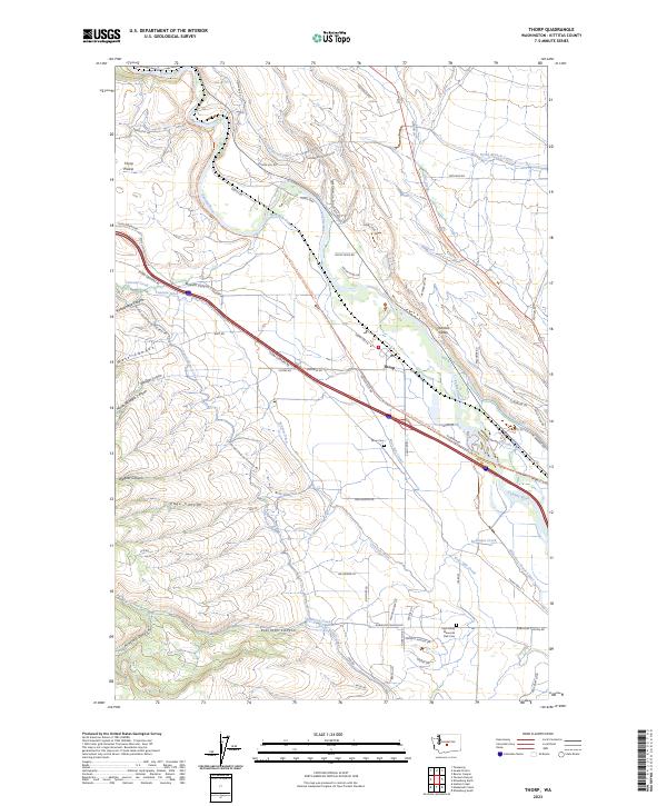 2023 Thorp2023 Print · USGSThe Yakima River valley near Thorp comes alive in this contemporary map of agricultural and desert terrain. Researchers can trace the extensive irrigation network including the North Branch Canal and find local landmarks like Thorp Cem and Thorp Prairie.
End of results
Showing maps 1-11 of 11
Top cities near Thorp
Frequently asked questions
- What are the different types of historical maps available for Thorp?
- What is the oldest map of Thorp?
- Where can I purchase historical maps of Thorp for my home or office?
- Where can I download high-res historical maps of Thorp?
- Are there historical topographic maps available for Thorp?
- Is there historical aerial imagery available for Thorp?
- Where are historical maps of Thorp sourced from?