Old Maps of Goodnoe, Washington for Hiking & Exploration
Hike through history with 11 historic maps of Goodnoe. Explore old trails, ghost towns, and forgotten backroads — perfect for outdoor adventurers and local explorers.
- Rediscover forgotten places: Map out old mining camps, roads, and footpaths that no longer exist on modern maps.
- Layer with modern tools: Combine with LiDAR or satellite views to plan hikes through historical terrain.
- Made for exploration: Popular among hikers, overlanders, and local history lovers.
Use these maps to find adventure and explore the hidden past of Goodnoe.
Goodnoe, WA maps
(11)- 1953 Map of The Dalles, 1965 Print
 1953 The Dalles1965 Print · USGSThe Columbia River Gorge at mid-century shows a region being transformed by massive hydroelectric dams and a growing highway network. Researchers can trace the development of The Dalles Dam, locate the Maryhill Museum, and find old rail stops in Rufus, Wishram, and Arlington.3 unique versions available
 - 1956 Map of The Dalles
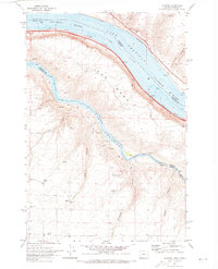
 1956 The Dalles1956 Print · USGSThe Columbia River Gorge and the high Cascades are captured in the mid-1950s, showing a vital corridor of rail and road. Researchers can trace the original path of The Old Oregon Trail or locate historical landmarks like the Maryhill Museum and Mount Hood.
 - 1957 Map of The Dalles
 1957 The Dalles1957 Print · USGSThe Columbia River Gorge and the high plateaus of the mid-1950s come alive on this detailed survey of northern Oregon and southern Washington. Researchers can trace the path of the Oregon Trail and The Old Barlow Road alongside river towns like The Dalles and Wishram.
 - 1957 Map of Wasco, 1959 Print
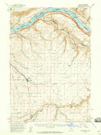 1957 Wasco1959 Print · USGSSherman County and the Columbia River frontier are captured in the late fifties, showing the vital rail and water routes of the Inland Empire. Researchers can trace historic settlements from Wasco to Klondike and locate family landmarks like Sunrise Cemetery.2 unique versions available
 - 1971 Map of Quinton, 1973 Print
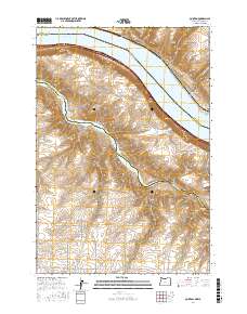
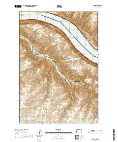
 1971 Quinton1973 Print · USGSThe Oregon-Washington borderlands are defined here in the early 1970s by the meeting of the Columbia and John Day rivers. Follow the industrial infrastructure of the Union Pacific railroad past the settlement of Quinton or locate family landmarks like Albert Philippi Park.2 unique versions available
 - 1980 Map of Goldendale, 1981 Print
 1980 Goldendale1981 Print · USGSThe Columbia River corridor in the 1980s was a critical junction of rail, water, and highway commerce between Washington and Oregon. Genealogists and historians can trace riverside settlements like Wishram, high-country towns like Bickleton, and the grounds of the Maryhill Museum.
 - 2011 Map of Quinton, 2011 Print
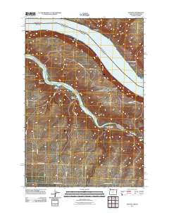 2011 Quinton2011 Print · USGSCovers Goodnoe, including Klickitat County, Sherman County, and other nearby areas
 - 2014 Map of Quinton, 2014 Print
 2014 Quinton2014 Print · USGSCovers Goodnoe, including Klickitat County, Sherman County, and other nearby areas
 - 2017 Map of Quinton, 2017 Print
 2017 Quinton2017 Print · USGSCovers Goodnoe, including Klickitat County, Sherman County, and other nearby areas
 - 2020 Map of Quinton, 2020 Print
 2020 Quinton2020 Print · USGSCovers Goodnoe, including Klickitat County, Sherman County, and other nearby areas
 - 2023 Map of Quinton, 2023 Print
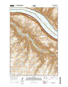
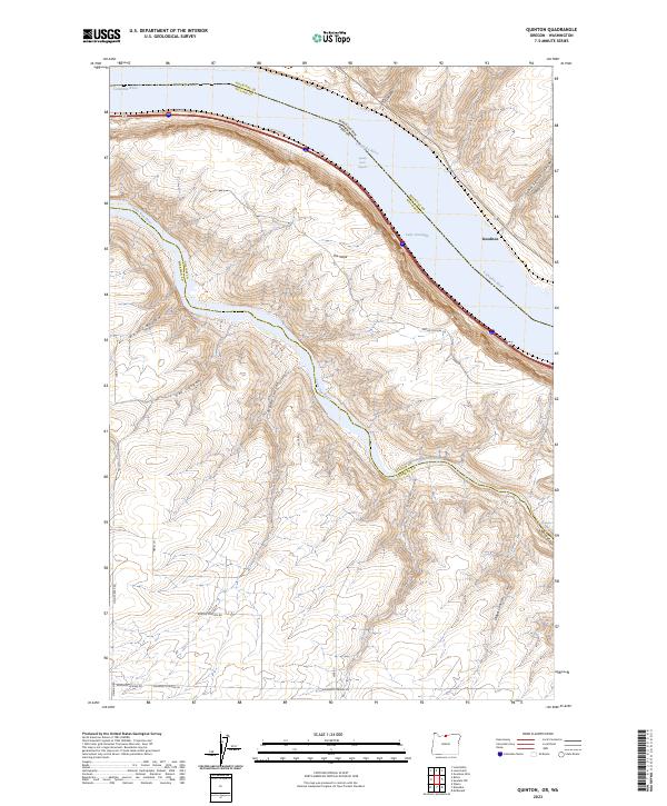 2023 Quinton2023 Print · USGSThe Columbia River corridor near the Oregon-Washington border is captured here at a time of modern water management and plateau ranching. Researchers can trace the steep drainages of Sand Spring Canyon or locate historic river points like The Nook and Squally Hook Rapids.
End of results
Showing maps 1-11 of 11
Top cities near Goodnoe
Frequently asked questions
- What are the different types of historical maps available for Goodnoe?
- What is the oldest map of Goodnoe?
- Where can I purchase historical maps of Goodnoe for my home or office?
- Where can I download high-res historical maps of Goodnoe?
- Are there historical topographic maps available for Goodnoe?
- Is there historical aerial imagery available for Goodnoe?
- Where are historical maps of Goodnoe sourced from?