
1971 Map of Quinton
USGS Topo · Published 1973About this map
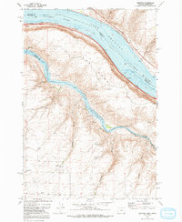
The confluence of the Columbia River Lake Umatilla and the John Day River Lake Umatilla dominates this 1970s landscape, illustrating the critical transportation and water management infrastructure of the era. The small settlement of Quinton sits on the southern shore of the Columbia, positioned along the busy Union Pacific rail corridor. To the west, the expansive terrain known as The Nook is framed by deep natural cuts like Biglow Canyon and Emigrant Canyon, leading down to the riverbanks.
Find a feature on this map
25 named features on this map. Tap any name to fly to it.
Don’t see what you’re looking for? This feature index may not catch every label — zoom into the map to look around manually.
Map Details
Editions of this 1971 Quinton Map
2 editions found
Other maps of this area

1916 · Arlington
USGS Topo · 1:125,000

1953 · The Dalles
USGS Topo · 1:250,000

1956 · The Dalles
USGS Topo · 1:250,000

1957 · The Dalles
USGS Topo · 1:250,000

1957 · Wasco
USGS Topo · 1:62,500

1957 · Satus Pass
USGS Topo · 1:62,500

1964 · Mc Donald
USGS Topo · 1:24,000

1965 · Goodnoe Hills
USGS Topo · 1:24,000
1971 · Sundale NW
USGS Topo · 1:24,000
1971 · Klondike
USGS Topo · 1:24,000