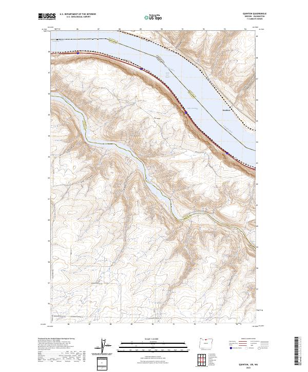
2023 Map of Quinton
USGS Topo · Published 2023About this map
The Columbia River defines this landscape on the border of Oregon and Washington, where the impounded waters of Lake Umatilla now cover much of the historic riverbed near Goodnoe. The geography is dominated by the massive basalt plateaus of Gilliam CO and Sherman CO, deeply incised by a series of dramatic drainages including Sand Spring Canyon and Biglow Canyon. To the south, the John Day Wild and Scenic River carves through the terrain, meeting the Columbia near the Narrows.
Find a feature on this map
29 named features on this map. Tap any name to fly to it.
Don’t see what you’re looking for? This feature index may not catch every label — zoom into the map to look around manually.
Map Details
Editions of this 2023 Quinton Map
This is the sole edition of this map. No revisions or reprints were ever made.
Other maps of this area

1916 · Arlington
USGS Topo · 1:125,000

1953 · The Dalles
USGS Topo · 1:250,000

1956 · The Dalles
USGS Topo · 1:250,000

1957 · The Dalles
USGS Topo · 1:250,000

1957 · Wasco
USGS Topo · 1:62,500

1957 · Satus Pass
USGS Topo · 1:62,500

1964 · Mc Donald
USGS Topo · 1:24,000

1965 · Goodnoe Hills
USGS Topo · 1:24,000

1971 · Quinton
USGS Topo · 1:24,000
1971 · Sundale NW
USGS Topo · 1:24,000